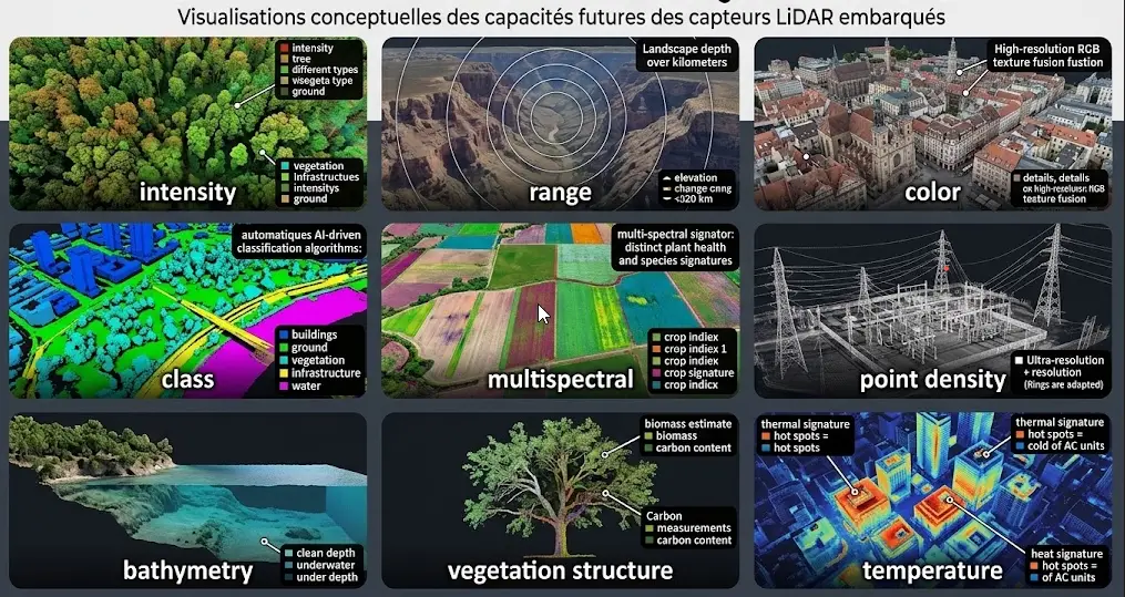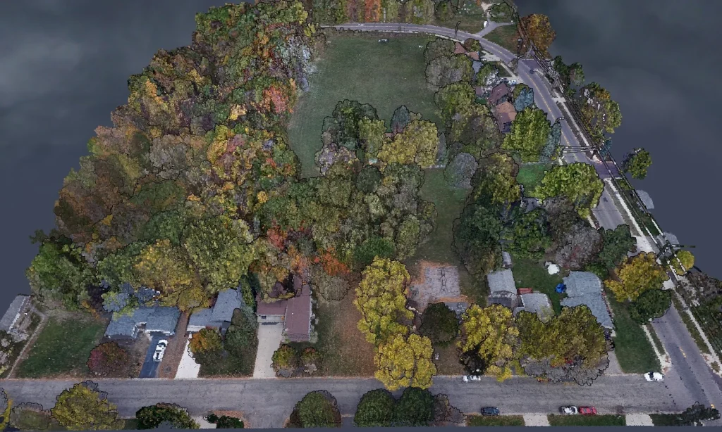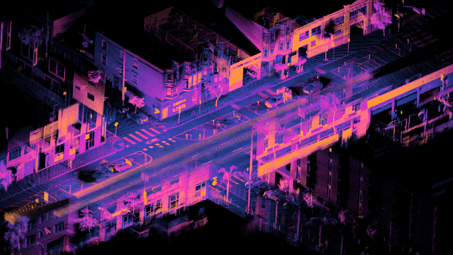
Classifying a point cloud is the core of work on aerial LiDAR data. It turns a set of geometric measurements into usable information, and every derived product depends on it.
This article sets out the standard nomenclature, the difficulties specific to this exercise and the method it requires. It extends the article on the comparison with photogrammetry.
What classifying means in aerial LiDAR
One dependency structures this field and it deserves stating before any consideration of method. Classification assigns a category to each measured point. It is not a segmentation of an image into regions but an attribution of labels to individual measurements, which changes both the tooling and the way quality is judged. Four products depend on it directly. The terrain model, produced by retaining only points classified as ground. The height model, produced by difference and therefore accumulating the errors of two classes. Forest measurements, derived from the ground and vegetation distinction. And clearance analyses, resting on the separation between objects of interest and their surroundings. One important consequence follows. A classification defect is not recovered at any later stage, and a terrain model produced from a mediocre classification carries that mediocrity without it being visible in the final deliverable.The standard aerial LiDAR nomenclature
A reference exists in the field’s exchange format and knowing it is a prerequisite. The base classes cover ground, low, medium and high vegetation, building, water, bridge decks, noise points and unclassified points. Three observations accompany that reference. The thresholds separating vegetation strata are not fixed by the standard, which leaves each project to define at what height medium vegetation begins, a decision that must be documented. The unclassified class is not a class but an absence of decision, and its proportion is an indicator of the work’s completeness. And additional classes are frequently added according to use, power conductors, pylons, road surface or street furniture notably. One recommendation follows. Taking the standard nomenclature and extending it rather than creating one’s own eases exchange and interoperability, a principle the nomenclature article in the previous series established.Ground classification, a special case
One class deserves separate treatment because it conditions every derived product of aerial LiDAR. The terrain model is produced by retaining only points classified as ground, which makes this class the direct determinant of its quality. The principle of automatic methods is to identify the locally lowest points then grow a surface by aggregating points compatible with a plausible slope and elevation variation. Four configurations defeat them. Sharp breaks in slope, banks and cliffs, where the continuity criterion wrongly discards legitimate ground points. Dense low vegetation, where no pulse reaches the ground, producing a surface interpolated above the real ground. Extensive low buildings, whose roof can be taken for ground. And steep terrain, where a parameterisation suited to flat ground systematically discards valid points. One important practical consequence follows. The parameterisation must suit the area’s relief, a single setting across varied terrain producing localised defects only a sector-by-sector check reveals.Difficulties at interfaces
One cross-cutting difficulty concentrates most of the disagreement between annotators, as the preceding series established for boundaries in imagery. Five interfaces require an explicit convention. Ground and low vegetation, the limit between grassy ground and a vegetation stratum belonging to a height threshold to be fixed. Low and medium vegetation, then medium and high, whose thresholds are not standardised. Ground and building, a retaining wall or a landscaped bank potentially belonging to either. Building and furniture, a veranda, a shelter or a container belonging to a decision. And ground and water, the limit of a gently sloping bank posing the same difficulty as the one set out in imagery. One observation runs across those five interfaces. Each is settled in minutes with an expert before production and produces, if omitted, a variability nothing subsequently distinguishes from error.The vegetation and building distinction
A second difficulty dominates and it belongs more to convention than to algorithm. A roof and a canopy present similar geometric properties, a raised surface above the ground, which makes distinguishing them non-trivial. Three criteria permit it and their combination is necessary. Local planarity, a roof presenting regular surfaces where a canopy is irregular. Echo structure, vegetation frequently producing multiple returns where a roof produces a single echo. And vertical distribution, a tree presenting points spread through height where a roof concentrates points on a surface. Four configurations remain difficult despite those criteria. Trees overhanging a building, whose points mingle. Green roofs, presenting both signatures. Complex irregular roofs, whose planarity is low. And greenhouses and translucent structures, whose laser behaviour is particular.Automatic aerial LiDAR classification
Three families are distinguishable and their combination is current practice. Geometric methods apply rules based on local form, planarity, verticality and elevation variation. They are fast, parameterisable and predictable, and they fail on atypical configurations. Classical learning methods exploit variables computed around each point, local density, dispersion and vertical distribution notably. They adapt better to variety and require a training corpus. And neural networks operating directly on point clouds handle the structure without passing through computed variables. They reach the best performance and require substantial training volumes. One important observation runs across those three families. All produce a result requiring human correction for a precise use, which makes automatic classification a starting point rather than an endpoint.Correction as the mode of work
One practical reality dominates this field and it defines the commonest engagement. A cloud generally arrives with a pre-existing classification, produced automatically, and the work consists of correcting it rather than producing it. Four operations compose that work. Locating the defective areas, an operation requiring a method rather than an exhaustive sweep, the area being too large. Reclassification by selection, the annotator isolating a group of points through a section or a volume and assigning it a class. Handling individual cases, reserved for isolated objects whose misclassification has consequences. And verifying the result, by generating a derived model and inspecting the anomalies it reveals. That fourth operation deserves emphasis. Generating a terrain model and examining it in relief immediately reveals ground classification defects, a misclassified building appearing as a bump and a missing area as a hollow.Verifying a classification through its derivatives
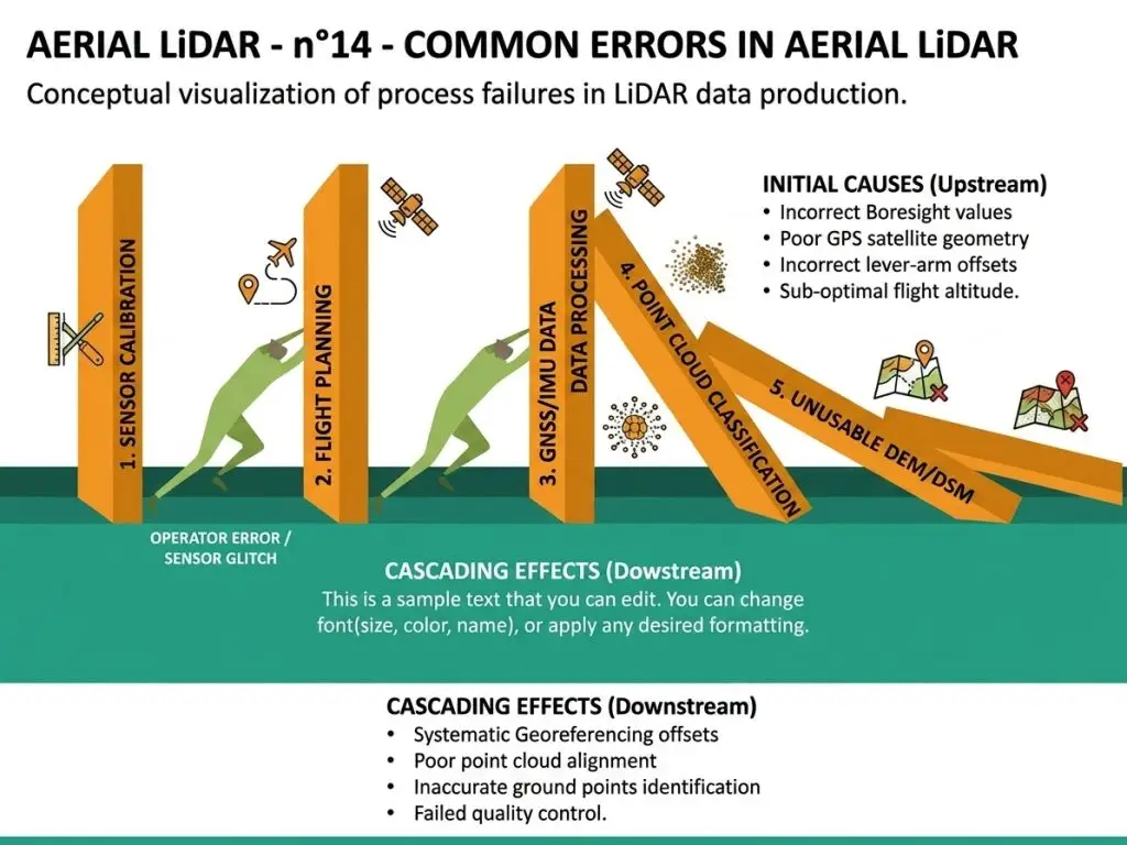
This control method deserves setting out because it reveals in minutes what point-by-point inspection would take hours to find. The principle is to generate a derived product and examine the anomalies it brings out, a classification defect producing a characteristic signature. Four signatures read immediately. A bump in the terrain model signals an object wrongly classified as ground, a building or a vehicle most often. A hollow signals an absence of ground points, either through occlusion or through an over-restrictive classification. Regular undulations signal a strip adjustment defect, a difficulty belonging to acquisition rather than to classification. And negative heights in the height model signal an inconsistency between the ground and surface classes, a physically impossible situation and therefore immediately diagnostic. One practical observation completes those four signatures. This verification is conducted on a hillshade of the terrain model, a representation making relief immediately legible and bringing out defects the point cloud view masks.Selection methods
Four modes of visualisation structure the work and mastering them conditions productivity. The free perspective view permits understanding a configuration by turning around it. The vertical section is the principal tool, a thin slice of the cloud immediately revealing vertical structure and classification errors. The top-down view coloured by class permits spotting anomalous areas at the scale of a batch. And the view coloured by elevation or intensity reveals structures the class colouring masks. One practical observation completes those four modes. The vertical section is the tool experienced annotators use most, and mastering it clearly distinguishes a beginner from a practitioner, which makes it the first point of any training.The role of attributes
Several attributes carried by each point assist classification and they are underused. The echo number and total count indicate whether the pulse met several surfaces, information that separates vegetation from a hard surface more reliably than geometry alone. Intensity informs about surface nature with caution, its value depending on the measurement geometry as much as on the material. The scan angle explains certain apparent anomalies, a point measured at a strong angle carrying a larger footprint and a less reliable position. And the flight line number permits attributing an inconsistency to a strip adjustment defect rather than to a classification error. One practical consequence follows for an aerial LiDAR project. Making these attributes accessible in the annotation tool markedly improves both speed and reliability, and their absence forces annotators to infer what the data already states.The conventions to fix
Six decisions must be settled before production and documented with illustrations. The height thresholds separating vegetation strata. The treatment of the interfaces set out above. The fate of noise points, discarded or classified in a dedicated category. The treatment of mobile objects, vehicles and people, present at the time of survey. The level of detail expected, a coarse and a fine classification not requiring the same effort. And the fate of the unclassified class, its presence being acceptable in some projects and proscribed in others.Difficult aerial LiDAR configurations
Six situations concentrate the difficulty and identifying them permits targeting the effort. Dense urban areas, where buildings, vegetation and furniture interleave over short distances. Steep terrain, where ground classification parameters suited elsewhere fail. Bridges and overpasses, whose points sit above the ground without belonging to a building. Riverbanks and shorelines, where the ground and water limit is gradual. Quarries and earthworks, whose sharp breaks resemble structures. And industrial installations, whose geometry resembles neither a building nor vegetation.Evaluating a classification
Three approaches combine and none suffices alone. Sampling verification re-examines a set of points selected under a documented plan and compares against an expert reference. Consistency checking looks for physically impossible situations, negative heights, isolated points floating in space or ground above surface. And derivative inspection, described above, reveals through the products the defects the cloud hides. One observation completes those three. Inter-annotator disagreement should be measured here as in imagery, and it concentrates on the interfaces, which makes a targeted measurement more informative than a global one.Organising an aerial LiDAR production
Four arrangements support multi-annotator work and they mirror those set out for imagery. Cutting the territory into assignable batches, with explicit treatment of objects straddling limits. A case library accessible during the work, illustrated with real configurations rather than described. Throughput tracking, which reveals a local difficulty before it affects substantial volume. And periodic calibration sessions, which maintain consistency over the months a project spans.Training an annotator for this task
A pedagogical progression deserves describing because the competence does not transfer from image annotation. Four stages structure that learning and they are crossed in weeks. Navigation first, an annotator having to move through a space, change viewpoint and above all master the vertical section, the tool experienced practitioners use most. Reading structure next, recognition proceeding through geometric form and relative arrangement in the absence of colour. Efficient selection third, productivity depending on the relevance of the selection criterion rather than on the precision of the gesture. And diagnosis fourth, the ability to locate where an automatic classification’s defects sit rather than sweeping exhaustively. One observation completes those four stages. The fourth distinguishes a productive annotator from a conscientious one, the area to handle precluding exhaustive examination and making the targeting strategy decisive. One organisational consequence follows for an aerial LiDAR provider. That training is an investment whose value lies in its scarcity, few actors making it, an observation the preceding series made about radar.Machine learning on point clouds
One technical development deserves situating because it changes what automatic methods reach. Architectures operating directly on unordered point sets have progressed considerably, and they now handle classification better than geometric rules on varied terrain. Three limits nonetheless persist. Training volumes required are substantial and geospatial corpora are scarce. Transfer between regions is limited, a model trained on one landscape performing worse on another. And evaluation still requires a manually verified reference. One consequence follows. These methods raise the starting quality and they do not remove the correction stage, which shifts the work rather than eliminating it.The cost of aerial LiDAR classification
Four factors determine it and they multiply rather than add. Point density, a denser survey containing more points to handle for the same area. The number of classes, each additional distinction requiring arbitration on a share of cases. Landscape complexity, a dense urban area costing several times a rural one at equal area. And the quality of the initial classification, correction being far cheaper than production where the starting point is decent. One practical consequence follows. Assessing the existing classification on a sample before quoting is the only way to estimate reliably, a task described as correction potentially amounting to production if the starting point is poor.What this work is worth commercially
Three consequences emerge for a data provider. The first is that classification is this field’s bottleneck. Every derived product depends on it, no automatic method reaches the quality an operational use requires, and correction represents most of the remaining work. The second is that the commonest engagement is correction rather than production, which lowers a project’s entry ticket and multiplies occasions, each national survey released creating a refinement need. And the third is that the competence is scarce and stays so, the training taking weeks and few actors making it. That third consequence deserves a qualification. The scarcity rests on an investment nothing prevents a competitor making, which makes it a lead rather than a protection, and that lead is maintained through accumulated practice rather than through the initial barrier.Deciding how far to classify
One scoping question deserves separate treatment because it drives cost more than any other and is rarely asked explicitly. Classification admits degrees, and a project can stop at several points along that range. Ground only is the minimum useful level, sufficient for a terrain model and for hydrological work, and it is by far the cheapest. Ground and vegetation adds forest measurement and clearance analysis, roughly doubling the effort. Ground, vegetation and building covers most territorial uses and is the common default. And a fine classification with additional classes, conductors, furniture or road surface, serves specific uses and costs several times the previous level. One observation runs across those four levels. Each additional class costs at annotation, costs at verification and degrades per-class quality, exactly as the nomenclature article established for imagery. The practical rule follows. Classify to the level a decision requires and no further, and where a client cannot name what a class would be used for, that class is a cost with no return.Common mistakes
These failures recur often enough that naming them is usually enough to avoid them.- Treating an automatic classification as a finished product.
- Using a single ground classification setting across varied relief.
- Omitting to fix the height thresholds between vegetation strata.
- Neglecting the conventions at interfaces between classes.
- Sweeping exhaustively rather than targeting defective areas.
- Not generating a derived model to verify the ground classification.
- Working in perspective without using the vertical section.
- Leaving a high proportion of unclassified points undocumented.
- Using image annotators without three-dimensional training.
- Classifying mobile objects with no explicit convention.
- Quoting a correction task without assessing the starting classification.
- Ignoring the echo attributes that separate vegetation from hard surfaces.