This series on aerial LiDAR closes on a forward-looking question, and the exercise calls for a methodological precaution. The fourteen preceding articles described states of affairs; this one explicitly separates what is under way from what remains speculative.
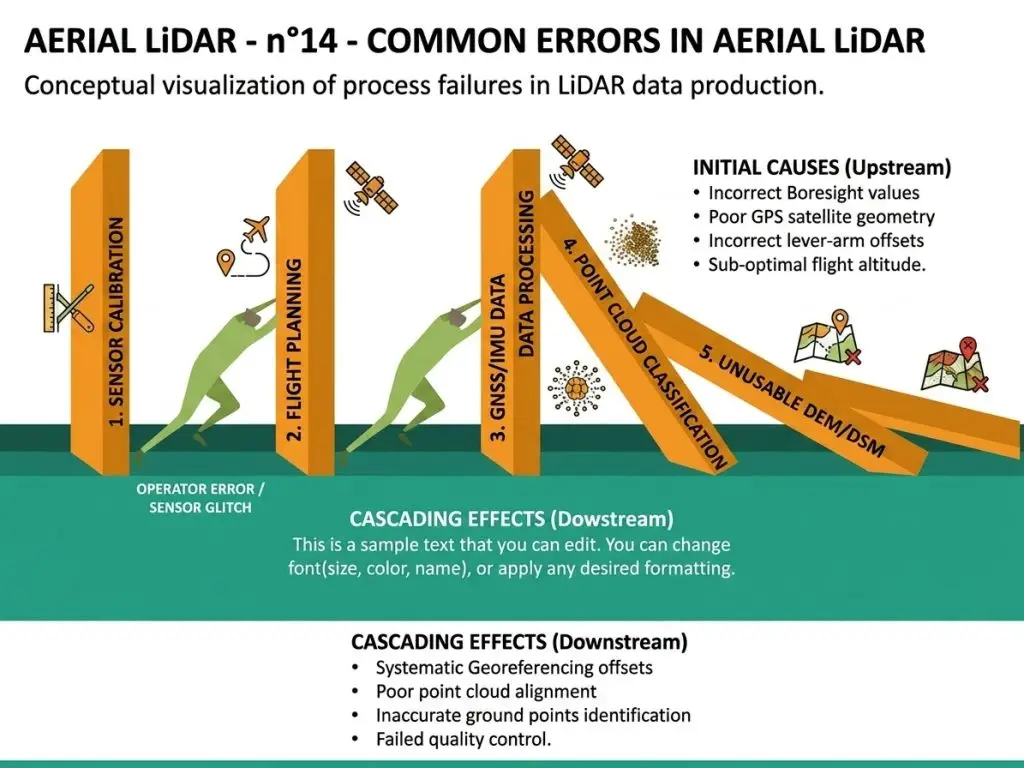
It extends the article on common errors.
What is already under way
Five developments rest on observable progress in aerial LiDAR.
Their continuation is not a matter of conjecture.
National programmes are extending and reaching their second coverage, which the corresponding article detailed and which is the most consequential development.
Sensors are progressing, achievable densities growing and acquisition costs falling at constant density.
Drones are becoming widespread, lowering the entry ticket on small footprints.
Learned classification methods are improving, now exceeding geometric rules on varied landscapes.
And documentary requirements are formalising, under the effect of regulation and the rise of institutional buyers.
The bottleneck that does not close
One constant runs through those five developments.
It deserves stating before any forward view.
None produces additional convention. They increase the data volume, the quality of the starting point and the processing speed, without modifying what determines a classification’s quality.
Three structural reasons explain that persistence.
Threshold and interface decisions remain human, no technical development stating where low vegetation ends and medium begins.
Ground knowledge is not deduced from geometry, a limit the use-case articles showed constant.
And evaluation requires a manually verified reference, a logical constraint no advance in automatic methods lifts.
One forward consequence follows. The starting point rises and the remaining work changes nature without disappearing, which shifts an aerial LiDAR provider’s value towards targeted correction and definition rather than mass production.
What second coverages will change
This development opens a market rather than improving an existing one.
It deserves a separate treatment.
A second national coverage turns a state into a series, which makes possible uses the first precluded.
Four new uses follow.
Change detection at territorial scale, construction, demolition and earthworks.
Vegetation growth monitoring, with the phenology precautions the forestry article set out.
Subsidence and landslide monitoring, subject to vertical accuracy permitting it.
And regulatory validation of an absence of conversion, a use the emerging requirements make demanding.
One important consequence follows. All four require comparability between campaigns, identical conventions and consistent datums, which makes harmonisation a new engagement and a competence few actors have had occasion to exercise.
What sensors will change
This hardware development progresses continuously.
Its effect deserves situating.
Three developments are currently under way.
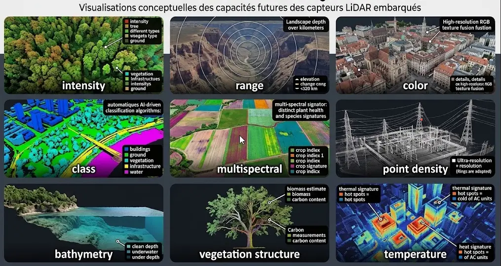
Emission frequencies are rising, which increases achievable density at constant flight speed and therefore lowers the cost per point.
Multi-beam sensors are spreading, producing several simultaneous footprints and improving the yield of a pass.
And wavelengths are diversifying, some configurations giving access to the bathymetry standard topographic laser does not measure.
Three limits accompany that progress.
The density and coverage trade-off remains, a higher density always reducing the area covered per hour.
Precision plateaus, the limit belonging to positioning and orientation rather than to the laser sensor.
And penetration under closed canopy stays bounded by the physics of foliage rather than by sensor performance.
One observation follows for an aerial LiDAR project. These advances lower the cost of a given density without lifting any of the constraints this series has identified as decisive.
What machine learning will change
This development dominates the aerial LiDAR discourse.
Its real effect deserves a measured examination.
Models operating on point clouds are progressing markedly and they raise a classification’s starting point.
Three effects are genuinely real. The correction volume falls. Classes geometry separates well become nearly automatic. And a model trained on a local corpus markedly surpasses a generic classification.
Three limits nonetheless persist. Annotated aerial LiDAR corpora remain scarce, which bounds the training. Transfer between landscapes is limited, a model degrading elsewhere. And evaluation still requires a verified reference.
One commercial consequence follows. This development strengthens the value of an annotated corpus rather than reducing it, a provider holding local corpora being able to train models its competitors lack the means to match.
What might not happen
An honest forward view sets out the developments whose realisation remains uncertain.
Maturation of the annotation tooling depends on a market whose narrowness has so far limited vendor investment.
Harmonisation of nomenclatures between national programmes progresses slowly and nothing guarantees it will conclude.
Generalisation of high density acquisitions runs into their cost, public programmes arbitrating in favour of coverage.
And the building of public annotated corpora, which would unlock the learning, finds no obvious sponsor.
Those four uncertainties concern pace rather than direction, which makes them trackable without being predictable.
The uses that appear to be developing
Four domains show converging signals and they deserve following closely.
Territorial change monitoring, which second coverages make possible and which is this modality’s economically strongest use.
Regulatory uses, forestry and carbon notably, where the traceability of a measurement is worth more than an estimate.
Linear infrastructure management, whose demand grows under safety requirements and network ageing.
And urban climate adaptation, heat islands and tree cover, driven by public policy whose funding is establishing.
One observation runs across those four domains. All require a reliable classification rather than a dense survey, which shifts demand towards processing and confirms this series’ central finding about aerial LiDAR.
What the sector will have to resolve
Four structural difficulties remain open and their treatment will determine part of the field’s evolution.
The scarcity of public annotated corpora, which bounds machine learning and which no actor has an interest in resolving alone.
The immaturity of three-dimensional annotation tooling, which follows from market narrowness rather than from technical difficulty.
The absence of shared conventions on thresholds and interfaces, which leaves each project reinventing its rules and makes corpora hard to combine.
And the disparity between national programmes, differing specifications and nomenclatures complicating cross-border projects.
Those four difficulties share a property. None is resolved by an isolated technical innovation, each requiring coordination between actors, which makes their timing uncertain.
One practical consequence follows for an aerial LiDAR project. A project cannot wait for their resolution and it can protect itself, by documenting its own conventions and building its own chain rather than hoping a standard emerges.
What will not change
One observation runs through the fifteen articles of this series.
The developments described concern sensors, data and methods. They do not concern what constitutes a project’s real difficulty.
Thresholds and interface conventions will remain human decisions.
The acquisition season will continue to determine what a survey permits under canopy.
Documentation will remain required and irrecoverable after the fact.
And the classified cloud will remain the asset, derived products staying regenerable views.
That permanence carries a practical consequence. Investment in those four points is independent of whichever technological scenario prevails, which makes it the safest allocation in an aerial LiDAR project.
What these trends imply
Four practical recommendations follow for an aerial LiDAR project.
They are immediately applicable.
Retain and document the classified corpora, whose value grows as learning methods improve.
Prepare for harmonisation between campaigns, a requirement second coverages will make routine.
Invest in large-scale processing infrastructure, a barrier few cross and which serves every subsequent project.
And adopt the documentary practices now, which anticipates a requirement that is arriving rather than answering one that exists.
Aerial LiDAR indicators worth tracking
Five indicators permit following this field’s evolution without depending on announcements.
The calendar of second national coverages, which conditions the opening of the temporal comparison market.
The publication of reference annotated corpora, which would unlock machine learning.
The appearance of natively geospatial three-dimensional annotation platforms, which would signal tooling maturation.
The entry into force of documentary requirements in public procurement, which would redistribute positions.
And the evolution of the ratio between acquisition cost and processing cost, whose current inversion explains this field’s economic structure.
One observation follows. The first indicator is the most decisive in the short term and the easiest to track, national programme calendars being public.
What a corpus built today will be worth tomorrow
One practical question closes this forward view because it bears on any present investment decision.
Three properties determine whether a classified corpus built today will retain all its value.
Documentation, an undocumented corpus losing its value when those who produced it leave, whatever its intrinsic quality.
Attachment to a durable source, a national survey remaining accessible indefinitely where a dedicated acquisition can disappear with its sponsor.
And separation between the classification and the derived products, a project storing models rather than the classified cloud having stored something that ages.
That third property is the most often lost in aerial LiDAR. A classification records what was on the ground at a date, information that does not expire; a terrain model generated with given parameters becomes worthless as soon as a use demands others.
One practical consequence follows. Those three properties cost little at the time of building and cannot be added afterwards, which places them in the same category as the threshold conventions this series described.
The calendar of coming years
Four milestones structure the period ahead, and they are tracked rather than forecast.
The completion and renewal of national coverages, whose calendars are public and whose slippage is habitual.
The maturation of learned classification methods, where the open question concerns the availability of sufficient training corpora.
The entry into force of documentary requirements in institutional procurement, whose final form remains open.
And the evolution of three-dimensional annotation tooling, whose immaturity could reduce if the market widens.
One recommendation runs across those four milestones. An aerial LiDAR project gains from knowing their calendar without pegging decisions to it, the method investments described above remaining relevant whatever their outcome.
What these trends imply for a provider
Three commercial consequences emerge from the whole of this series.
The first is that a classification provider’s position strengthens rather than erodes. The developments under way increase the volume of data available and the quality of the starting point without increasing the capacity to define and validate, which raises the relative scarcity of what is missing.
The second is that three-dimensional competence stays scarce and remains so. It does not follow from image annotation, it requires its own training and tooling, and entry into this modality costs enough that few actors make it.
And the third is that large-scale processing infrastructure is a durable barrier. It is built once, it serves every subsequent project, and it separates the actors able to process a territory from those who process a few tiles.
One observation completes those three consequences. They reinforce one another, a provider having crossed all three barriers occupying a position the rhythm of technical announcements does not threaten.
The position to build
This observation turns the above into an aerial LiDAR decision.
Three conditions currently coincide and none is permanent.
Available coverage extends faster than processing capacity, which leaves demand exceeding the supply of providers able to work at territorial scale.
The quality of automatic classifications stays low enough that correction is plainly necessary, a state that will last some years.
And second coverages have not yet reached most territories, which places the temporal comparison market at its opening rather than at its maturity.
One reading follows. Those three conditions describe a window rather than a steady state, and a provider building capability now arrives before the second coverages and before automatic methods narrow the correction gap.
An honest caveat accompanies that reading. A window closes from both ends, and the same reasoning recommending action today will recommend against it in several years, which makes the timing argument part of the reasoning rather than an accessory.
What fifteen articles will have established
A summing-up deserves closing this series because the fifteen articles converge on a single finding.
Aerial LiDAR measures a geometry with a precision no other technique reaches, and that geometry becomes information only through a classification that remains largely human.
Three readings follow.
Classification is the stage where value is created, every derived product depending on it and no defect being recoverable afterwards.
The dominant difficulties are of convention rather than of technique, thresholds, interfaces and edge cases determining the ceiling of everything after.
And the classified corpus is the asset, derived models staying regenerable views and automatic methods changing generation.
That finding matches exactly the one from the preceding series, formulated in domains with opposite constraints, which suggests a general property of exploiting data through machine learning rather than a peculiarity of this modality.
A reading that goes beyond aerial LiDAR
One generalisation deserves stating because this series’ central finding is not specific to it.
Four series have now been devoted to domains with very different constraints. Medical imaging concerns data that is scarce and legally constrained. Earth observation concerns data that is massive and free. Satellite image segmentation concerns a well-tooled technical operation. And aerial LiDAR concerns a measurement of unmatched precision.
Those four configurations produced the same finding. The limiting factor is neither the data, nor the models, nor the tools, but the documented definition of what is being measured and the reference permitting it to be evaluated.
Three readings follow. That property appears general to machine learning exploitation. It explains why the same difficulties recur in related forms across domains with no apparent connection. And it suggests that competence in definition and documentation transfers between domains better than technical competence does.
That third reading has direct practical reach. A provider having established a rigorous method in one domain holds a transferable asset, where tooling or a model is not.
What this forward view does not predict
One caveat deserves stating because an honest forward view sets out its own limits.
Three things escape this analysis.
Pace, the developments described being under way without their speed being predictable, public programmes being accustomed to slippage.
Ruptures, an unforeseen advance potentially altering one of the balances described substantially, which no extrapolation captures by construction.
And market effects, actor consolidation and demand evolution belonging to economic dynamics this technical analysis does not cover.
One consequence follows for how the above should be used. The recommendations made hold because they are independent of those three uncertainties, concerning invariants rather than bets, which is the only kind of advice a forward view can honestly give.
Three things to do now
An operational conclusion condenses this forward view into three immediate actions.
Document the conventions of every project under way, which costs hours and makes the corpus reusable whatever the evolution of methods.
Retain the classified clouds separately from the delivered products, which costs storage and preserves the one thing time does not devalue.
And check the second coverage calendars over the territories of operation, which costs minutes and signals when the temporal comparison market will open locally.
Those three actions share a property. None presupposes a bet on a particular development, each holds under every scenario described, and their cost bears no relation to what they preserve.
Where to start if starting now
One aerial LiDAR question deserves answering plainly, since an organisation reading this series may be deciding whether to enter this modality at all.
Four steps take a team from nothing to a defensible first engagement, and they are ordered by what each unlocks.
Learn to read the data before learning to produce it. A week spent navigating clouds, cutting sections and generating hillshades establishes whether the team can work in three dimensions at all, which is the question that decides everything after.
Take an assessment engagement before a production one. Assessing an existing classification is short, low risk and revealing, and it produces a client relationship without committing to a volume the team cannot yet estimate.
Build the conventions and the case library on that first small engagement, since they are the outputs that make the second one cheaper.
And invest in the processing chain only once the volume justifies it, the infrastructure barrier being real and premature investment in it being the commonest way to lose money on a first project.
One observation completes those four. The order matters more than the speed, and a team that reverses the last two — building infrastructure before establishing conventions — pays for a chain it cannot yet use well.
Common errors of reading
These misreadings recur often enough that naming them is usually enough to avoid them.
- Expecting automatic methods to remove correction.
- Confusing a development under way with an announced one.
- Assuming sensor improvement resolves convention difficulties.
- Neglecting preparation for harmonisation between campaigns.
- Deferring documentation on the expectation of future standardisation.
- Underestimating the market opening second coverages represent.
- Waiting for tooling to mature rather than building one’s own chain.
- Neglecting the growing value of a local annotated corpus.
- Assuming a model trained elsewhere will work on a new landscape.
- Taking a raised starting point for a disappearance of the work.
What to take away
Five developments are under way in aerial LiDAR, extension of national programmes, sensor progress, drone adoption, machine learning and documentary formalisation, and none produces additional convention.
Three readings emerge. Second national coverages turn a state into a series and open four uses the first precluded, all requiring a comparability between campaigns that makes harmonisation a new engagement. Machine learning raises the starting point and strengthens the value of a local annotated corpus rather than reducing it, a provider holding such corpora being able to train models its competitors do not match. And four things will not change, thresholds as human decisions, season as a constraint, documentation as an irrecoverable requirement and the classified cloud as the asset, which makes investment in those four the safest allocation.
For the general frame of this series, the article on aerial LiDAR sets out the panorama. For the difficulties these trends do not remove, the article on common errors lists them.
To explore delivery arrangements, supported formats and applicable control mechanisms, see our dedicated page on geospatial data processing. And if you are preparing a corpus intended to outlast a generation of methods, let us discuss your project.