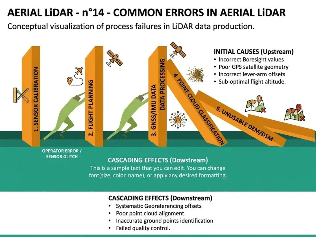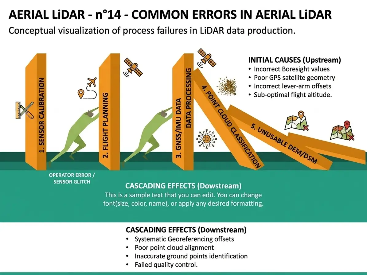
The twelve preceding articles in this series on aerial LiDAR flagged errors as their subjects arose. This one gathers them and classifies them by when they occur, a method permitting a difficulty to be detected where it appears rather than at delivery.One observation runs through this inventory: most of these errors are corrected at a negligible cost when they are committed and at a considerable cost afterwards. It extends the article on fusion with imagery.
Scoping errors
This family occurs before any data is handled.It is the most expensive in an aerial LiDAR project.Expecting surface nature information from aerial LiDAR is the commonest error, a point carrying no colour and intensity informing imperfectly.Targeting facade modelling from an airborne survey alone is the second, a downward-looking sensor undersampling vertical surfaces.Acquiring leaf-on for a project concerning ground under forest is the third, a constraint only the season lifts.And promising a risk analysis from a survey that only permits a statement of fact is the fourth, the absence of mechanical characteristics precluding unfavourable position modelling on a network.Specification errors
This family conditions what the data will permit.Its effects appear late.Confusing density with precision, two distinct notions specified separately.Specifying a mean density without a minimum value per unit area, which permits delivering a survey conforming on average and insufficient where the project needs it.Reasoning on total density rather than ground point density in wooded areas, a considerable gap and rarely made explicit.Omitting the vertical datum, a silent source of error whose scale exceeds any accuracy specification.And choosing a density out of caution rather than by calculation, which raises the acquisition cost and the processing cost simultaneously.Convention errors
This family concentrates most of the real variability.Omitting to fix the height thresholds between vegetation strata, values the standard nomenclature does not normalise.Neglecting the conventions at interfaces, ground and low vegetation, ground and building, building and furniture notably.Not settling the fate of mobile objects present at the time of survey.Illustrating a case library without sections, a three-dimensional configuration not being understood from a single view.And making that library inaccessible during the work, which reduces it to a document consulted at the start then forgotten.Production errors
This family belongs to execution.It affects throughput as much as quality.Working in perspective without using the vertical section, the tool experienced practitioners use most.Always using the same selection mode whatever the situation.Neglecting the combination of attribute criterion and spatial extent, which handles in one gesture what would take dozens of actions.Sweeping exhaustively rather than targeting defective zones, the extent of the batches precluding complete examination.And using image annotators without three-dimensional training, the competence not transferring directly.Control errors
This family produces results that look good without being so.Relying on a global rate of correctly classified points, an indicator majority classes dominate.Omitting the derived product check, the method with the best return and costing minutes per batch.Neglecting minority classes in the evaluation, though they often carry what matters.Not measuring expert disagreement on difficult configurations, which deprives the project of the achievable performance bound.And having work checked by whoever produced it, which removes the independence of the check.Technical errors
This family produces systematic effects in aerial LiDAR.Nothing signals them afterwards.Confusing a strip adjustment defect with a classification error, the former belonging to acquisition and not being corrected by annotation.Loading a whole scene into memory rather than reading it by windows, which blocks processing beyond a certain size.Colourising without verifying registration between sources, which systematically assigns the neighbour’s colour.Losing the echo attributes during colourisation, which removes precisely what distinguishes vegetation from a hard surface.And mixing different coordinate references, a uniform error and therefore invisible to internal consistency checks.Delivery errors
This family concerns technically correct work.It compromises its use.Delivering the derived products without the classified cloud, which precludes any later regeneration.Omitting the log of unclassifiable zones, which turns a known limit into an invisible defect.Not recording the conventions used, which prevents a third party from understanding what the deliverable describes.Omitting the quality report, which makes any claim unverifiable.And delivering a model without a density map, which suggests a uniform reliability the product does not have.Durability errors
This family occurs after delivery.It is the least anticipated of all.Not planning an updating strategy, a territory changing and a classification ageing.Neglecting comparability between campaigns, a change of convention producing an apparent change with no real evolution.Leaving knowledge of the conventions in one person’s head, which makes the corpus unextendable the moment they leave.And omitting the operating line from the budget, which produces an arrangement nobody funds after the project closes.Errors specific to three-dimensionality
One family deserves isolating because it has no equivalent in imagery and it surprises teams coming from that field.Five errors follow directly from the spatial nature of the data.Judging a configuration from a single view, a vertical superposition requiring a section to be understood.Transposing a surface sampling check, the third dimension making a zone apparently homogeneous in plan very varied in depth.Underestimating navigation fatigue, moving through a space demanding a cognitive effort examining an image does not.Neglecting occlusion, one object masking another according to viewpoint, which produces omissions no single view reveals.And reasoning in area rather than in volume when costing, two zones of equal footprint potentially containing very different point volumes.One observation follows for an aerial LiDAR provider. Those five errors are committed almost systematically by a team approaching this modality for the first time, which makes them the priority content of any training.The comparative cost of errors
Not all of them cost the same.This economic reading clarifies the priorities of an aerial LiDAR project.A scoping error costs the entire project, nothing produced serving.A specification error costs a new acquisition, the data not permitting what was expected of it.A convention error costs the corpus, whose rework is the dominant line.A control error costs the credibility of a result already announced, a damage exceeding the cost of redoing the measurement.A technical error costs a reprocessing, generally automatable and therefore modest.And a durability error costs reconstitution, more than the initial build since the context has been lost.That gradation leads to a practical conclusion. Prevention effort is most efficiently placed on the first three families, where it costs days and avoids months.The common structure of these errors
One cross-cutting observation explains their persistence despite being avoidable.Three properties characterise them.They are committed by omission rather than by action, a decision not taken being less visible than a wrong one.They produce no immediate effect, their consequences appearing weeks or months later.And correcting them produces no visible deliverable, which makes it hard to justify to a sponsor awaiting a result.That asymmetry between prevention cost and correction cost is the dominant characteristic of this inventory, a written threshold convention costing an hour and its reconstitution after production costing the corpus.Warning signals
Six signs indicate an aerial LiDAR project is starting badly and they are visible early.Nobody can name the decision the result will inform.The survey was adopted without its season or its ground point density being checked.The height thresholds between strata appear nowhere.The schedule contains no stage for assessing the existing classification.No derived product check is planned before delivery.And no end user has taken part in the scoping discussions.One observation follows. Those six signs are verified by reading a specification, they require no technical competence, and their presence predicts a difficulty better than any analysis of the technical arrangement adopted.The prevention arrangement
Six measures address the majority of the aerial LiDAR errors listed.Their total cost is modest.The five-question scoping, geometric information, available survey, existing classification, season and density.Prior assessment on a sample, which establishes the nature of the work and its throughput.Documented conventions with sections illustrating each decision.Checking by hillshading the terrain model, systematic before any delivery.Automatic consistency checks, developed once and applied everywhere.And the quality report written during the work, which cannot be reconstituted afterwards.Reworking a project in difficulty
One frequent situation deserves treating, a provider being regularly approached after unsatisfactory first work.Four questions determine what can be salvaged.Which family does the defect belong to, a technical error being corrected by reprocessing and a scoping error requiring starting again.Are the conventions used documented, their presence permitting identification of what must be reworked and their absence requiring reconstitution by sampling.Has the classified cloud been retained, its retention precluding any regeneration and its absence making the work unrecoverable.And is the acquisition metadata available, its absence preventing an annotation defect from being distinguished from a survey defect.One important observation follows for an aerial LiDAR provider. The third question is the most decisive, a project having delivered models without retaining the cloud having nothing to rework and needing to redo everything.Auditing a project under way
Four questions suffice.They establish in an hour where an aerial LiDAR project stands, from a team met for the first time.Ask to see the threshold and interface conventions. A document illustrated with sections indicates the project has addressed its dominant risk, an oral description indicates the opposite.Ask how the existing classification was assessed. A figure based on a sample indicates a grounded costing, a general impression indicates a blind estimate.Ask whether a hillshade of the terrain model is generated before delivery. Its absence means defects are reaching the client that minutes would have caught.And ask what will be delivered beyond the derived products. The absence of the classified cloud means the work cannot be reworked or regenerated.One observation follows. Those four answers characterise a project more reliably than any performance indicator, and they require no access to the data.The errors that are not errors
One qualification deserves making, not every observed discrepancy being an error.Four situations are regularly treated as failures when they are structural.The absence of ground points under very dense canopy, which belongs to physics rather than to processing, no classification creating points the sensor did not measure.Disagreement between annotators on ambiguous configurations, expected and constituting information rather than a defect.Lower performance on minority classes, structural and not correctable by better work.And geometric uncertainty on steep surfaces, a property of the measurement nothing reduces.One practical consequence follows for an aerial LiDAR project. Distinguishing an error from a limit avoids spending effort correcting what cannot be corrected, and that distinction belongs at diagnosis rather than after several unsuccessful attempts.A checklist before production
Ten points condense this inventory into a check applicable before launching an aerial LiDAR production.The decision the result will inform is named.The information sought is geometric in nature.The survey season suits the intended use.Ground point density has been measured over the sectors that matter.The existing classification has been assessed on a sample.The height thresholds between strata are fixed and documented.The interface conventions are written and illustrated with sections.The vertical datum is verified and compatible with the other data.The derived product check is planned before each delivery.And retention of the classified cloud appears in the delivery scope.A project ticking those ten has addressed most of the causes listed. A project ticking fewer than half will probably meet several of the families set out, and it is better to know that before committing the budget.Why these errors persist
One cross-cutting observation deserves stating because known errors keep occurring.Three mechanisms sustain them beyond ignorance.Schedule pressure favours shortcuts, all six prevention measures delaying the first visible result while producing nothing exhibitable.The information asymmetry means a client cannot distinguish rigorous work from fast work before the consequences appear, a situation aggravated in aerial LiDAR where the data is less legible than an image.And the field’s youth leaves each project reinventing its conventions, three-dimensional annotation lacking the established practices imagery has accumulated.That third mechanism is changing. The spread of national programmes multiplies projects, which accelerates the formation of shared practice, and the documentary requirements the preceding series described progressively introduce a method constraint.One consequence follows for a provider. Adopting these practices now amounts to anticipating a requirement that is arriving rather than answering one that exists, a considerably cheaper position than the reverse.Setting these errors out to a client
Naming possible failures looks counterproductive in aerial LiDAR and is not.This commercial dimension deserves stating.Three reasons justify that transparency.An informed client asks better questions, which produces a better scoped project and fewer disputes at delivery.The field being young, most clients have no experience of its failure modes, which makes the information genuinely useful rather than redundant.And a difficulty announced before it occurs is handled jointly, where the same difficulty discovered at delivery becomes a reproach.One caveat accompanies that recommendation. Setting out the errors without setting out the arrangement that addresses them installs an anxiety without answering it, which argues for presenting both together systematically.What this inventory offers a provider
Three commercial consequences emerge.The first is that a scoping engagement has demonstrable value. An interlocutor able to pose the five feasibility questions before commitment spares a client a failure whose cost far exceeds that of the scoping.The second is that the dominant families, scoping, specification and convention, belong precisely to an annotation provider’s competence domain, which makes its intervention more decisive than the acquisition team’s.And the third is that these errors are little discussed publicly, the field’s youth not having produced the literature imagery holds, which makes setting them out differentiating.That third consequence deserves emphasis. An aerial LiDAR provider able to name what makes a project fail demonstrates an experience no capability presentation replaces, and that demonstration costs one conversation.What this inventory teaches
One cross-cutting observation closes this examination because it matches the preceding clusters’ finding.The errors listed are almost all non-technical.Three findings compose it.None follows from a shortfall in skill, the operations involved being simple to describe and to execute.Almost all follow from a decision not taken, a threshold not fixed, a convention not written, a verification not conducted.And their prevention is demonstrated through documents rather than assertions, which makes it verifiable by a third party.One consequence follows for an aerial LiDAR provider. Methodological rigour is here a measurable differentiator rather than a posture, it costs days per project, and it is demonstrated to a client by simply presenting the documents it produces.The first project always costs more
One observation deserves stating plainly, since it reframes several of the errors above as a predictable phase rather than as failures.A team’s first aerial LiDAR project bears costs the following ones do not.Four of them are unavoidable. Building the tooling chain, which no product supplies complete. Training annotators in three-dimensional work. Establishing conventions that no prior project supplies. And discovering the failure modes this article lists, some of them by experiencing them.Two consequences follow for how that first project should be run.Scope it small enough that the learning is affordable, since the errors will be made and their cost scales with the volume they affect.And capture what is learned deliberately, the conventions and the case library being the outputs that make the second project cheaper, and being lost by default if nobody is responsible for writing them.That second consequence is the one teams miss. A first project completed without documenting what was learned has paid the entry cost and kept none of the benefit, which is the most expensive outcome available on this modality.The most expensive errors
These failures recur often enough that naming them is usually enough to avoid them.- Acquiring leaf-on for a project concerning ground under forest.
- Costing a correction without prior assessment.
- Omitting to fix the thresholds between vegetation strata.
- Relying on a global rate of correctly classified points.
- Omitting the derived product check.
- Confusing a strip adjustment defect with a classification error.
- Delivering the derived products without the classified cloud.
- Omitting the log of unclassifiable zones.
- Leaving the conventions undocumented.
- Omitting the operating line from the budget.