Three models derive from a classified aerial LiDAR survey, and confusing them is one of this field’s very commonest misunderstandings. They describe three different surfaces and serve distinct uses.
This article sets out what each represents, how it is produced and what determines its quality. It extends the article on classifying a point cloud.
Three distinct surfaces
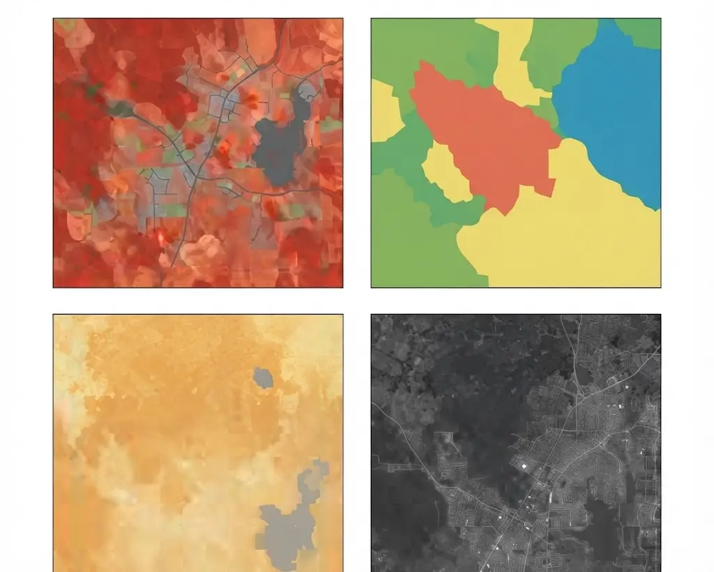
This founding distinction takes one sentence each. It separates the three products of aerial LiDAR. The digital terrain model describes the elevation of bare ground, as it would be without vegetation or construction. The digital surface model describes the elevation of the top of whatever covers the ground, canopy and roofs included. And the canopy height model describes the difference between the two, meaning the height of objects above the ground. Three important observations accompany that distinction. Over open ground, terrain and surface coincide and the height is nil. The third model is computed rather than measured, which means it accumulates the errors of the first two. And the terrain is not observed but reconstructed, interpolation between ground points producing a surface where no measurement exists.How a terrain model is produced
A three-stage chain produces it from an aerial LiDAR survey. Each stage introduces its own limits. Selection retains only points classified as ground, which makes this product entirely dependent on that class’s quality. Interpolation estimates an elevation at every cell of a regular grid from the available ground points, an operation necessary since those are irregularly distributed. And optional smoothing regularises the resulting surface, which improves appearance and can erase real detail. One important consequence necessarily follows. A terrain model contains measured zones and estimated zones, and nothing in the final product distinguishes them, which makes ground point density information as important as grid resolution. That observation has direct practical reach. Under dense forest cover, ground point density can be very low and the model largely interpolated, while its stated resolution suggests uniform precision.Interpolation methods
Four approaches are distinguishable. Their choice affects the result more than is generally supposed. Triangulation links ground points by triangles and interpolates linearly within them. It respects the measured points exactly and produces an angular surface. Inverse distance weighting estimates each cell by a weighted average of neighbouring points. It is simple and produces characteristic artefacts around isolated points. Geostatistical methods model the spatial structure and produce an estimate accompanied by an uncertainty, a real advantage rarely exploited. And surface functions fit a continuous surface, producing a smooth result that can attenuate real breaks. One recommendation follows for an aerial LiDAR project. The interpolation method and its parameters must be documented, two models produced differently from the same points not being comparable.Choosing the resolution
This parameter is regularly mis-set in aerial LiDAR. The mechanism deserves setting out. Grid resolution should match the available point density rather than exceed it. A grid finer than the density produces a majority of interpolated cells, which gives an appearance of precision without foundation and needlessly enlarges the file. A grid coarser than necessary loses information that was actually measured. A simple practical rule exists. Cell size should be on the order of the mean spacing between ground points, which ensures a majority of cells contains at least one measurement. One important difficulty accompanies that rule. Ground point density varies strongly with land cover, high on open surfaces and low under canopy, which makes a single resolution unsuited to varied terrain and sometimes justifies producing several versions.The surface model
This product is simpler to obtain. It nonetheless deserves some qualification. It is produced by retaining the locally highest points, independently of their class, which makes it less dependent on classification than the terrain model. Three particularities distinguish it clearly. It is better sampled, first-return density exceeding ground point density, which permits a finer resolution. It presents sharp discontinuities at building and tree limits, which smooth interpolation methods degrade. And it varies over time far more than the terrain, vegetation growth and construction modifying it continuously. That third particularity has a practical consequence. A comparison between two dates concerns the surface model rather than the terrain, which makes this product the object of change monitoring.The height model
It is the most useful and the most fragile product. It deserves the most attention. It is computed by subtraction and it inherits the errors of both models composing it. Four characteristic defects signal it immediately. Negative heights, physically impossible, revealing an inconsistency between the two models. Excessive heights, revealing an unfiltered noise point or a ground classification defect. Abrupt variations in homogeneous areas, revealing a terrain interpolation defect. And systematic underestimation under dense canopy, the interpolated terrain there often sitting above the real ground. One immediate practical consequence follows. Those four defects constitute an instant quality check, searching for them automatically revealing in minutes classification problems the point cloud inspection does not show.Break lines
This element appreciably improves a terrain model. It is nonetheless regularly omitted. Interpolation smooths sharp breaks, levelling a retaining wall, softening a bank and filling a ditch. Break lines are vectors telling the interpolator that a discontinuity exists and that it must not interpolate across it. Four situations make them necessary. Hydraulic structures, ditches and channels, whose function depends precisely on the break. Road embankments and cuttings. Retaining walls and terraces. And watercourse banks, whose position conditions any flow modelling. One practical consequence follows for an aerial LiDAR project. A model intended for hydrology without break lines produces wrong flows, water crossing obstacles the interpolation erased, and that requirement should appear in the specification. One observation completes that. Capturing break lines is annotation work in its own right, distinct from classification and often forgotten in quotations although it conditions the final product’s quality.The uses of each model
This correspondence avoids the commonest misunderstanding in aerial LiDAR. The terrain serves hydrology, flow and flood-prone area modelling, planning and earthwork calculation, and archaeology. The surface serves solar potential and irradiance calculation, visibility and propagation studies, and change monitoring. And the height serves forestry, building characterisation, vegetation management under networks and biomass estimation. One important observation runs across that correspondence. A client asking for hydrological modelling and receiving a surface model obtains an entirely wrong result, water appearing to flow over canopies, which makes this distinction non-negotiable at scoping.Zones without measurement
This difficulty runs across all three products. It is rarely documented. Some zones contain no usable point and their treatment belongs to a convention. Four distinct configurations produce them. Water surfaces, where the laser is absorbed. Laser shadow zones, masked by relief or a structure. Highly absorbing surfaces, certain dark coverings notably. And very dense understorey, where no pulse reaches the ground. Three treatments are possible and the choice between them must be explicit. Interpolating across, which produces a continuous surface and masks the absence of measurement. A null value, which signals the absence and complicates use. And a documented mask, which explicitly distinguishes the measured from the estimated. That third option is the most honest and the least practised. It lets a user know where the product rests on a measurement, information neither of the other two options nor the usual metadata supplies.Other derived products
Four complete the three main aerial LiDAR models. They serve specific uses. Hillshading simulates grazing illumination over the terrain model, which makes relief immediately legible and constitutes a control tool as much as a deliverable, archaeology making it its principal instrument. Slope and aspect maps derive from the terrain by local computation and serve agronomy, risk management and siting installations. Canopy structure indicators, density, stratification and cover fraction, derive from the vertical distribution of points rather than from a surface, which distinguishes them from the three models. And building models extract construction geometry from points classified as building, with a degree of generalisation to fix. One observation runs across those four products. All depend on the same classification as the three main models, which confirms this series’ central observation about aerial LiDAR: a survey’s value is settled at the classification stage rather than at the stages following it.Comparing two dates
This use constitutes these products’ principal economic value. The difference between two models acquired at distinct dates reveals what has changed, vegetation growth, construction, earthworks or erosion. Four precautions condition the validity of that comparison. The vertical datum must be identical, a change of datum between two campaigns producing a uniform offset an unwary user interprets as generalised subsidence. Horizontal registration must be verified, a planimetric offset producing apparent differences on every slope with no real change having occurred. The season must be comparable for surface models, a leaf-on and a leaf-off survey over the same forest producing a discrepancy of several metres. And the interpolation method must be identical, two models produced differently not being comparable even from the same points. One practical consequence follows. A difference map unaccompanied by a significance threshold leads to noise being read as change, and that threshold should derive from the combined accuracy of the two models rather than from an arbitrary choice.Documenting a model
Six pieces of information must accompany any aerial LiDAR delivery. Their absence strongly limits use. The source survey’s acquisition date, a model describing a state at an instant. The point density used in its production, distinct from grid resolution. The interpolation method and its parameters. The coordinate system and above all the vertical datum, whose incompatibility with other data is a frequent and silent source of error. The treatment applied to zones without measurement. And the estimated vertical accuracy, with the method used to establish it.Delivery formats
Three coexist for aerial LiDAR products. Their choice conditions downstream use. The raster grid is the standard format, each cell carrying an elevation, with the same geospatial properties as a raster image and universal compatibility. The triangulated irregular network respects the measured points exactly and adapts its density to local sampling, which produces a lighter file over homogeneous areas and suits raster processing poorly. And the classified point cloud itself is sometimes the best deliverable, a client with their own tooling preferring to produce the models under their own parameters. One recommendation follows. Delivering the classified cloud alongside the derived models costs little and preserves the client’s ability to reproduce or modify the products, which extends the engagement’s value beyond the initial delivery. One observation completes that recommendation. A model delivered alone becomes unusable as soon as a parameter must change, where a classified cloud permits everything to be regenerated, which matches the separation between reference and derived product the preceding series established.Quality control of a model
Four verifications reveal most of the defects. They are conducted quickly. Hillshading the terrain model, a representation making relief immediately legible and bringing out misclassified buildings as bumps and missing zones as hollows. Searching for negative heights, a physical inconsistency whose presence signals a problem unambiguously. Examining cross-sections, which reveal interpolation artefacts and abnormal breaks. And comparing against ground control points, the only absolute verification of vertical accuracy. One observation completes those four controls. The first is the most profitable, it takes minutes and it reveals most classification defects, which makes it the gesture to systematise.Verifying a model received
One frequent situation deserves treating, a project often beginning by receiving a model rather than producing one. Five simple verifications establish in an hour what the product permits. Generate a hillshade and examine it, which immediately reveals misclassified buildings, missing zones and interpolation artefacts. Search for impossible values, negative heights or aberrant elevations, whose presence signals a defect unambiguously. Verify the vertical datum and its compatibility with the project’s other data, a frequent and silent source of error. Compare the stated resolution against ground point density where the source cloud is available, which reveals an overstated resolution. And examine the dense canopy zones, where the gap between appearance and reliability is greatest. One observation completes those five. None requires particular tooling or rare competence, and their omission explains part of the projects that discover late that their base data did not support what they expected of it.What these products teach
One cross-cutting observation deserves closing this examination because it holds beyond these three models. These products have a property that makes them misleading. They are continuous and smooth, they display at a precise resolution, and nothing in their appearance distinguishes a densely measured zone from an entirely interpolated one. Three important consequences follow. Apparent quality systematically exceeds real quality, a model produced from sparse points looking the same as one produced from a dense survey. The usual metadata does not close that gap, a grid resolution and a mean accuracy saying nothing about the spatial distribution of reliability. And an unwary user reasons on appearance, which produces decisions grounded in zones where the product is only an estimate. One recommendation follows for an aerial LiDAR provider. Delivering a ground point density map alongside the model is the most useful and cheapest complement, it lets the user know where to trust the product, and few suppliers offer it.What these products are worth commercially
Three consequences emerge for an aerial LiDAR data provider. The first is that these products are not an engagement in themselves. Their generation is largely automatic once the classification exists, which makes them a delivery complement rather than billable added value. The second is that they are, in return, an excellent demonstration tool. A hillshade immediately reveals a classification’s quality, which permits showing a gap between two treatments where figures do not convince. And the third is that verifying them is a legitimate engagement. A client who has received models from an acquisition supplier rarely holds the means to assess their quality, and the five verifications set out above establish in an hour what their product actually permits. That third consequence deserves emphasis. It is a cheap entry point for the client and a revealing one for a provider, a model audit frequently leading to a need for classification rework.The vertical datum question
One technical point deserves separate treatment because it causes aerial LiDAR errors that are large, silent and easy to prevent. An elevation is meaningless without stating what it is measured from, and two references coexist in practice. Ellipsoidal height measures from a mathematical model of the Earth’s shape, and it is what satellite positioning delivers directly. Orthometric height measures from a gravity-based reference approximating mean sea level, and it is what maps, surveys and engineering documents use. The two differ by tens of metres in most places, and the difference varies geographically rather than being a constant offset. Three consequences follow for an aerial LiDAR project. A model delivered in one reference and combined with data in the other produces an error far exceeding any accuracy specification. The error is uniform over a small area, which makes it invisible in internal consistency checks. And it only surfaces on comparison against an external source, often late. One practical rule follows. Verify the vertical datum of every dataset before combining anything, and record it explicitly in the delivery documentation. That check takes minutes and it prevents an error class that no downstream quality control catches.Common mistakes
These failures recur often enough that naming them is usually enough to avoid them.- Confusing terrain model with surface model.
- Using a surface model for hydrological modelling.
- Choosing a grid resolution finer than the point density.
- Neglecting the variation in ground point density with land cover.
- Interpolating across zones without measurement and not documenting it.
- Smoothing a terrain model without measuring the effect on real breaks.
- Comparing two models produced with different interpolation methods.
- Omitting the vertical datum from the documentation.
- Not searching for negative heights before delivery.
- Delivering a terrain model without having verified the ground classification.
- Producing a model intended for hydrology without break lines.
- Comparing two dates without verifying the vertical datum.