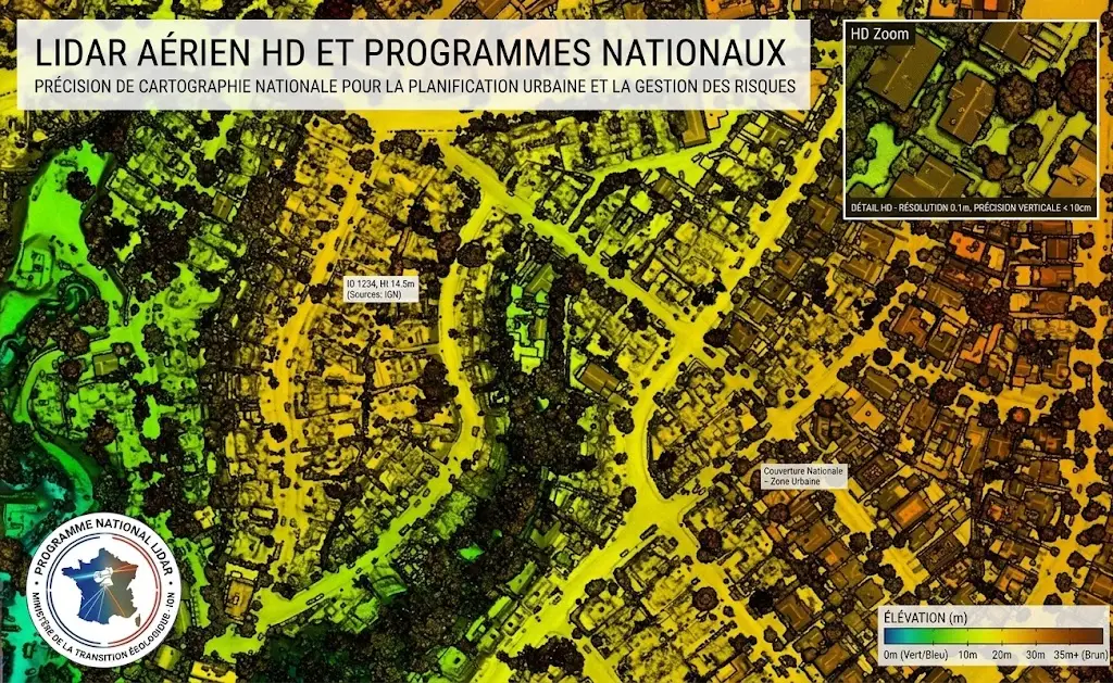
Several countries have now launched aerial LiDAR coverage programmes at national scale. That development changes this field’s economics more profoundly than any technical advance of the past decade.
It removes the cost line that dominated a project and shifts the question towards processing. This article sets out what these programmes supply, what they do not, and what that changes. It extends the article on urban planning.
What these programmes produce
A common logic structures these aerial LiDAR initiatives. It persists despite their national differences. The principle is to overfly an entire territory under homogeneous specifications, produce a classified point cloud and distribute it under an open licence. Four characteristics clearly distinguish them from a commercial acquisition. Coverage is exhaustive rather than targeted, which makes available areas no project would have justified surveying. The specifications are homogeneous, permitting comparisons between regions that a patchwork of disparate acquisitions would forbid. Distribution is open, removing the licensing restrictions the cost article in the previous series flagged as sometimes invalidating a business model. And an automatic classification generally accompanies the data, a point the following section develops and which is this article’s crux.What the delivered classification is worth
This observation determines the nature of the remaining work. It deserves stating plainly. The classification supplied with these programmes is produced automatically, at the scale of a whole territory and with no human intervention per batch. Three important consequences follow. It is of acceptable quality on common configurations, open ground, isolated buildings and homogeneous vegetation, which make up most of the area. It is defective on the difficult configurations, those the preceding articles listed, and those configurations concentrate precisely what most uses care about. And its quality varies geographically, a single parameterisation applied to a varied territory producing uneven results according to relief and land cover. One decisive practical consequence follows. This classification is a starting point and not a finished product, and most of a project’s work consists of assessing it then correcting it where the use requires.How to assess a delivered classification
This operation conditions any aerial LiDAR costing. It takes a few hours. The principle is to examine a representative sample before committing to a volume of work. Four simple verifications compose it. Hillshading the terrain model over several contrasting sectors, which immediately reveals ground class defects. Examining difficult configurations in section, trees overhanging buildings, structures and steep terrain. Counting unclassified points, a high proportion signalling the zones the algorithm gave up on. And comparison against an external reference where one exists, cadastre or building database, which reveals omissions and false detections. One direct commercial consequence follows for an aerial LiDAR provider. This assessment is an engagement in itself, inexpensive for the client and revealing, and it frequently leads to a correction need whose scale was not suspected.The specifications to check
Six elements determine what a national aerial LiDAR survey permits. They appear in the programme’s documentation. The nominal point density, an average value bounding what is resolvable and not guaranteed everywhere. The acquisition date by block, a national programme spanning several years and the blocks not being contemporary. The acquisition season, decisive for ground under canopy as the preceding articles established and rarely homogeneous across a territory. The stated vertical and horizontal accuracy, plus the method used to establish it. The coordinate system and above all the vertical datum, a frequent source of error when combining with other data. And the classification scheme used, whose classes and thresholds may differ from the standard nomenclature. One important observation follows for a project. Those six elements are consulted in minutes and they sometimes rule out a project before any work, an unsuitable season or insufficient density making the intended use infeasible on this source.What these programmes do not supply
Five limits define the space of the remaining work. Specific classes are missing, a national programme delivering base classes and not the categories sectoral uses require, conductors, furniture or road surface notably. Currency is limited, a national survey spanning several years and its repetition being widely spaced, which makes the data old in areas that change fast. Density is fixed by the programme’s specifications, generally suited to general uses and insufficient for demanding applications. The derived products delivered, where any exist, are generated with generic parameters that do not suit every use. And the quality documentation is global, a national average accuracy saying nothing about the reliability of a particular sector. That last limit is by far the most consequential. A user cannot know, from the metadata supplied, whether the classification is reliable over their area of interest, which makes local assessment indispensable.What this changes for a project
Three major shifts characterise these programmes’ effect on an aerial LiDAR project’s economics. The acquisition line disappears, which considerably lowers the entry ticket and makes accessible projects that were not. The classification line becomes dominant, and it takes the form of correction rather than production, which changes how it is organised. And the calendar question shifts, a project no longer awaiting a weather window or a flight campaign, but depending on the date of the available survey. One important commercial consequence follows. These programmes have not reduced the processing market, they have widened it, each covered area creating possible projects each of which requires a refinement the programme does not supply.The question of commercial use
One legal dimension deserves stating because it conditions a business model. An open licence is not an absence of conditions, and three elements deserve verification before building an offering. The right of commercial reuse, generally granted by open licences and to be confirmed rather than assumed. The attribution obligation, often present and easy to satisfy when known. And the regime for derived products, the question being whether a deliverable produced from this data must itself be distributed under the same licence, a point that can affect a proprietary model. One observation follows for an aerial LiDAR provider. That verification takes minutes and it prevents a difficulty the cost article in the previous series flagged as sometimes invalidating a business model after its construction. One further remark deserves adding here. The data being public, a client can obtain it themselves, which means a provider’s value lies entirely in the processing and not in the access, a situation that clarifies the positioning rather than weakening it.The correction work in practice
Four stages structure a correction engagement in aerial LiDAR. Their order matters. Assessment, set out above, which establishes where the defects sit and therefore the volume of work. Targeting, which identifies the zones to rework according to the intended use rather than to absolute quality, a defect without consequence for the project not justifying effort. The correction proper, by selecting groups of points as the corresponding article detailed. And adding the specific classes, an operation distinct from correction and often the bulk of the value for a sectoral use. One important observation nonetheless runs across those four stages. The second determines the engagement’s return, exhaustive correction costing several times a targeted one for an equivalent result as far as the use is concerned.The question of scale in aerial LiDAR
One practical difficulty accompanies this data and it surprises projects approaching this source for the first time. A national survey represents a considerable volume, several terabytes for a medium-sized territory, which precludes the approaches valid on an isolated scene. Four technical consequences follow directly. Tiling is imposed by the distributors, which requires handling objects straddling several tiles and their overlaps. Storage becomes a real line, unlike satellite imagery whose volumes are more modest for the same area. Processing must be automated and parallelised, sequential processing on a workstation becoming impracticable beyond a few tiles. And progress tracking becomes necessary, production across thousands of tiles requiring an organisation a few scenes did not. One observation follows for an aerial LiDAR provider. These constraints are a real barrier to entry, and the infrastructure permitting them to be handled is built once and reused on every subsequent project, which makes it an infrastructure investment rather than a project cost.The uses these programmes make possible
Six families of project become accessible and they are worth identifying since they constitute the market these programmes created. Small budget projects, authorities and consultancies that would not have funded an acquisition, now reach data they can process. Studies over large footprints, where acquisition cost grew with area, become conceivable over whole regions. Exploratory analyses, which did not justify a prior investment, can be conducted before deciding on a project. Comparisons between territories, which a patchwork of disparate acquisitions forbade, become possible through the homogeneity of specifications. Time series begin, a first national coverage constituting the initial state of a monitoring the next coverage will permit. And regulatory uses find a source whose neutrality and traceability are established, which matters where data must stand up to challenge. One observation runs across those six families. All require processing the programme does not supply, which confirms that free data creates work rather than removing it.Combining national data with dedicated acquisition
One configuration deserves describing because it answers the limits set out above without giving up the economic advantage. The national survey supplies a free homogeneous base, and a dedicated acquisition completes it where its limits get in the way. Four different arrangements are used. The currency complement, a recent acquisition over only the zones that have changed, presupposing a prior detection and costing a fraction of full coverage. The density complement, a denser survey over demanding footprints, infrastructure corridors or urban centres, the national survey serving the rest. The season complement, a leaf-off acquisition over forested sectors where the national survey was flown in summer. And the modality complement, a terrestrial acquisition supplying the facades the airborne survey undersamples. One practical consequence follows for an aerial LiDAR project. This mixed approach is markedly cheaper than a full dedicated acquisition, and it requires managing heterogeneity between sources, differing densities and dates having to be documented and sometimes harmonised.Costing an engagement on national data
Five factors determine the cost of a project based on this data and they differ from those of a project on dedicated acquisition. The quality of the initial classification, the dominant factor and knowable only through the assessment set out above, a good starting point dividing the effort. The complexity of the territory concerned, a dense urban sector requiring several times the effort of a rural one at equal area. The number of classes to add, an operation distinct from correction and often the bulk of the value. The use’s level of requirement, correction targeted on what matters costing a fraction of exhaustive correction. And volume, the scale constraints set out above imposing infrastructure whose cost amortises over time rather than over one project. One important practical consequence follows. A costing without prior assessment is a blind estimate, the gap between a sound classification and a defective one representing a factor rather than a margin, which makes prior assessment non-negotiable for a fixed-price engagement.Approaching a project on national data
Five questions scope this type of project and they are asked before any commitment. Is the area covered and at what date. That check takes minutes and determines whether the project has a free base. Do the specifications suit the use. Density and season can make the source unsuitable whatever its availability. What is the real classification quality over the area. That assessment conditions the costing and it follows from no global metadata. Which classes are missing for the intended use. Adding them is often the bulk of the value and it is distinct from correction. And does the licence permit the intended use. That check protects a business model before its construction rather than after. Those five answers determine feasibility, scope and budget for an aerial LiDAR project on national data. Asking them upfront turns an uncertain estimate into a defensible costing.What should improve
Four developments appear probable and they deserve tracking without pegging decisions to them. Second coverages are arriving, which opens the temporal comparison uses the first made impossible and is probably the most consequential development. The quality of automatic classifications is progressing, learning methods progressively replacing geometric rules, which will raise the starting point without removing correction. Densities are increasing, recent programmes’ specifications exceeding those of the first ones, which extends the accessible uses. And harmonisation between countries progresses slowly, which would ease cross-border projects today complicated by differing specifications and nomenclatures. One important observation accompanies those four developments. None removes the need for targeted correction, they shift the starting point without modifying the nature of the work, which matches the finding this series on aerial LiDAR has made about technical progress in general.A provider’s positioning
Three commercial consequences emerge from this development and they define a stance. The first is that the assessment engagement is a low-friction entry point. It costs the client little, it takes hours, and it establishes a need whose scale was not suspected, which makes it the most effective first contact in this market. The second is that targeted correction is a defensible engagement. Its scope is clear, its cost is established on an assessment rather than an estimate, and its result is demonstrated by comparison against the initial classification. And the third is that large-scale processing infrastructure is a barrier few cross. It is built once, it serves every subsequent project, and it durably separates the actors able to process a territory from those who process a few tiles. That third consequence deserves emphasis. It turns a technical constraint into a competitive advantage, exactly as the three-dimensional competence this series’ opening article identified.What this development teaches
One cross-cutting observation deserves closing this examination because it matches a finding the preceding series established in another domain. Satellite imagery went through the same development a decade earlier, free massive distribution replacing paid restricted access. Three effects occurred then and they are recurring here. The raw data market collapsed, access ceasing to be a source of value. The processing market widened, abundance creating projects scarcity forbade. And the bottleneck shifted towards interpretation, the ability to say what the data shows becoming the scarce resource. A general lesson follows for an aerial LiDAR provider. Free data shifts value downstream rather than destroying it, and an actor positioned on processing benefits from this development where an actor positioned on access suffers it. One practical consequence follows. National programmes continue and extend, which makes this development durable rather than cyclical, and an investment in processing capacity is justified by an established trend rather than by a bet.What to tell a client who has the data already
One aerial LiDAR conversation recurs on this market and it deserves preparing, since the client’s opening position is usually that the work is nearly done. They have downloaded a classified national survey. It opens, it looks complete, and the classes are populated. The natural question is what a provider adds. Three answers land, and they work in this order. Show rather than argue. A hillshade of their terrain model over a sector they know reveals the defects immediately, and one image does more than any explanation of automatic classification limits. Locate the gap against their use. A defect is not a problem in the abstract; it becomes one when it sits where their decision is made, and connecting the two makes the case concrete. And quantify the remaining work honestly, including the parts that need no attention. A provider who says most of the territory is fine and names the sectors that are not is more credible than one who proposes to redo everything. That third answer is the one that converts. It matches what the client suspects, that the data is largely usable, while establishing that usable is not the same as sufficient for what they intend to do with it.Common mistakes
These failures recur often enough that naming them is usually enough to avoid them.- Treating the delivered classification as a finished product.
- Committing to a correction volume without prior assessment.
- Correcting exhaustively rather than according to the intended use.
- Neglecting the survey date in an area that changes fast.
- Assuming homogeneous quality from a national average accuracy.
- Expecting sectoral classes from a national programme.
- Using the delivered derived products without checking their generation parameters.
- Neglecting the density check against the project’s requirement.
- Comparing two areas surveyed years apart without flagging it.
- Omitting to verify the licence conditions for a commercial use.