Vegetation is the third case in this series on satellite image segmentation, and it combines the difficulties of the two preceding ones. Like water, it presents diffuse limits and strong temporal variability. Like buildings, it sometimes calls for counting individual objects.It adds a difficulty of its own: the same vegetated surface can belong to different classes according to a criterion invisible on the image. This article sets out those difficulties and the conventions a project must fix. It extends the article on segmenting buildings.
Why vegetation is easy to detect
One physical property explains this class’s apparent ease in satellite image segmentation.Chlorophyll strongly absorbs radiation in the visible red and the cellular structure of leaves strongly reflects in the near infrared. Active vegetation therefore presents a considerable contrast between those two bands, a contrast no mineral surface reproduces.That property gave rise to normalised vegetation indices, computed from those two bands, whose use is so widespread that they are often a project’s first product.Three practical consequences follow directly. Distinguishing vegetation from non-vegetation is immediate and requires no learning at all. Infrared bands are indispensable, imagery limited to the visible performing markedly worse. And that index measures photosynthetic vigour rather than a class, which explains most of the difficulties that follow.What the index does not tell you
One confusion dominates this domain and it deserves setting out first, since it produces badly scoped projects.A high vegetation index indicates substantial photosynthetic activity. It says nothing about which plant, which use or which environment.Four distinctions escape the index alone. A meadow and a cereal crop at a comparable stage present similar values. A broadleaf forest and a plantation present similar values. A healthy dense canopy and a stressed dense canopy are poorly distinguished at a single date. And a fallow field and a maintained meadow are not distinguished at all.One methodological consequence follows. Those distinctions require either a time series, seasonal dynamics differentiating what a single date confuses, or texture and structure information, or an external source.That dependence on the time series is this class’s most decisive characteristic. It turns an image segmentation problem into a series segmentation problem, which changes the tooling, the acquisition cost and the nature of the corpus.Seasonal dynamics
They constitute both the principal difficulty and the principal resource.One property dominates this domain. The same parcel changes appearance radically across the year. Bare soil in winter becomes dense cover in spring then a harvested surface in summer, and those three states belong to the same use class.Three consequences follow for annotation. An annotation at a single date is valid at that date and wrong at another, which forbids using it as such on a different acquisition. The choice of acquisition date largely determines what is distinguishable, some crops differentiating only at a precise stage. And a corpus built over a single season cannot evaluate a year-round product.That same property constitutes the principal resource. The temporal profile of a vegetation index, its shape across the year, distinguishes covers no single date separates, which makes the time series the dominant approach in crop mapping.One important practical consequence follows. A satellite image segmentation project concerning vegetation must be conceived from scoping as a time series project rather than as a single image project.The three levels of nomenclature
Three families of class are distinguishable in vegetation and confusing them produces unexecutable projects.Cover describes what is physically present: tree, shrub, herbaceous, cultivated, bare soil. It is directly observable and it constitutes the most reliable level.Biological type describes the species or species group: broadleaf, conifer, a given crop. It is partly observable, the broadleaf and conifer distinction being accessible through phenology and texture, where the distinction between neighbouring species is not.And environment or use describes a functional category: production forest, protected natural area, permanent grassland. It is not observable and it belongs to the distinction the nomenclature article drew between cover and use.One recommendation follows for scoping. Establishing which level the request sits at avoids an impossible project, a client frequently asking for a functional level while assuming it is deducible from the image.The forestry case
It justifies separate treatment in satellite image segmentation.Its particularities explain the richness of existing references. Its definition is regulatory and quantified. Forestry references define a forest by a tree cover proportion, a minimum tree height and a minimum area, sometimes completed by a minimum width.That quantified definition has a considerable advantage: it is verifiable and it produces little disagreement between annotators, unlike classes defined by labels.Three specific difficulties nonetheless remain. The cover proportion is not directly measurable on medium resolution imagery, where each pixel mixes canopy and ground. Height is not observable in two-dimensional imagery, a difficulty identical to the one set out for buildings. And temporarily cleared surfaces, clearcuts and recent fires, remain legally forest while no longer looking like it.That third difficulty is the most frequent in practice. A model trained on appearance will classify a clearcut as non-forest, which contradicts the regulatory reference and produces systematic disagreement with any official source.Deforestation monitoring
This use dominates the domain economically.It is not about mapping a state but about detecting a transition, which shifts every requirement.Four distinctions are decisive there and confusing them invalidates a product.Cover loss denotes any observed disappearance, including temporary and including natural.Deforestation denotes a durable conversion to another use, which excludes clearing followed by regeneration.Degradation denotes a partial loss of cover without conversion, a situation far harder to detect than a clearcut.And natural disturbance denotes a loss from fire, wind or pests, whose distinction from a cut requires context the image does not always supply.One important commercial consequence follows. A client asking for deforestation monitoring generally expects the second notion and a remote sensing product delivers the first, a gap better set out at scoping than discovered at delivery.The difficulty of degradation
One distinction deserves further development because it is this domain’s current technical frontier.A clearcut produces a massive change detectable by any reasonable arrangement. Degradation produces a partial change, a reduction in canopy density that medium resolution imagery does not distinguish from seasonal variation.Three approaches are used and their limits deserve knowing. Time series analysis detects a break in a pixel’s profile, which requires a dense and regular series. Texture analysis detects a modification of canopy structure, which requires fine resolution. And height measurement detects a reduction in vertical structure, which requires an elevation source.One consequence follows for annotation. Building a degradation reference is markedly harder than building a clearcut reference, since the phenomenon is gradual and qualifying it requires a quantified criterion rather than a binary observation.That difficulty explains the scarcity of degradation corpora and it makes them precisely a resource of value, an observation the previous series made about scarce corpora in general.Agriculture and crop mapping
A second major use deserves describing since its requirements differ markedly from the forestry case.Crop mapping rests almost entirely on temporal dynamics, each crop presenting a characteristic development profile.Four requirements distinguish it. The series must cover the full growing season, a single acquisition not permitting crops to be distinguished. Series regularity matters, gaps from cloud having to be handled explicitly. Geographic location conditions the profiles, a cropping calendar varying strongly between regions. And the reference often comes from administrative area declarations, a source the opening article of the previous series flagged as the least expensive.That last characteristic is a considerable advantage for a project. A partial reference exists in many countries, which turns corpus building into verification and completion work rather than full production.Three precautions nonetheless accompany its use. A declaration concerns an intended crop rather than an observation, which produces real discrepancies. The declared geometry may differ from the physical parcel. And the declaration date precedes the campaign, which leaves room for change.Handling gaps in a satellite image segmentation series
This difficulty is regularly underestimated.It dominates time series projects in vegetation satellite image segmentation. Cloud cover removes acquisitions irregularly, producing incomplete series whose gaps are not random: some regions and some seasons are systematically cloudier.Four strategies are used and their effects differ markedly.Temporal interpolation fills gaps by estimating missing values from neighbouring observations, which works well on a smooth phenomenon and masks an abrupt break occurring during the gap.Smoothing produces a regularised profile, which eases comparison and attenuates short events.Compositing retains the best observation over a given period, which produces a regular series at the price of an effective date varying between pixels.And recourse to radar fills gaps with a modality insensitive to cloud, which requires handling the heterogeneity of the two sources.One important consequence follows for annotation. The gap handling method must be documented and identical between corpus and production, a model trained on interpolated series applied to composited series meeting data whose structure differs from its training.The question of object scale
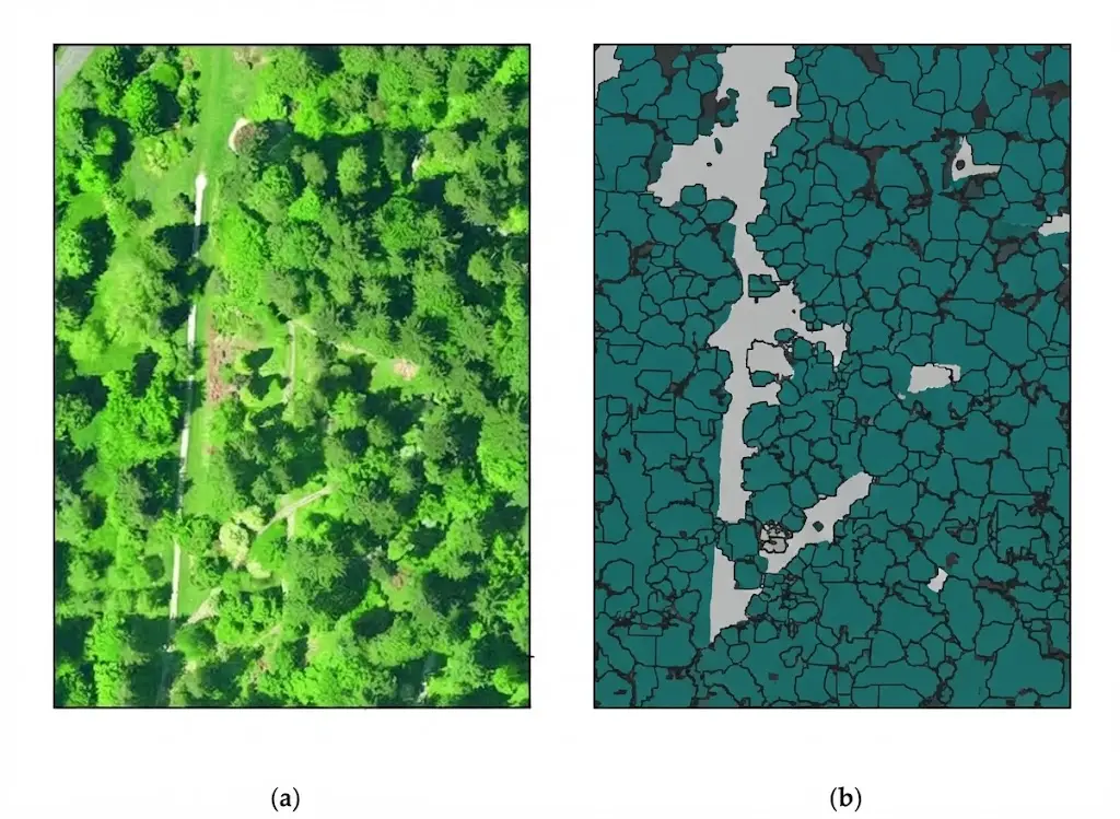
One structuring choice deserves stating since it differs by vegetation type.Three object scales coexist in vegetation satellite image segmentation.The pixel suits continuous cover and vigour indicators, where the notion of an object has no meaning.The parcel or stand suits agriculture and production forestry, where a homogeneous management unit is the natural object and where a parcel layer often exists.And the individual tree suits inventory, health monitoring and fine biomass estimation, and it presupposes sub-metric resolution or an elevation source.That third scale deserves a qualification. Detecting individual trees under dense canopy is very difficult from imagery alone, crowns overlapping, which explains the growing recourse to elevation data the next cluster details.One recommendation follows for scoping. Establish the expected object scale before any resolution discussion, since it determines the source required and therefore most of the budget.The conventions to fix
Seven decisions must be settled before production and omitting them produces substantial variability in vegetation satellite image segmentation.The cover threshold defining each class, which makes the definition verifiable.The reference date or period, without which an annotation has no meaning.The treatment of temporarily cleared surfaces, which settles the gap with regulatory references.The treatment of forest edges, whose exact position is conventional as for any gradual transition.The treatment of isolated trees and hedgerows, which often fall below the minimum mapping unit without being negligible.The treatment of agricultural surfaces between crops, bare soil belonging to an agricultural use.And the treatment of mixed vegetation, agroforestry mosaics and transitional environments, calling either for a class of their own or for a dominance rule.Evaluating a vegetation product
Three particularities distinguish it in satellite image segmentation.The reference date must match the annotation date, failing which a disagreement reflects a temporal gap rather than an error. That check precedes any diagnosis.Confusions between neighbouring classes dominate the error, a meadow taken for a fodder crop being a less serious confusion than a meadow taken for an artificial surface. A full confusion matrix is therefore more informative than a global score, and a hierarchical nomenclature allows evaluation at several levels.And interannual variability requires evaluation across several years, a product validated on a single campaign potentially failing in a climatically atypical year.That third particularity is the least respected. A drought year or a late year modifies temporal profiles enough to appreciably degrade a model calibrated on an average year.The cost of a vegetation corpus
It differs markedly from the other classes.Three characteristics distinguish it.The cost is temporal rather than spatial. Annotating a parcel takes little time; establishing its crop requires examining a series, which shifts effort from delineation to qualification.Delineation is often free. An existing parcel layer frequently supplies the geometry, which reduces the work to assigning a class per object, a markedly cheaper task than delineation.And expertise dominates. Distinguishing two crops or two stands requires knowledge the image does not replace, which raises the hourly rate and limits the number of annotators available.Two levers effectively reduce that cost. Field survey on a sample, which supplies a reliable reference and serves to calibrate photo-interpretation on the rest. And using administrative declarations where they exist, with the precautions set out above.That structure makes this class economically more accessible than it appears where a parcel layer and declarations exist, and markedly more expensive where they are missing, which matches the geographic disparity research has documented.Emerging regulatory requirements
This development transforms demand in vegetation satellite image segmentation.Several regulatory arrangements now require demonstrating that a product does not originate from forest conversion, which creates a need for documented proof rather than estimation.Three requirements follow and they differ from the preceding uses. Method traceability becomes contractual, a claim having to be auditable by a third party. The reference date is fixed by the text rather than chosen by the project. And the burden of proof falls on the operator, which makes a product’s uncertainty as important as its average performance.One direct commercial consequence follows. A product intended for these uses must be accompanied by method documentation and uncertainty characterisation, requirements the validation articles in the previous series detailed and which become enforceable here.That development markedly favours a methodical provider. It turns documentary rigour, until now perceived as an overhead, into a condition of market access.What this use case teaches
This observation completes those drawn from water and buildings in satellite image segmentation.Three classes have been examined and they illustrate three distinct difficulties.Water poses a difficulty of definition, three notions hiding behind one word.Buildings pose a difficulty of geometry, projecting a three-dimensional object producing three distinct objects.And vegetation poses a difficulty of observability, the distinguishing information simply not being contained in a single image.That third difficulty is the most radical and it calls for a response of a different order. Where a convention resolves the first and a geometric correction attenuates the second, the third requires acquiring additional information, a time series or an external source, which belongs to designing the arrangement rather than to annotation method.One general recommendation follows. Before any work, establish whether the necessary information is present in the intended data, a question distinct from whether a model can extract it, and whose negative answer is discovered more cheaply at scoping than after training.Choosing the acquisition window
One satellite image segmentation decision determines more of the outcome than any modelling choice, and it is taken early or not at all.Where a single date must be used, the window is chosen for maximum separability between the target classes rather than for image quality. That optimum is usually narrow and it differs by region.Three considerations set it. The phenological stage at which target classes diverge most, which requires knowing the local calendar rather than a general one. Cloud probability over the window, which determines whether the chosen date is actually obtainable. And the stability of the window between years, a date optimal in an average year potentially missing an early or late one.Where a series is used, the question becomes one of density rather than date, and three thresholds matter. Enough observations to characterise a profile shape. Enough regularity to compare profiles between pixels. And enough coverage of the divergence period, gaps there costing more than gaps elsewhere.One practical consequence follows for annotation. The corpus should be built on the same acquisition window as the deployment, since a reference established at an optimal stage and applied to a suboptimal one measures a performance the product will not reproduce.Common mistakes
These failures recur often enough that naming them is usually enough to avoid them.- Expecting a vegetation index to identify a species or a use.
- Conceiving a vegetation project as a single image project.
- Annotating without recording the acquisition date.
- Asking for a functional level while assuming it is deducible from the image.
- Confusing cover loss with deforestation.
- Classifying a clearcut as non-forest against the regulatory reference.
- Handling degradation with the means designed for clearcuts.
- Using area declarations without measuring their gap against observation.
- Building a corpus over a single agricultural campaign.
- Neglecting series gaps caused by cloud cover.
- Training on interpolated series and applying to composited ones.
- Setting a resolution before establishing the expected object scale.