

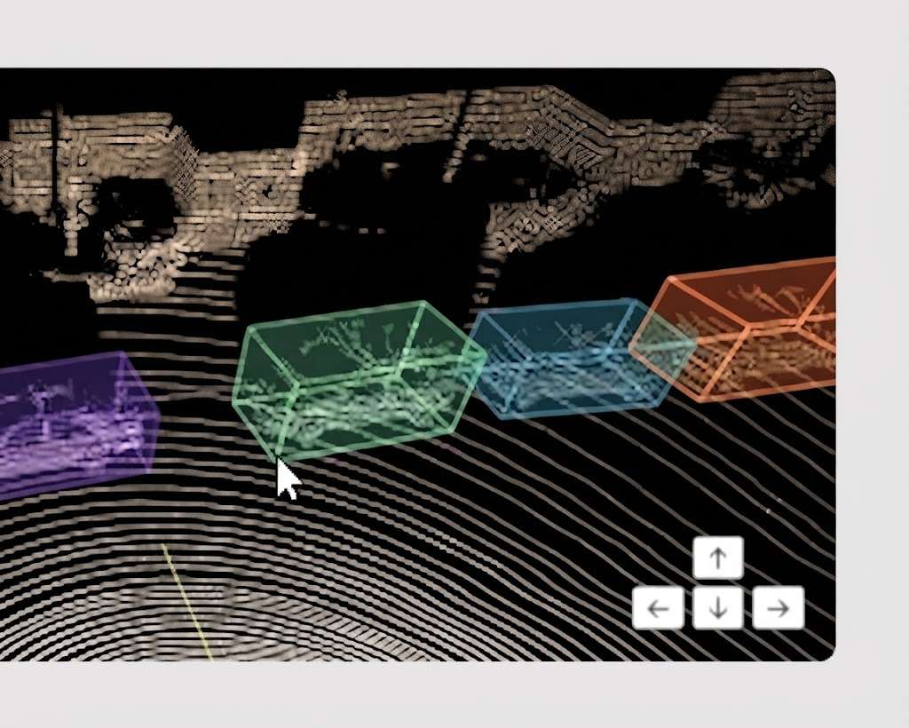
Two methods produce point clouds and they do not produce the same data. The choice between them precedes the annotation project and it determines what that project will be able to establish.This article sets out the criteria. It extends the article on 3D annotation for robotics and logistics.
Two measurement principles
Two approaches feed a 3D annotation project.They produce coordinates whose nature differs profoundly.LiDAR measures a distance by timing a signal, each point resulting from a direct measurement.Photogrammetry infers a position by comparing several images, each point resulting from a computation.One important practical consequence follows. The first method produces a measurement and the second an estimate, a distinction governing everything this chapter sets out about 3D annotation.What LiDAR brings
Five properties characterise this 3D annotation data source.Metric precision, a distance measured directly and not inferred.Independence from lighting, the sensor emitting its own signal.Range, which reaches distances no image reconstruction covers.Return intensity, additional information distinguishing materials of identical geometry.And controlled sparsity, a regular and predictable cloud rather than an uneven one.One observation follows. The second property explains this source’s adoption in outdoor contexts, a night acquisition or one under variable lighting staying usable where an image reconstruction fails.What photogrammetry brings
Five properties characterise this second source.Density, far higher on textured and well-lit surfaces.Native colour, each point carrying the information of the image it came from.Acquisition cost, a camera being of no comparison with a range sensor.Flexibility, an acquisition being conducted with common equipment and a quickly trained operator.And retrospective access, a set of old images being reconstructible where a measurement not taken is lost.One practical consequence follows for a 3D annotation project. The second property changes the annotation work, colour resolving a share of the class ambiguities geometry alone leaves open.What photogrammetry cannot do
Four limits bound this method in 3D annotation.They are structural.Textureless surfaces do not reconstruct, a plain wall or a sky supplying no matching point.Reflective surfaces produce erroneous points, their appearance changing with viewpoint.Absolute scale is not given, a reconstruction being defined up to a factor with no external reference.And precision falls sharply with distance, the gap between viewpoints becoming insufficient.One important observation follows. The third limit is the heaviest in consequences for a 3D annotation corpus, a dimensional measurement having no meaning without a reference element introduced into the scene.Establishing a scale in photogrammetry
One operation lifts this method’s principal limit and it is prepared before acquisition.Three approaches establish an absolute scale in photogrammetry.A target of known dimensions placed in the scene, a simple method presupposing on-site preparation.Control points surveyed by an external means, heavier and more precise.And the carrier’s position data, practicable by drone where the positioning precision permits.One important practical consequence follows for a 3D annotation project. Those three approaches are decided before the outing and cannot be recovered, a reconstruction with no reference being scalable retrospectively only by returning to the site.What LiDAR cannot do
Four limits bound this method as well.Density stays lower on near objects, a sensor scanning on a fixed pattern rather than according to content.Colour is absent, unless paired with a camera, which introduces a calibration requirement.Glazing and water produce aberrant returns or no return.And the equipment cost stays a barrier for occasional or dispersed acquisitions.One practical consequence follows. The second limit explains the frequency of mixed arrangements, colour’s contribution being decisive enough to justify the calibration constraint.What each method changes in the annotation
Four differences appear at the very moment of 3D annotation work.The class decision is faster on a coloured cloud, texture lifting ambiguities shape leaves open.Delimitation is more reliable on a measured cloud, a point’s position not carrying a reconstruction error.The artefacts differ, isolated aberrant points for one and noisy or missing surfaces for the other.And dimensional control is only possible with an established scale, which excludes an unreferenced photogrammetry.One important observation follows. The last difference deprives an unreferenced photogrammetric corpus of the most powerful check in 3D annotation, which must be verified before accepting such a dataset.The artefacts specific to each source
Four characteristic defects permit identifying a cloud’s origin with no documentation.Isolated points far from any surface signal a LiDAR having met dust, rain or a reflection.Bulging or undulating surfaces where flatness is expected signal an imperfectly constrained image reconstruction.Sharp holes with regular outlines correspond to textureless zones in photogrammetry.And streaks of points following a scan line betray a badly compensated mobile sensor.One observation follows for a 3D annotation project. Those four signatures are recognised in a few minutes of examination, they inform on the source where documentation is missing, and they permit anticipating the difficulties the corpus will pose.The mixed arrangement
This configuration combines the two sources in 3D annotation.It is frequent.A range sensor calibrated with a camera produces a measured and coloured cloud.Three contributions follow in 3D annotation.The geometric precision of the first is added to the semantic richness of the second.Classification becomes fast without losing dimensional reliability.And verification is easier, a checker finding in the image what they cannot distinguish among the points.Three requirements accompany that arrangement in 3D annotation.Calibration between sensors must be established and documented.Temporal synchronisation becomes critical as soon as the scene or the carrier moves.And the delivery format must retain the parameters permitting projection.What the carrier changes
Four acquisition configurations occur.They steer the choice of source.The static survey on a tripod, which allows both methods and produces the best precision.The mobile ground carrier, vehicle or trolley, where LiDAR dominates through its robustness to lighting.The drone, where weight and endurance long favoured photogrammetry before light sensors spread.And the handheld device, where a camera’s flexibility remains a decisive advantage.One practical consequence follows for a 3D annotation project. The first case allows a free trade-off and it is the rarest, the other three constraining the choice by logistical considerations rather than by the quality of data sought.The contexts that settle it
Five situations impose one method rather than the other.Night acquisition or acquisition under variable lighting, which excludes photogrammetry.Uniform textureless surfaces, which exclude it too.Contractual dimensional measurement, which requires an established scale.Retrospective reconstruction from existing images, which excludes LiDAR.And a constrained acquisition budget across numerous dispersed sites, which often puts it out of reach.One observation follows. Those five situations settle the matter with no trade-off, which makes the question of context more decisive than comparing the two methods’ respective merits.The verticals and their dominant source
Five domains show a marked preference and it is explained by context rather than by fashion.Autonomous driving adopts LiDAR, the range requirement and the independence from lighting being decisive.Heritage and archaeology often adopt photogrammetry, colour and texture being part of the deliverable.Building adopts static LiDAR, dimensional precision conditioning use in a digital model.Agriculture and forestry use both, the choice depending on the presence of canopy and on the range needed.And industrial inspection adopts photogrammetry on small parts, the density obtained exceeding that of a range sensor.One observation follows for a 3D annotation provider. Those preferences determine the artefacts a vertical’s corpora will present, which makes experience acquired in one domain partly transferable to another sharing the same source.What this changes in the project’s cost
Four effects appear on the 3D annotation workload.Photogrammetric density lengthens processing time without improving the decision.Colour strongly reduces the time spent on ambiguous classes.Zones with no reconstruction create voids that call for a convention and slow the work.And the absence of scale removes the automatic checks, which shifts the load towards human verification.One important practical consequence follows. Those four effects partly offset one another, a photogrammetric source being neither more nor less expensive to annotate in principle, which makes the pilot batch indispensable for settling the matter.What the conventions must provide for by source
Four rules differ according to the data’s origin and they do not transfer.The minimum density threshold, expressible as a point count on a regular LiDAR and far less stable on an uneven reconstruction.The treatment of aberrant points, isolated and easy to discard on one side, integrated into noisy surfaces on the other.What to do with data-free zones, absolute occlusion for one and absence of texture for the other.And the dimensional tolerance, expressible in absolute value on a measurement and only proportionally on an estimate.One important practical consequence follows. The last rule explains why a 3D annotation reference written for one source does not apply as it stands to the other, a transposition that looks harmless and produces untenable requirements.Combining two corpora of different sources
A question arises where a client holds sets from both methods.Four gaps prevent a direct combination in 3D annotation.The density distribution differs, which produces an imbalance between the two parts of the corpus.The artefacts differ, a system trained on one meeting on the other defects it has never seen.The presence or absence of colour makes part of the examples incomplete.And dimensional precision is not of the same order, which blurs any requirement expressed in absolute value.One important observation follows for a 3D annotation project. Those four gaps do not forbid combination and they require keeping the source as metadata, the only way to evaluate performance separately and to prevent a weakness on one source being masked by the average.What the mesh adds
One transformation sometimes intervenes between acquisition and annotation and it deserves flagging.A cloud can be converted into a continuous surface before being annotated.Three notable effects follow.Holes are filled by interpolation, which produces a complete and partly invented surface.Noise is smoothed, which improves the appearance and erases information about local reliability.And the data becomes lighter and faster to handle.One important practical consequence follows for a 3D annotation project. The first effect is the most problematic, an annotator working on a reconstructed surface no longer distinguishing what was measured from what was filled in, which argues for annotating the cloud and delivering the mesh rather than the reverse.How to verify data received
Five verifications are needed before accepting a dataset for 3D annotation.The data’s origin, measurement or reconstruction, information that is not always supplied.The presence of an established scale and how it was established.The presence of intensity or colour, which conditions certain nomenclatures.The effective density on the objects of interest rather than the announced average density.And the extent of the data-free zones, which bounds the usable share of each scene.One important observation follows for a 3D annotation project. The fourth verification frequently produces a surprise, a flattering average density potentially masking an insufficient density precisely where the objects to annotate are found.The pilot batch that settles it
One method separates the two sources where context does not.The principle is to acquire the same scene by both methods and to have both clouds annotated.Four usable measurements follow.The throughput observed on each source, which replaces any estimate.The rate of undecided classes, which measures colour’s real contribution.The share of the scene with no usable data, which differs strongly by method.And the disagreement between annotators, which bounds what can be promised on each.One practical consequence follows for a 3D annotation project. That double acquisition costs a day on a representative site, it produces a grounded trade-off rather than a preference, and its cost bears no relation to that of a complete campaign run on the wrong source.Approaching this choice in a project
Five questions scope this trade-off in 3D annotation.Is a dimensional measurement expected. A positive answer requires an established scale.Are the lighting conditions controlled. A negative answer rules out photogrammetry.Does the nomenclature distinguish materials. That answer calls for colour or intensity.What distance must be covered. That answer bounds what each method permits.And does the data already exist. A positive answer makes the trade-off moot.Those five answers determine the appropriate source. Asking them before acquisition avoids a corpus whose nature forbids what the project expected to establish.The question that settles it
One question separates the two sources faster than any comparison chart.Will the deliverable contain a dimension expressed in real units.A positive answer requires a measurement or a scale established on site, which rules out an unreferenced photogrammetry whatever its apparent quality.A negative answer opens the field, classification and relative localisation being satisfied by a reconstruction.That question concerns the deliverable and not the technique, it is asked before any acquisition, and it avoids the most expensive case, a careful corpus discovered afterwards to be incapable of carrying any measurement.Three checks on receipt
Three checks suffice to qualify a dataset before committing.Establish the data’s origin, measurement or reconstruction, information that is often missing and that changes everything after.Verify the presence of a scale and how it was established, without which no dimensional requirement holds.And measure the density on the objects of interest rather than on average, the only value that predicts feasibility.Those three checks take an hour on a sample, they need no particular tooling, and they avoid accepting a corpus whose nature forbids what the project expected.What this choice commits over time
Three consequences extend beyond the initial project and deserve stating at scoping.The source determines the artefacts the system will learn to tolerate, which limits its later use on data of another origin.A change of source mid-programme invalidates part of the contractual requirements expressed in absolute value.And a corpus built on one source stays combinable with another of the same origin and only with difficulty with another.One observation follows. Those three consequences argue for settling early and documenting the source in the metadata, a decision costing one field and preserving the corpus’s value as the programme extends.What the provider must ask for
Four pieces of information condition an honest quotation and they are requested before costing.The acquisition method used, whose answer determines the artefacts to expect.The presence of an established scale, which conditions the checks available.A representative sample rather than a demonstration scene, the only way to measure the real density.And the availability of associated images, whose presence changes the throughput on ambiguous classes.One observation follows for a 3D annotation provider. Those four questions are asked in one email, they precede any serious costing, and a client’s inability to answer them is itself information about the project’s maturity.What this chapter teaches
One cross-cutting observation deserves closing this examination.The two methods produce objects of different nature under an identical appearance.Three findings compose it in 3D annotation.A measured cloud and a reconstructed one look alike on screen and do not license the same assertions.The absence of absolute scale deprives a corpus of dimensional control, the principal advantage of 3D annotation over image annotation.And native colour accelerates the class decision as much as measurement makes delimitation reliable.That finding matches the one the preceding series established about data sources: the question is not which is better but which carries the information the project must establish.What a provider gains from handling both
One observation about capability belongs here, since most providers specialise in one source without deciding to.Handling both sources is less a technical achievement than a set of documented conventions.Three things make it worth acquiring.Clients rarely control their source, since it is imposed by the carrier, the budget or an existing dataset, so a provider tied to one source loses engagements for reasons unrelated to competence.The transposition trap is real and invisible, applying a LiDAR reference to a photogrammetric corpus producing requirements nobody can meet.And the double pilot described above is only offerable by someone able to annotate both, which turns a scoping service into a differentiator.One practical consequence follows for a 3D annotation provider. The investment is mostly in writing two convention sets rather than in tooling, which places this capability within reach of a team that already handles one source well.Common mistakes
These failures recur often enough that naming them is usually enough to avoid them.- Treating a reconstructed cloud as a measured one.
- Accepting an unscaled photogrammetry for a measurement project.
- Adopting photogrammetry on textureless surfaces.
- Neglecting calibration in a mixed arrangement.
- Comparing corpora produced by two different methods.
- Relying on the announced average density rather than on the density on the objects.
- Ignoring the zones with no reconstruction in the costing.
- Fixing a materials nomenclature with neither colour nor intensity.
- Assuming a dense source is a precise source.
- Choosing the method after acquisition rather than before.


