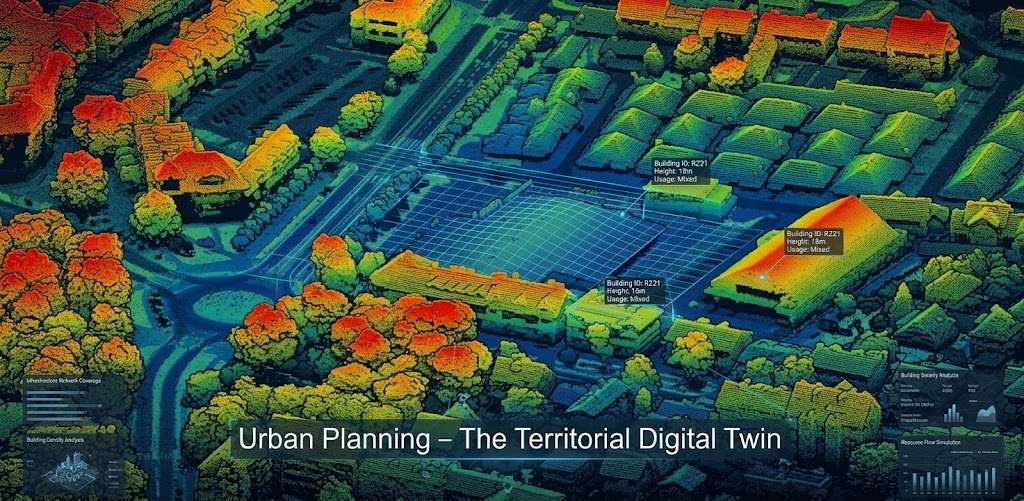
The territorial digital twin is the aerial LiDAR use with the broadest ambition and the most heterogeneous requirements. It is no longer about measuring a precise object but about describing a whole territory to serve uses that are not all known at the time of construction.This article sets out what that ambition implies and the difficulties it produces. It extends the article on power lines.
What a digital twin denotes
A loose definition circulates around this term.It is worth clarifying before any technical discussion of aerial LiDAR.The term covers very different realities, from a simple three-dimensional model to a system fed continuously by sensors.Three levels are clearly distinguishable and confusing them produces disappointed expectations.The geometric model describes a territory’s geometry at a date, which suffices for visualisation, insertion studies and many analyses.The enriched model adds semantic attributes, building use, surface nature and networks, permitting thematic analysis.And the twin in the strict sense adds continuous updating and a simulation capability, which presupposes infrastructure few authorities hold.One important observation follows for an aerial LiDAR project. Most projects announced as digital twins belong to the first or second level, and that clarification at scoping avoids a gap between the expected deliverable and the one that will be produced.What aerial LiDAR brings
Four contributions distinguish it from the other sources of a territorial model.The three-dimensional geometry of buildings, heights and roof forms, information no two-dimensional cartographic source supplies.The terrain model, the elevation basis of any flow, accessibility or earthwork analysis.Urban vegetation, trees and green space characterised by volume rather than by area.And infrastructure, structures, overhead networks and furniture, insofar as their size makes them detectable.One limit accompanies those four contributions and it deserves stating. Facades are poorly sampled by a downward-looking sensor, which limits detailed modelling and justifies recourse to terrestrial LiDAR as a complement.Levels of building detail
This standardised gradation structures urban modelling.Knowing it avoids misunderstandings.The simplest level represents a building by its footprint extruded to a single height, producing a box.The next level adds roof form, distinguishing a flat roof from a pitched one and considerably improving both realism and solar analysis.The level above details the facades, openings and architectural elements, which aerial LiDAR alone does not permit.And the highest level describes building interiors, belonging to entirely different sources.One practical consequence follows. An airborne survey correctly produces the first two levels and not the following ones, which must be established at scoping since the cost gap between these levels is considerable.Extracting the buildings from aerial LiDAR
One operation is the technical heart of this use and it deserves detailing.Moving from points classified as building to a building model takes four successive stages.Grouping the points into distinct entities, a delicate operation in continuous urban fabric where two adjoining buildings present no geometric separation.Detecting roof planes, each pitch being fitted separately and the intersections defining the ridges.Geometric regularisation, imposing right angles and alignments the measurement does not produce exactly, an operation improving appearance and potentially departing from reality.And assembly into a closed volume, a topological constraint necessary to most downstream uses.Three recurring difficulties accompany that chain. Complex roofs, whose decomposition into planes is ambiguous. Superstructures, chimneys and plant rooms, whose inclusion belongs to a convention. And adjoining buildings, whose separation often requires an external cadastral source.One practical consequence follows for an aerial LiDAR project. Registration against an existing cadastral reference appreciably improves this result, which makes the availability of that source a question to ask at scoping.The uses of a territorial model
Six families of analysis employ models derived from aerial LiDAR.Their requirements differ markedly.Solar potential and irradiance studies exploit roofs and shading, a use where roof form matters more than facade precision.Urban hydrological modelling exploits terrain and impermeability, a use where buildings matter mainly as obstacles.Propagation studies, radio and noise, exploit volumes and reflecting surfaces.Viewshed and landscape insertion analysis exploits overall geometry.Monitoring land take exploits comparison between dates.And urban climate study, heat islands and ventilation, exploits morphology and vegetation.One observation runs across those six families. None requires the highest level of detail, which makes the pursuit of detail less productive than improving consistency and coverage.The difficulty specific to this use
This characteristic distinguishes this domain from the preceding cases.It constitutes its central difficulty.The uses are not all known at the time of construction. An authority builds a model anticipating needs that will appear later.Three consequences follow.Scoping by the decision, a principle this series has defended throughout, applies poorly, no single decision governing the content.The risk of over-specification is real, a highly detailed model costing much and serving uses that could make do with less.And the risk of under-specification is equally real, an impoverished model needing to be redone when a need appears.A practical answer exists and it deserves stating. Retaining the classified cloud permits regenerating products under future specifications, which shifts the question of detail level from the deliverables to the quality of the classification, which conditions everything that can later be drawn from it.What annotation requires in this domain
Five requirements distinguish urban work in aerial LiDAR.They make it one of the heaviest.Object density is at its maximum, an urban square kilometre containing thousands of buildings, trees and items of furniture where the same rural area contains a few dozen.The classes are numerous, a territorial model requiring distinctions the other uses ignore, road surface, furniture, structures and vegetation by stratum.The interfaces are multiple and complex, a tree overhanging a building overhanging a road being a common configuration in a city and rare elsewhere.Mobile objects are numerous, vehicles and people present at the time of survey requiring an explicit convention.And urban vegetation is poorly distinguished from buildings, a pergola, a clipped hedge or a multi-stemmed tree presenting ambiguous geometries.One economic consequence follows. The classification cost per unit area in an urban environment far exceeds that of the other uses, which should appear in an estimate rather than be discovered in production.Urban vegetation
One object deserves separate treatment because its demand is growing and its difficulties differ from forestry’s.Urban trees attract growing interest, under the effect of climate adaptation policy and the recognised value of tree cover in cities.Four measurements are commonly requested. Cover fraction, the proportion of area shaded by crowns. Canopy volume, a more relevant indicator than area for thermal effects. Count and position of specimens, for asset management. And height, for assessing the service provided.Four difficulties specific to the urban environment complicate this work.Isolated trees dominate, which makes stand metrics unsuitable and pushes towards individual detection.Rows and clipped trees present regular geometries that methods designed for forests recognise poorly.Proximity to buildings produces frequent occlusion and mixing configurations.And the distinction between tree, hedge and shrub belongs to an arbitrary height threshold that must be fixed explicitly.One practical consequence follows. The forestry protocol does not transpose to the urban environment, which matches this series’ general observation about aerial LiDAR that the use precedes the method.The question of updating
This difficulty dominates the exploitation of these models.It is regularly underestimated.A territory changes continuously, construction, demolition, extension and vegetation growth, which makes a model perishable.Three updating strategies exist and their costs differ markedly.Periodic rebuilding reconstructs entirely from a new survey, a simple and expensive method whose frequency is limited by budget.Targeted updating handles only the zones that have changed, which presupposes knowing where they are and therefore a prior detection.And continuous updating incorporates changes as they are administratively declared, an economical method dependent on the quality of those declarations.One important observation follows. The second strategy is the most profitable and it requires change detection, which is an engagement in itself and matches the observation this series has made repeatedly about the value of monitoring.Consistency with existing references
One particular requirement weighs on this domain and it distinguishes it from sectoral uses.An authority already holds references, cadastre, networks, road and green space inventories, and a territorial model contradicting them is hard to exploit.Three forms of inconsistency occur in practice.Geometric inconsistency, a building footprint from the survey not coinciding with the cadastral one, a discrepancy that may belong to georeferencing, to date or to definition, roof outline against ground footprint.Semantic inconsistency, a classification nomenclature not matching the categories the services use.And temporal inconsistency, a survey and a reference describing states at different dates.Three distinct responses exist. Registration onto the existing reference, privileging consistency over measurement fidelity. Retaining both with documented discrepancies, preserving the information and complicating use. And updating the reference from the survey, which presupposes an institutional decision exceeding the project.One observation follows for an aerial LiDAR provider. This question is political as much as technical, and it is put to the client rather than settled by the provider.The cost of a territorial model
Five lines compose it and their distribution differs markedly from sectoral uses.Acquisition, often nil thanks to national programmes, which has made these projects accessible to authorities that would not have reached them.Classification, the dominant line and markedly heavier than elsewhere through object density and class count.Building extraction, a semi-automatic operation requiring verification proportional to the number of buildings.Integration with existing references, an often underestimated line whose scale depends on the quality of those references.And updating, a recurring line most projects omit from the initial budget.One important observation follows. The cost of these projects is dominated by human work rather than by data, which matches this series’ general finding about aerial LiDAR, with greater intensity through urban complexity.Governance of a territorial model
One organisational dimension determines these projects’ success more than technique does and it deserves stating.A territorial model serves several services of an authority, planning, green space, water, mobility and heritage, whose needs and vocabularies differ.Four governance questions condition its exploitation.Who owns the model, a lead service having to assume its maintenance failing which it ages with nobody attending to it.Who arbitrates the nomenclatures, each service having its categories and their unification presupposing a cross-cutting decision.Who funds the updating, a recurring line whose budgetary attachment is rarely established at the outset.And who controls changes, a model modified by several services without coordination losing its consistency.One observation follows for an aerial LiDAR provider. These questions belong to the client and the absence of an answer is a warning signal, a technically successful project potentially remaining unused for want of an owner, a situation the failure articles in the preceding series documented.Combining with other sources
Four sources usefully complete an airborne survey and each answers a precise limit.Terrestrial or mobile LiDAR brings the facades the airborne sensor undersamples, permitting the higher detail level over the footprints traversed.Aerial imagery brings colour and texture, indispensable both to visualisation and to identifying surface nature.The cadastre brings the legal limit and parcel identity, information no measurement supplies.And network references bring what is buried, entirely invisible to aerial LiDAR as to other remote sensing modalities.One observation runs across those four combinations. Each corrects a structural limit rather than a quality shortfall, which means no advance in the technology will make them superfluous.One practical consequence follows. A territorial model is multi-source by nature, and the integration competence counts as much as the classification one, which widens an engagement’s scope beyond annotation.Quality control of a territorial model
Four verifications answer this deliverable’s heterogeneity and they are conducted quickly.Comparative counting, the number of buildings extracted being set against the cadastral reference, a large discrepancy signalling a grouping or classification defect.Verifying volume closure, a topological constraint whose breach makes the model unusable in most downstream software.Sample height checking, comparison against independent measurements on a few dozen buildings.And visual inspection in virtual flyover, an informal and very effective method for spotting flagrant anomalies, merged buildings, aberrant roofs or missing objects.One observation completes those four verifications. The last is the most profitable on this type of deliverable, the richness of the content making defects immediately visible to a trained eye where no aggregate indicator signals them.Approaching a territorial project
Five questions scope an urban aerial LiDAR project and they are asked in one meeting.Which uses are identified today. Their list determines the detail level needed and reveals whether the level targeted exceeds the need.What level of twin is expected. That clarification avoids the gap set out above between a geometric model and a simulation system.Which references exist and carry authority. Their presence conditions building extraction and raises the consistency question.Who will own the model after delivery. An absence of answer signals a risk of non-use that technique does not compensate.And what updating strategy is planned. Its absence produces a model that ages and whose rebuilding will cost as much as its construction.Those five answers determine the scope, the detail level, the integration effort and the project’s viability over time. Asking them before drafting a proposal avoids delivering correct work into an arrangement that will not exploit it.What this use case teaches
One cross-cutting observation deserves closing this examination because it contrasts with the two preceding uses.Forestry and network management have a single client, an identified use and a decision depending on the result.The territorial model has none of the three. It serves several services, partly unknown uses, and it informs not one decision but an open set of future ones.Three consequences follow.The principle of scoping by the decision, which this series has defended throughout, reaches its limit here, and the answer is to preserve optionality rather than to optimise for a use.The principal risk is organisational rather than technical, a correct model potentially remaining unused for want of an owner.And the durable value sits in the classified and documented cloud rather than in the delivered products, those being regenerable where the classification is not.That third consequence matches exactly this series’ central finding about aerial LiDAR. The classification is the asset, the models are views, and a project delivering the second without retaining the first has produced something that expires.Starting small on a territorial project
One aerial LiDAR recommendation deserves stating because the scale of these projects encourages an approach that frequently fails.The instinct is to cover the whole territory at once, since the survey exists and coverage looks like the point.Four reasons favour starting with a district instead.The conventions get tested on real configurations before they are applied to everything, which is where a pilot earns its cost.The throughput becomes measurable, which turns the full-territory estimate from a guess into an extrapolation.The services see something usable within weeks, which builds the internal support these projects need to survive their first budget cycle.And the governance questions surface early, while the investment is still small enough that an unanswered one can stop the project cheaply.That fourth reason is the one that matters most. The commonest failure of a territorial model is not technical but organisational, and a district-scale first phase reveals whether an owner exists before the full budget is committed.One qualification applies. The district chosen should be representative rather than easy, since a pilot on the simplest tissue in the territory teaches little about what the dense centre will cost.Common mistakes
These failures recur often enough that naming them is usually enough to avoid them.- Using the term digital twin without stating the level intended.
- Promising facade detail from an airborne survey alone.
- Targeting a detail level beyond what the uses require.
- Underestimating classification cost in dense urban areas.
- Neglecting the convention on mobile objects.
- Delivering the models without retaining the classified cloud.
- Designing a model without planning its updating strategy.
- Handling urban vegetation with forestry conventions.
- Confusing ground footprint with roof outline in the building model.
- Neglecting consistency between the model produced and existing references.