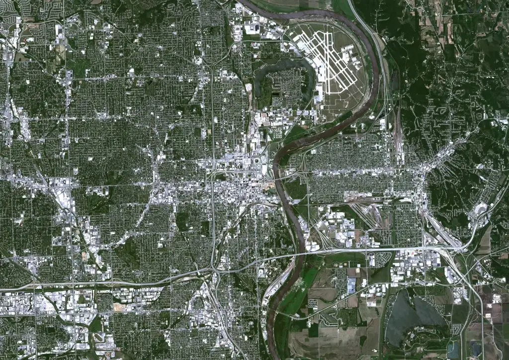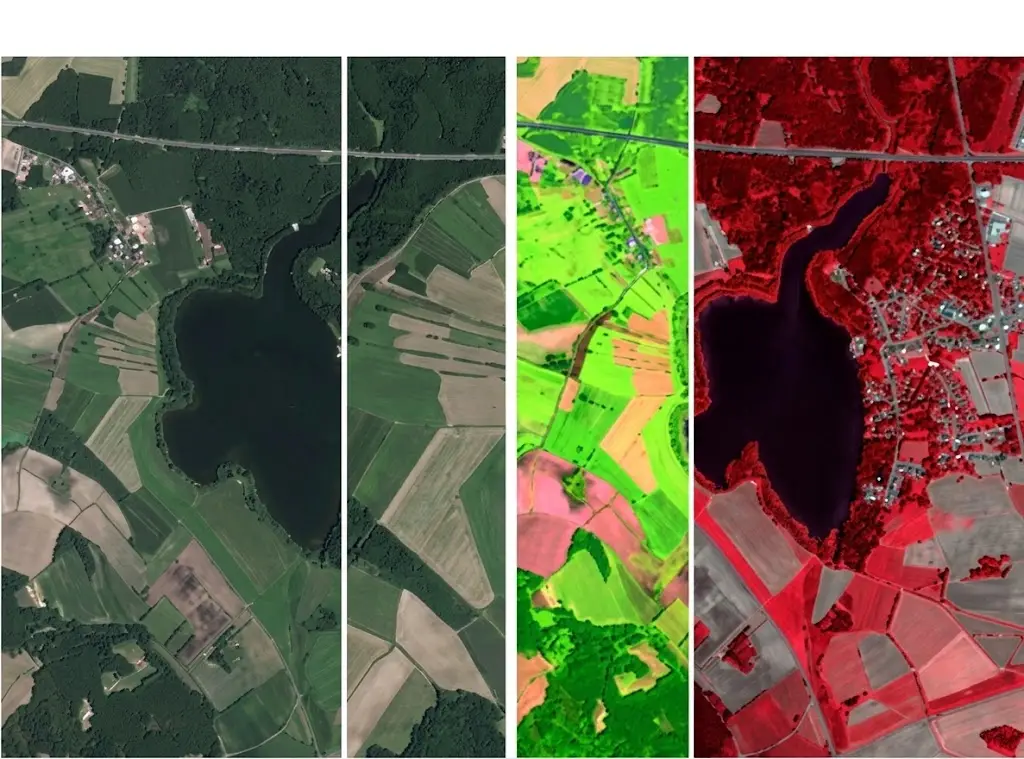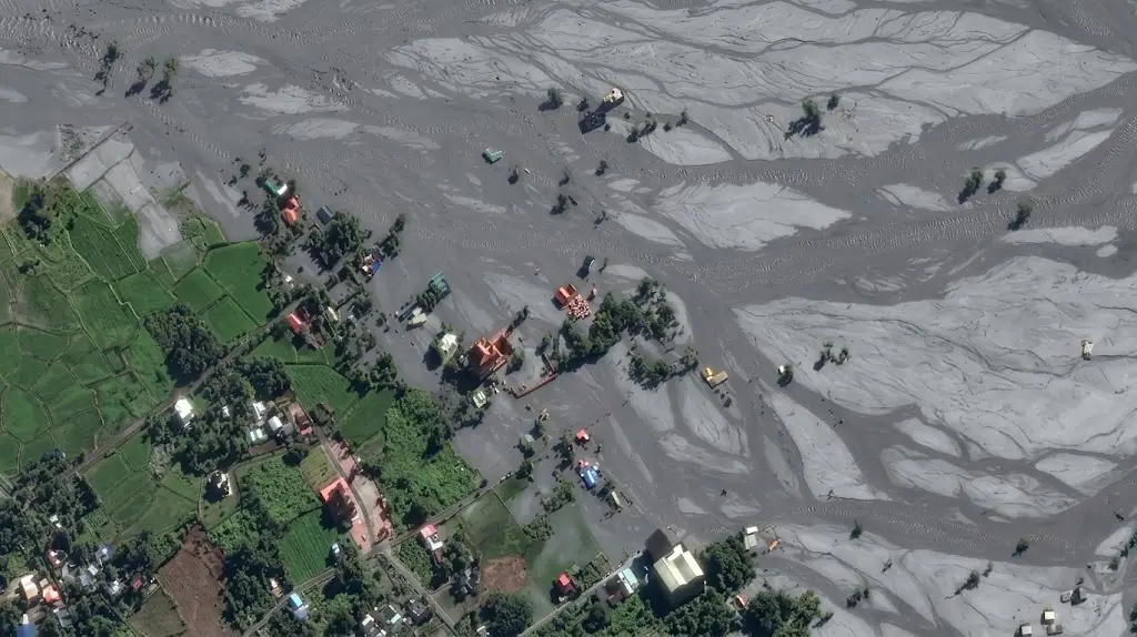
After an earthquake, every hour counts more than every detail. Damage assessment reverses annotation’s usual priorities, since an approximate result delivered the next day is worth more than an exact one delivered the following week.
This article sets out those conditions. It extends the article on infrastructure.
The uses that structure the field
Six crisis applications occur in satellite imagery.
Rapid assessment of the exact extent of an affected area.
Counting the buildings damaged or entirely destroyed.
Identifying the accesses that remain passable.
Locating displaced populations along with their shelters.
Estimating the damage with a view to compensation.
And documenting the event with a view to a lessons-learned review.
One important practical consequence follows. The first three uses all belong to the emergency while the last three belong to the assessment, which separates two working regimes whose delay and demand for correctness bear no comparison.
What the delay imposes
Five constraints accompany work conducted under emergency conditions.
Acquisition must be tasked within the very first hours that follow.
Cloud or smoke very often limits the first image available.
The reference must be entirely ready before the event.
Teams then mobilise with no specific preparation.
And quality control then reduces to the strict essentials.
One important observation follows for a satellite imagery project. The third constraint is the only one that can be anticipated, a damage reference written in calm conditions permitting an immediate start, whereas a reference improvised under emergency produces classes nobody applies in the same way.
What before-and-after comparison requires
Five conditions make a pair of images usable in satellite imagery.
An earlier image actually available over the same area.
A perfectly exact superimposition of the two acquisitions.
Viewing angles that are sufficiently comparable.
A neighbouring season for all the vegetated surfaces.
And a sufficient resolution on each of the two dates.
One practical consequence follows. The first condition is prepared before the crisis rather than at the moment it strikes, an earlier image that cannot be found making any change assessment impossible over the most exposed areas.
What grading damage presupposes
Five levels compose a common scale in satellite imagery.
No damage apparent from an overhead view.
Light damage, with a roof only partly affected.
Serious damage, with a structure very visibly compromised.
Complete destruction, a building collapsed or entirely gone.
And an indeterminate case, for want of a usable view.
One observation follows. The first level is the most misleading, a vertical view not showing the facades, which leaves invisible a structurally affected building whose roof has stayed intact.
What each type of event changes
Five hazards produce different satellite imagery signatures.
An earthquake, whose effects read above all on the roofs.
A flood, whose extent delimits particularly well.
A cyclone, which combines wind, surge and debris at once.
A fire, whose burnt surface stands out very clearly.
And a landslide, highly visible but always localised.
One important practical consequence follows for a satellite imagery project. The second signature is the most favourable to imagery, a water surface delimiting without ambiguity, which explains why flood maps are the fastest and most reliable products in this field.
What the reference requires here
Four sources establish a post-crisis ground truth in satellite imagery.
Assessments carried out directly on site by rescue teams.
Ground photographs taken throughout the intervention.
Loss declarations filed well after the event.
And expert reports conducted with a view to compensation.
One important observation follows. The first source arrives late and partially, rescuers having priorities other than documentation, which leaves the initial assessment unverified during precisely the period when it is most used.
What preparation in calm conditions permits
Five satellite imagery elements are prepared before any event.
An archive of earlier images covering the most exposed areas.
A damage reference already written, discussed and then tested.
A team already trained in that scale and in its limiting cases.
A processing chain already proven during an exercise.
And a delivery format agreed in advance with the recipients.
One important observation follows for a satellite imagery project. Those five elements cost little and are prepared outside any crisis, whereas each of them becomes impossible to put in place on the day the event strikes, which makes this the field where anticipation most directly determines the quality of the service rendered.
What the measurement must reflect
Five indicators describe such a satellite imagery system’s performance.
The delay elapsed between acquisition and the result being made available.
The proportion of destroyed buildings that are correctly identified.
The confusion observed between neighbouring levels of the damage scale.
The proportion of cases finally graded as indeterminate.
And the gap with the field assessments once those are available.
One important practical consequence follows. The first indicator outweighs all the others under an emergency regime, a map delivered two days late no longer directing any intervention decision whatever its degree of accuracy.
What the scale of the area imposes
Four satellite imagery effects accompany a wide extent to be handled fast.
Exhaustive annotation becomes quite simply impossible within the allotted delay.
Prioritising the sectors to handle becomes a decision in its own right.
Reasoned sampling sometimes replaces the complete count.
And mobilising numerous teams immediately raises a problem of consistency.
One important practical consequence follows. The last effect deserves attention, a team enlarged under emergency having no time to agree on the limiting cases, which makes a simple and unambiguous reference preferable to a fine one nobody will apply in the same way.
What radar brings in a crisis
Four advantages justify this satellite imagery sensor in the aftermath of an event.
An acquisition remaining possible beneath a storm’s cloud cover.
An observation possible by night, when the event strikes in the evening.
A total insensitivity to the smoke of a fire still under way.
And a particularly effective delimitation of flooded surfaces.
One important practical consequence follows for a satellite imagery project. The first advantage is decisive on meteorological events, a cyclone leaving behind it the cloud cover that prevents optical imagery from observing precisely the damage it has just caused.
What this work’s throughput presupposes
Four factors determine the time spent per satellite imagery tile.
The density of the built environment present in the affected area.
The number of levels the adopted damage scale holds.
Whether or not a superimposable earlier image is available.
And the proportion of views degraded by smoke or by cloud.
One important observation follows for a satellite imagery project. The second factor is settled at scoping and weighs heavily under emergency, a three-level scale being handled several times faster than a six-level one, which justifies deliberately simplifying the reference once delay becomes the main criterion.
What the annotator must know here
Five kinds of knowledge condition correct work on this subject.
The damage scale adopted along with its limiting cases already settled.
The appearance of a collapse seen from above, very often less clear than expected.
The distinction between debris and materials stored before the event.
The treatment rule applied to a partly masked building.
And the precise moment when they should flag rather than grade.
One important practical consequence follows for a satellite imagery project. The last kind protects the whole result, an operator pressed by the emergency tending to settle instead of flagging, which produces confident gradings on cases nobody should have settled from a vertical view.
What the delivery format requires here
Four choices condition the use of the result in a crisis.
A format legible by teams without specialised tools.
A tie to landmarks already known to the responders.
An explicit statement of the acquisition hour of each image.
And explicit marking of the areas not covered or not usable.
One important observation follows for a satellite imagery project. The last choice avoids a dangerous misreading, an area absent from the result being able to mean it is intact or that it was never observed, a distinction a responder must be able to make immediately without calling anyone.
What pre-annotation permits here
Three uses appreciably lighten the work in a crisis.
An automatic flagging of areas whose appearance has changed strongly.
A wholly automatic delimitation of flooded surfaces.
And a transfer of building footprints taken from an earlier base.
Two caveats accompany it in satellite imagery.
Grading the damage level stays entirely the operator’s own responsibility.
And a proposal accepted without examination spreads very fast when time is short.
What this subject has that is particular for a provider
Four traits separate this satellite imagery field from the cluster’s others.
Demand arrives with no notice at all and withdraws as fast.
The volume of a single event far exceeds the ordinary workload.
The client expects above all an availability rather than a capacity.
And the value rendered is measured above all in hours gained.
One important practical consequence follows. The third trait changes the nature of the contract, a crisis engagement being paid in part for a reserve of means never mobilised, which brings this service closer to a subscription than to an assignment billed on volume produced.
What the first exercise must establish
Four results justify a rehearsal conducted in calm conditions.
The real delay elapsed between an image being made available and delivery.
The number of operators genuinely mobilisable within twenty-four hours.
The disagreement rate obtained on a scale applied with no preparation at all.
And the breaking points of the processing chain placed under heavy load.
One important practical consequence follows for a satellite imagery project. The last result justifies the exercise on its own, a chain proven on ordinary batches often giving way at the first crisis volume, a defect no theoretical analysis reveals and a rehearsal uncovers in a day.
What coordination between actors imposes
Four constraints follow from an intervention involving several organisations.
Several teams produce assessments in parallel over the same sectors.
The damage scales employed differ from one actor to another.
The geographic divisions employed do not always coincide.
And results spread far faster than they are verified.
One important practical consequence follows for a satellite imagery project. The second constraint produces contradictory figures on one same event, two assessments each correct on their own scale appearing to contradict each other, which makes using a shared scale more useful than using a better designed one.
What the corpus must cover here
Five axes structure a damage dataset built in satellite imagery.
The types of hazard covered, from earthquake through to flood.
The damage levels annotated, including all the intermediate cases.
The types of construction encountered, whose response to a hazard differs.
The regions handled, whose building methods sometimes vary very strongly.
And degraded acquisition conditions, smoke and cloud cover included.
One important observation follows. The third axis is the most decisive and the least covered, a concrete building and a sheet-metal construction presenting no common signature once damaged, which makes a corpus built in one country largely inapplicable in another.
What this chapter shares with forest monitoring
Four satellite imagery findings recur across these two subjects.
An earlier image entirely conditions any assessment of change.
Radar becomes indispensable as soon as the sky closes in for long.
Detection delay holds an economic value of its own.
And the exact cause of a change is decided rather than observed.
One important observation follows for a satellite imagery project. Those four findings characterise the surveillance subjects, as against the inventory subjects handled earlier in this course, which suggests two families of project with distinct requirements rather than a gradation of difficulty.
Three errors proper to this subject
Three satellite imagery defects appear only under an emergency regime.
A perfectly exact result delivered after the moment it would have served.
An unobserved area nothing comes to distinguish from an intact one.
And a grading settled where the operator should merely have flagged their doubt.
Those three defects are not corrected afterwards, they belong to the arrangement rather than to the execution, and their common point is to be prepared months before the event that reveals them.
What the provider brings here
Four contributions distinguish a crisis engagement conducted on satellite imagery.
A reference prepared and tested well before any event.
A mobilisation capacity that is both rapid and documented.
A delivery chain already proven during a full exercise.
And annotators already trained in the damage scale finally adopted.
One important practical consequence follows. The second contribution sells badly and verifies badly, the announced capacity being distinguished from the real one only at the moment of the event, which makes an exercise conducted with the client far more convincing than a contractual commitment on a delay.
Approaching a crisis management project
Five questions scope such a satellite imagery arrangement.
Does the result serve the emergency or the assessment. The regimes differ.
Does an earlier image exist. It conditions the comparison.
Is the damage reference written. Improvising it costs dearly.
What delay makes the result useful. Beyond it, it no longer serves.
And does a class of indetermination exist. Doubt is frequent.
Those five answers determine the arrangement’s real usefulness. Asking them well before the crisis avoids discovering its gaps at the precise moment when time is shortest.
The question that frames the arrangement
One question determines the whole arrangement in satellite imagery.
Does the result serve to decide now or to establish later.
Deciding now, directing rescue or evacuating a sector, requires a delay of a few hours, tolerates a coarse scale and is satisfied by well-chosen partial coverage.
Establishing later, compensating or documenting, permits several weeks, requires a fine scale, full traceability and exhaustive coverage.
That question belongs to the recipient and not to technique, it is asked before the event, and it separates two services whose price and means bear no comparison.
Three decisions before the crisis
Three decisions commit a crisis management arrangement in satellite imagery.
Building an archive of earlier images over the exposed areas.
Writing and testing the damage reference outside any event.
And fixing the delay beyond which the result ceases to be useful.
Those three decisions cost a few days taken entirely in calm conditions, they precede the event by months, and their absence is discovered precisely when time is shortest.
Three checks on a crisis arrangement
Three checks qualify an emergency arrangement in satellite imagery.
The actual existence of an archive of earlier images over the exposed areas.
The damage reference, written then proven during an exercise.
And the delay genuinely observed at the last event handled.
Those three checks are each asked in one question, they require no particular technical competence, and their absence indicates an arrangement whose first real test will also be its first rehearsal.
What this chapter teaches
One cross-cutting observation deserves closing this examination.
This is the only field where delay outweighs correctness.
Three findings compose it.
A map delivered two days late no longer directs any decision.
An earlier image that cannot be found makes any change assessment impossible.
And a vertical view leaves invisible an affected building whose roof is intact.
That finding entirely reverses the logic of the preceding chapters, preparation made in calm conditions counting here far more than the quality of the execution.
What this chapter leaves to the next
A collapsed building is recognised far better by its lost height than by its colour.
Three questions stay open in satellite imagery.
What an elevation measurement genuinely brings to a damage assessment.
How to annotate data that is precisely not an image.
And what the third dimension genuinely costs in processing time.
Those three questions all belong to airborne LiDAR, which constitutes the subject of the following chapter.
Why the retainer is the honest structure here
One point about pricing belongs at the close of this chapter.
Crisis work does not fit a per-unit price at all.
Three reasons follow in satellite imagery.
Most of the value sits in readiness that is never invoiced.
The event itself arrives too fast to negotiate anything.
And a provider paid only on volume has no reason to stay ready.
One important practical consequence follows for a satellite imagery provider. Saying this plainly at the outset is worth more than a low rate, since a client who understands they are buying availability will fund the rehearsals and the reference work that actually determine the outcome, whereas a client buying tiles will discover on the day that nobody was prepared.
Common mistakes
These failures recur often enough that naming them is usually enough to avoid them.
- Improvising a damage reference at the moment of the crisis.
- Discovering the absence of an earlier image after the event.
- Concluding to no damage from the view of the roof alone.
- Measuring accuracy without measuring the delay to availability.
- Comparing two acquisitions taken at very different angles.
- Omitting a class of indetermination from the damage scale.
- Applying a scale designed for an earthquake to a flood.
- Evaluating an emergency arrangement on assessment criteria.
- Waiting for field assessments that will arrive too late.
- Neglecting smoke and cloud in acquisition planning.
What to take away
Damage assessment is prepared before the event rather than after it.
Three readings emerge. A map delivered two days late no longer directs any intervention decision whatever its degree of accuracy, which makes delay the principal indicator under an emergency regime and reverses the usual hierarchy. An earlier image that cannot be found makes any change assessment impossible, which shifts the decisive work towards building a reference archive over the exposed areas, long before any event strikes. And a vertical view does not show the facades, which leaves invisible a structurally affected building whose roof has stayed intact and makes the first level of any damage scale systematically optimistic.
For the third dimension, the article on airborne LiDAR details the approach. For technical preparation, the article on resolution and tiling sets it out.
To explore delivery arrangements, supported formats and applicable control mechanisms, see our dedicated page on annotation for geospatial. And if you are preparing a crisis management arrangement, let us discuss your need.