

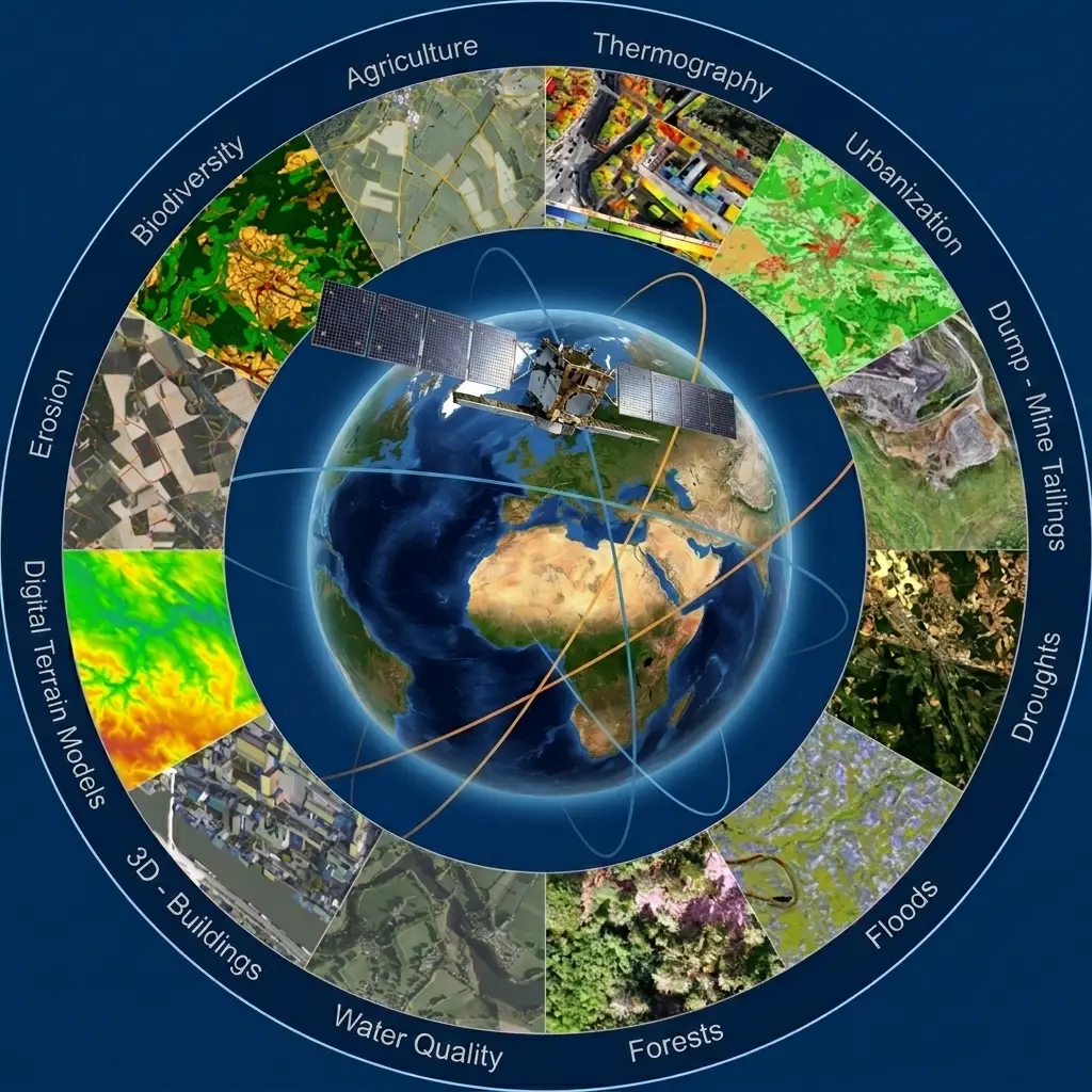
A figure published by the European Space Agency situates the satellite’s place in measuring the climate system: of the 55 Essential Climate Variables required to characterise the climate system, climate data records for two-thirds of them, that is 38, are exclusively or largely measured from Space.
Those variables are defined by an international observing system and they constitute, according to the same source, the information required for systematic monitoring of the Earth system as a whole. Two-thirds of that information therefore depends on satellites.
This article examines what Earth observation measures in climate terms, with what rigour, and what that requires in data work. It extends the article on constellations and NewSpace.
What Essential Climate Variables are
This notion structures the whole field and it remains little known outside it.
It is a list of physical, chemical and biological quantities whose systematic measurement is judged necessary to characterise the state of the climate. They cover the atmosphere, the oceans and land surfaces.
Three properties make them something more than a mere nomenclature. They are defined collectively rather than by one operator, guaranteeing comparability between programmes. They come with precision and continuity requirements, which constrain instruments. And they serve as a common reference for the scientific community and for institutional monitoring arrangements.
The European agency devotes a dedicated programme to them, indicating that it comprises a suite of research projects dedicated to the development, production and qualification of high-quality satellite-derived data records, twenty-seven of them being listed as of January 2024.
The main families of Earth observation measurement
Four are distinguishable and their technical requirements differ markedly.
Atmospheric measurements in Earth observation concern the composition of the air, including greenhouse gases and aerosols. They require spectroscopic instruments of extreme sensitivity.
Land surface measurements concern land cover, biomass, glaciers, snow cover and soil moisture. They rest on imagery and they call for the most annotation work.
Ocean measurements concern surface temperature, water colour, sea level and sea ice. They combine imagery, altimetry and radiometry.
Energy budget measurements concern incoming and outgoing radiation fluxes, and they demand the most rigorous calibration.
One observation runs across those four families. The second, land surface, is where machine learning has developed most, precisely because it rests on image interpretation rather than direct physical measurement.
What the Earth observation archive contributes
One property distinguishes the climate domain from every other use of these data.
The European agency describes its programme as designed to realise the full potential of the long-term global Earth observation archives that the agency and its member states have established over the past 40 years.
Forty years of measurement constitutes a resource that nothing else replaces. A climate phenomenon is characterised by a trend, and a trend requires a long series.
Three consequences follow from that. Mission continuity becomes a major programmatic issue, an interruption creating a break in the series. Homogenisation between instrument generations is scientific work in its own right, since successive sensors do not measure identically. And the constellations article showed that this continuity requirement remains specific to major institutional programmes, a commercial operator being unable to commit across decades.
The quality requirement that follows
It deserves detailing because it constitutes a methodological reference for Earth observation as a whole.
The European agency enumerates the properties expected of its products: gridded data at a usable resolution, bias corrected across multiple satellites, validated by in situ observations, with uncertainty characterisation per pixel, full documentation and version control.
That list deserves close attention because it describes a standard rarely reached elsewhere. Five requirements read out of it: inter-sensor correction, validation by ground measurement, quantified uncertainty, documentation and versioning.
The same source specifies that those records are robust, with high levels of documented traceability and consistency, including the quantitative uncertainty estimates required by the climate science and modelling communities.
One observation applies here. That level of requirement corresponds exactly to what the medical clusters showed to be required in a regulatory file. The climate domain has applied it for a long time, which makes it a transposable methodological reference.
Detecting greenhouse gases from space
This domain illustrates the level of precision Earth observation now reaches.
The European agency indicates satellites are used to detect the smallest change in atmospheric concentration, and that by accurately detecting these small changes, to within 1 part per million for carbon dioxide, satellite observations help the scientific community improve global climate models.
One part per million on an atmospheric concentration is a considerable metrological requirement. The same source indicates carbon dioxide reached 416.7 parts per million by the end of 2022 and that methane concentrations are now around 150 per cent above pre-industrial levels.
One methodological observation applies here. That precision requires combining sources, the agency indicating its products result from merging datasets from several atmospheric missions.
That multi-mission fusion is heavy technical work in itself and it constitutes the core added value of these programmes, more than the acquisition itself.
From detection to action
One documented case illustrates the passage from measurement to intervention.
A reference portal on greenhouse gas missions reports that a satellite observed a methane plume over a British locality, originating from a pipe leak near a landfill site; researchers from a national Earth observation centre and a university spotted the emission; the constellation was tasked to make five further measurements, which observed methane emission rates of between 200 and 1,400 kilograms per hour; those observations were validated by in situ measurements and then used to inform the attributor, who promptly addressed the leak.
The same source specifies this was the first time a methane emission had been detected from space and mitigated in that country.
That documented case illustrates four elements of a complete chain. The initial, opportunistic detection. The retasking of the constellation, a capability the NewSpace article described. Validation by ground measurement, a constant methodological requirement of the field. And attribution to an identifiable responsible party, which turns an observation into an action.
That fourth element is the one most often missing altogether, and it conditions the operational usefulness of a detection.
Comparing declarations with observations
This use deserves flagging with the methodological caution it requires.
National emissions inventories traditionally rest on declarative methods, applying emission factors to recorded activities. Satellite observation provides an independent measurement.
An institutional publication notes that this work has highlighted inconsistencies between national emissions reporting and observations, and that currently only large, high-emitting countries can be assessed, denser satellite sampling being anticipated in the coming years.
Three methodological cautions accompany that reading. A gap between declaration and observation may stem from a calculation method, a measurement uncertainty or an unrecorded emission, and attribution requires analysis. Coverage is uneven, which precludes a global comparison. And the uncertainty of satellite measurements must be weighed alongside that of the inventories.
That methodological caution is the field’s own position, and it is worth reproducing rather than simplifying.
What these uses require in annotation
This distinction determines precisely where the need sits.
Direct physical measurements, atmospheric and radiometric notably, rest on inversion algorithms grounded in radiation physics. They require no annotation in the usual sense, but validation by ground measurement.
Surface state measurements by contrast rest on interpretation, and they are precisely where the need lies. Four examples show it.
Land cover and its evolution require a defined nomenclature and annotated examples, with the convention difficulties the opening article flagged.
Biomass estimation requires reference plots measured on the ground to calibrate satellite estimates.
Glacier inventories require delineation by an expert, the boundary between ice, snow and rock not always being obvious.
And deforestation detection requires distinguishing a forest clearing from a natural disturbance, a distinction demanding judgement.
Those four examples share one decisive common feature. The reference is not in the image, it comes from elsewhere, which returns to the bottleneck the opening article set out.
Difficulties specific to climate work
Five of them distinguish this domain from other Earth observation uses.
The continuity requirement, already noted, which forbids methodological breaks and requires reprocessing the archive when an algorithm changes.
The quantified uncertainty requirement, rare elsewhere, which means characterising error rather than ignoring it.
The slowness of the phenomena, which makes validation difficult since a trend is not verified over one season.
The global coverage required, imposing a geographic representativeness the opening article flagged as rarely achieved.
And the sensitivity of the use, these measurements feeding institutional monitoring arrangements, which imposes higher documentary rigour.
Those five difficulties explain why climate corpora count among the best documented in the field, and why they constitute a methodological reference for other uses.
Carbon markets and Earth observation verification
This developing use creates a need for independent, documented measurement.
Carbon offset mechanisms rest on projects claiming sequestration or emission reduction, and their credibility depends on verifying those claims.
Earth observation contributes three things there. Biomass measurement, allowing the carbon stock of a wooded area to be estimated. Change monitoring, allowing verification that a forest announced as preserved actually is. And additionality verification, allowing a project’s trajectory to be compared with that of comparable unaffected areas.
An institutional publication notes that a European project develops Earth observation based approaches to help forestry stakeholders meet the requirements of both compliance and voluntary carbon markets.
Three important caveats accompany that use. Biomass estimation from space carries substantial uncertainty, which limits the precision of claims. Verification requires reference plots measured on the ground, which is precisely the expensive work. And the additionality question involves counterfactual reasoning that measurement alone does not settle.
Those three caveats explain why this particular market is methodologically demanding and why it is a real outlet for rigorous data work.
Adaptation, a less visible use of Earth observation
This family of uses concerns consequences rather than causes.
Where greenhouse gas measurement belongs to monitoring emissions, Earth observation also serves to document effects and prepare adaptation.
Four uses attach to that. Shoreline and erosion monitoring, which conditions coastal planning. Flood zone and flood event mapping, which feeds prevention. Urban heat island monitoring through thermal imagery, which guides planning policy. And water resource monitoring, snow and soil moisture, which conditions agricultural and hydraulic management.
Those four uses differ from the preceding ones on three points. They operate at local rather than global scale, which changes resolution requirements. They interest local authorities and managers rather than scientific bodies, which shortens decision cycles. And their validation rests on locally available observations, which makes ground truth more accessible.
That third difference is particularly notable for a provider. A local adaptation project often holds existing field data, cadastral records, technical department surveys or manager observations, which appreciably lowers the cost of building a corpus compared with a global project.
What this means for an Earth observation data provider
Four practical consequences follow from everything above.
The first is that the climate domain’s documentary requirements markedly exceed those of ordinary commercial uses. A provider able to supply provenance, composition, protocol and uncertainty meets a standard few reach.
The second is that validation by ground measurement remains constitutive of this domain. A climate corpus without an independent reference has no value, which shifts the engagement towards articulating satellite data with field surveys.
The third is that geographic representativeness conditions a product’s acceptability. A corpus concentrated on a few regions does not support a global claim, a constraint this domain states explicitly where others pass over it.
A fourth consequence deserves flagging too. Players in this domain are mostly institutional or academic, which implies long decision cycles, formalised procedures and framed budgets, but also durable relationships once established.
Approaching a climate Earth observation project
Four questions determine feasibility before any technical work is planned.
Over what duration must the result hold. A climate trend requires a long series and therefore an archive, which points towards institutional missions rather than recent constellations.
What independent reference is available. Validation by in situ measurement being constitutive of the field, a project without access to ground surveys will meet a major difficulty.
What uncertainty is acceptable for the intended use. A biomass estimate to twenty per cent suits a regional mapping and not a carbon transaction, a distinction determining the scale of the work.
And what geographic coverage is claimed. A product announced as global assumes a representativeness the opening article showed is rarely achieved, and that claim commits.
Those four questions take a single meeting. They eliminate infeasible projects and they determine, for those that remain, the respective shares of satellite work and field work, a division constituting most of the budget.
What climate work teaches other domains
This cross-cutting observation goes well beyond the subject treated here.
The climate domain established, before others and under the constraint of its subject, a data production standard the clusters on other sectors have met in related forms.
Four principles read out of it and all four of them are transposable. Uncertainty is characterised rather than ignored, which means quantifying it per pixel rather than globally. Validation rests on a source independent of the one that produced the measurement, a principle earlier clusters formulated as the need for a cross-check. Documentation and versioning accompany the product rather than following it. And consistency between sources is explicit work rather than an assumption.
Those four principles follow from no particular regulatory constraint in Earth observation. They result from the field’s scientific requirement, and they constitute an available reference for a project seeking to establish its credibility.
One practical consequence follows from that for a provider. Referring to the climate domain’s documentary practices is a solid argument with a client in another sector, since it is an established standard rather than a self-proclaimed requirement.
Where climate ground truth actually comes from
Since validation by independent measurement is constitutive of this domain, it is worth setting out where that measurement originates.
Four sources serve climate work and their availability varies enormously by region. Established observation networks, meteorological stations, flux towers, tide gauges and ocean buoys, which are reliable, sparse and unevenly distributed. Field campaigns, which are precise, expensive and cover limited areas for limited periods. National inventories, forestry and agricultural, which cover large areas and reflect declarations rather than observation. And photo-interpretation on very high resolution imagery, which is the commonest compromise for land surface work.
One asymmetry deserves stating plainly. Those networks are dense in some regions and almost absent in others, which means validation quality varies geographically and that a product validated well in one place may be unvalidated where it matters most.
That asymmetry is the concrete form the representativeness problem takes in climate work, and it is why the field states its geographic limitations explicitly. A provider working in an underserved region holds something genuinely scarce, which is worth understanding as an opportunity rather than a handicap.
Common errors of reading
These misreadings recur often enough that naming them is usually enough to avoid them.
- Treating a climate measurement as an ordinary detection with no associated uncertainty.
- Comparing series from different instruments without bias correction.
- Interpreting a gap between declaration and observation without examining both uncertainties.
- Neglecting validation by ground measurement in a climate product.
- Claiming global reach from a geographically concentrated corpus.
- Confusing a seasonal variation with a long-term trend.
- Changing an algorithm without reprocessing the corresponding archive.
- Using a commercial source with no continuity guarantee for a climate series.
- Confusing direct physical measurements with image interpretations.
- Underestimating multi-mission fusion work in an atmospheric product.
- Claiming a biomass precision incompatible with a carbon transaction.
- Launching a climate project without access to independent ground surveys.
Why this domain sets the standard
A closing observation explains why climate work developed a rigour that other Earth observation uses did not.
Three pressures produced that rigour, and none of them was regulatory.
The phenomena measured are small relative to natural variability. Detecting a trend beneath seasonal and interannual noise requires knowing the size of the measurement error, which forces uncertainty to be quantified rather than assumed negligible.
The measurements feed models whose outputs are scrutinised. A product entering a climate model carries its errors into the model’s conclusions, which makes uncharacterised error unacceptable to the users themselves.
And the results are contested in public. Work whose conclusions attract scrutiny must be defensible in its method, which produces documentation habits that work attracting no scrutiny does not develop.
That third pressure is the most interesting of the three. It suggests documentary rigour follows from expecting to be questioned, which is exactly the situation the medical clusters described under regulatory obligation and which arises here without one.
The practical lesson for any data project is that this standard is available to be adopted well before it is required. Doing so costs little during production and it is what distinguishes a corpus that survives examination from one that has never been examined.
What to take away
Earth observation carries most of climate measurement, two-thirds of the Essential Climate Variables, 38 of 55, being exclusively or largely measured from space.
Three readings emerge. The climate domain imposes on data a standard few uses reach: bias correction across satellites, validation by in situ observation, uncertainty characterised per pixel, full documentation and version control, requirements matching exactly those regulatory regimes impose elsewhere. The forty-year archive is an irreplaceable resource, which makes continuity a programmatic issue and preserves the role of major institutional programmes alongside commercial constellations. And the annotation need concentrates on surface state measurements, land cover, biomass, glaciers and deforestation, where the reference is not in the image but in an independent survey.
For a use with opposite requirements on timeliness, the article on Earth observation, security and sovereignty examines surveillance. For the dynamic that made denser measurement possible, the article on constellations and NewSpace describes the economic transformation.
To explore delivery arrangements, supported formats and applicable control mechanisms, see our dedicated page on geospatial data processing. And if you are building a climate corpus requiring uncertainty and representativeness documentation, let us discuss your project.


