
Agricultural Image Annotation
and data Processing
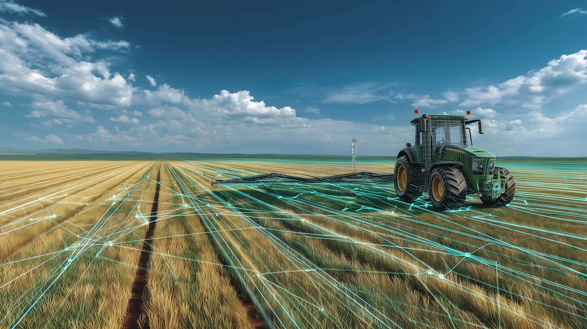
Satellite images, crop photos, drone videos, IoT sensors, environmental measurements
Home > Image Annotation and Agricultural Data Processing
What we do
A team of experts, bringing expertise and precision to every project.
Precisely structured and annotated datasets enable the development of high-performance AI models to monitor crops, anticipate diseases, and maximize yields.
Thanks to our expertise, we deliver reliable annotations and optimized datasets designed to accelerate your projects.
Rigorous and Controlled Process
Each project follows a clear and structured methodology, ensuring consistent quality at every stage. Images are carefully prepared, cleaned, and normalized to ensure compliance with GDPR standards and industry norms.
A precise annotation protocol, developed in collaboration with experts and the client, defines categories, guidelines, and required levels of accuracy.
Annotations are then performed by qualified specialists, reviewed, and validated to ensure reliability and consistency. Finally, automated quality checks detect any anomalies, guaranteeing the delivery of structured, secure, and immediately usable datasets for your AI models.
Security and ISO 27001 Compliance
The protection of agricultural data is at the heart of our commitment. Our processes comply with GDPR and ISO 27001 certification, ensuring maximum security for the storage, processing, and transfer of sensitive data.
Satellite images, sensor readings, and field surveys are anonymized before annotation and stored in secure environments with strict access control.
Our subsidiary in Madagascar applies the same European standards, ensuring reliability, traceability, and security for all projects, regardless of their complexity.
Technologies and Tools
We use specialized annotation platforms capable of processing large sets of satellite images, crop photos, or sensor readings with optimal precision.
Our solutions promote collaboration between annotators, agronomists, and AI engineers, ensuring rigorous progress tracking and real-time quality control.
Annotated data is exported in standard formats, ready for training intelligent agricultural models.
Our workflows, flexible and scalable, integrate with client systems or are custom-developed to ensure performance, reliability, and efficiency at large scale.
EXpertise
Smart data for sustainable and high-performance agriculture
At Infoscribe, we transform aerial, satellite, and field images into valuable insights for the agriculture of tomorrow. By combining advanced agronomic expertise, cutting-edge technologies, and an ISO 27001-certified methodological framework, we produce reliable, consistent, and secure datasets.
IMAGE ANNOTATION FOR AI – AGRICULTURE SECTOR
Crop Detection and Segmentation
Precise identification and delineation of crops in satellite images, drone footage, or field photos, enabling reliable monitoring of growth and assessment of cultivated areas
Plant Disease and Stress Detection
Annotation of visible symptoms related to diseases, nutrient deficiencies, or water stress to train AI models capable of early diagnosis and optimized interventions.
Soil Health Analysis
Segmentation and classification of soil types from multispectral images, facilitating understanding of fertility and planning of agricultural practices.
Plant Counting and Monitoring
Automated annotation and counting of plants, fruits, or seedlings to estimate crop density and improve yield forecasts.
Detection of daturas, weeds, thistles, and other unwanted plants
Identification and localization in aerial or field images, contributing to the development of AI-based
Vegetation Coverage Analysis
Segmentation of green areas and calculation of indicators such as NDVI to assess crop vigor, biomass, and stress.
Pest and Visual Anomaly Detection
Annotation of infestations and leaf anomalies to train automatic detection models, useful for plant health monitoring.
Field and Crop Rotation Monitoring
Annotation of field boundaries and classification of successive crops to enhance traceability and agronomic management of farms.
Deforestation and Land Use Monitoring
Annotation of vegetation cover changes and agricultural expansion for sustainability and environmental management projects.
Post-Harvest Analysis
Annotation of crop or agricultural product images to assess quality, detect defects, and automate sorting or classification.
HIGH-PRECISION VITICULTURE MONITORING
Annotation of vineyard images (drone, satellite, field) to detect intra-field heterogeneities, water stress, vine diseases, and vigor variations, as well as missing vines within a row.
TEXT ANNOTATION FOR AI – AGRICULTURE SECTOR
Named Entity Annotation
Precise identification and labeling of entities in agricultural texts: crop names, varieties, diseases, plant treatments, climatic conditions, and soil parameters.
Agronomic Information Extraction
Structuring data from field reports, farm logs, agronomic studies, or research databases, facilitating analysis, monitoring, and agricultural decision-making.
Creation of Standard Reports and Bulletins
Automated production of clear, standardized reports that comply with the requirements of agricultural organizations, delivered on time to ensure reliability, consistency, and performance of AI projects.
Agricultural Data Coding and Standardization
Conversion of agronomic information into interoperable formats and standards (AGROVOC, ISO 19156, INSPIRE) for seamless use by agricultural management systems and AI models.
Analysis of Crop Logs and Technical Notes
Annotation and extraction of information from crop logs, technical reports, or field observations to enrich datasets and improve the accuracy of predictive models.
Detection of Agronomic Correlations
Identification of relationships between weather conditions, treatments, yields, and plant stress to create structured datasets for agricultural research and modeling.
Multilingual Text Analysis
Annotation and normalization of agricultural documents in multiple languages, enabling the creation of usable datasets at an international scale and comparison of practices across different geographic regions
AGRICULTURAL MARKET AND PRICE MONITORING
Annotation of market reports, price bulletins, news, and economic analyses to track price trends, detect market fluctuations, and feed AI decision-support models for crop sales, purchases, and planning.
Other Industry Sectors
FAQ
Frequently Asked Questions
Infoscribe handles a wide range of agricultural data from multiple sources, supporting agritech companies, research organizations, and production stakeholders in leveraging their information. The company relies on its expertise in annotation, structuring, and data preparation to transform heterogeneous datasets into resources usable by analytical models, AI systems, or agronomic management tools.
For visual data, Infoscribe processes satellite images, high-resolution drone imagery, and ground photographs taken by farmers, technicians, or embedded sensors. These data are essential for detecting water stress, monitoring growth, identifying diseases, and segmenting fields. Video data from drones or agricultural robots can also be processed for tasks such as counting, object tracking, or crop recognition.
Infoscribe also handles agricultural IoT sensor data, such as soil moisture, temperature, sunlight, pH, chemical composition, and input rates. These time series feed predictive models for yield estimation, irrigation management, or resource planning.
3D data is also supported, including LiDAR point clouds generated by drones, agricultural machinery, or robots. These datasets are useful for biomass analysis, plant structure modeling, or terrain mapping.
Finally, Infoscribe can process documentary data, such as farm records, intervention histories, soil analysis results, crop surveys, or weather data. This information can be extracted, organized, and standardized to complement visual or sensor datasets.
Thanks to this versatility, Infoscribe effectively supports projects requiring reliable, standardized agricultural data that is ready for analysis or integration into intelligent systems.
Infoscribe’s services target all major agricultural sectors, as its data processing, annotation, and structuring solutions address cross-cutting needs in the modernization and digitalization of agricultural practices.
Infoscribe primarily supports the field crops sector (cereals, oilseeds, legumes), where the analysis of satellite images, drone imagery, and sensor data enables growth monitoring, anomaly detection, and yield optimization.
The company also operates in the viticulture sector, which is particularly sensitive to plant health, climate variations, and fine-grained field management. Aerial imagery and predictive models based on annotated data are key tools for anticipating quality and protecting crops.
The fruits and vegetables sector benefits from Infoscribe’s expertise as well, through data processing that enables automated counting, disease identification, row segmentation, and maturity management.
Vegetable, horticultural, and specialty crop sectors (medicinal plants, aromatic plants, etc.) leverage structured datasets to automate monitoring tasks and improve agronomic accuracy.
Finally, precision agriculture activities, including irrigation optimization, soil analysis, and IoT data integration, are fully supported by Infoscribe’s services.
In summary, Infoscribe’s offerings cover a wide range of agricultural sectors, each benefiting from reliable, annotated, and analysis-ready data to support innovation and performance.
Text annotation plays a crucial role in enhancing the analysis and understanding of agronomic data, as it transforms raw information into actionable knowledge for artificial intelligence systems. In agriculture, textual data comes from multiple sources: field observations written by technicians, farm reports, phytosanitary diagnostics, crop histories, weather descriptions, or data from connected sensors. These contents, often heterogeneous and unstructured, require annotation to be properly interpreted by analytical or predictive models.
Text annotation first enables the identification and structuring of key elements in these documents: crop names, phenological stages, observed symptoms, environmental conditions, soil types, performed interventions, or detected risk levels. By consistently labeling this information, AI can automatically recognize patterns, classify situations, or link different agronomic factors together.
Moreover, text annotation helps improve the accuracy of natural language processing (NLP) models used in agritech. By providing reliably annotated examples, models learn to interpret formulations specific to the agricultural domain, often technical or local. This enables automated report reading, extraction of agronomic indicators, and assisted diagnostics.
Text annotation also facilitates the integration of IoT sensor data. When a sensor records an event (temperature fluctuation, soil moisture, disease detection), annotations help link these readings to human descriptions, enhancing the quality of predictive models.
Finally, this textual structuring allows the creation of agricultural knowledge bases, useful for research, crop management, and decision support. Thanks to text annotation, agricultural stakeholders benefit from more comprehensive, faster, and more relevant analyses.
Infoscribe supports a wide variety of agricultural data formats and standards to ensure maximum compatibility with analysis tools, agritech platforms, and decision-support systems. Outputs can be tailored based on client needs and the type of data processed — images, time series, sensor data, 3D models, or technical documents.
For aerial or drone images, common formats such as JPEG, PNG, TIFF, GeoTIFF, and georeferenced orthomosaics are fully supported. These formats allow seamless integration into agricultural imaging software or field monitoring platforms.
For agricultural IoT sensor data, Infoscribe can deliver structured files such as CSV, JSON, Parquet, or real-time databases, suitable for monitoring systems, agronomic dashboards, and predictive models. Time series can be normalized to facilitate processing by analytical or forecasting algorithms.
For point clouds and 3D data, industry-standard formats such as LAS, LAZ, PLY, or XYZ are supported. These formats enable immediate use in 3D mapping software, terrain modeling, or biomass analysis.
Finally, for textual or documentary data, Infoscribe can deliver structured formats such as XML, JSON, CSV, or exports ready for NLP pipelines.
The goal is to adapt to the client’s tools while ensuring clean, standardized, and immediately usable data in agricultural, AI, or geospatial workflows.