
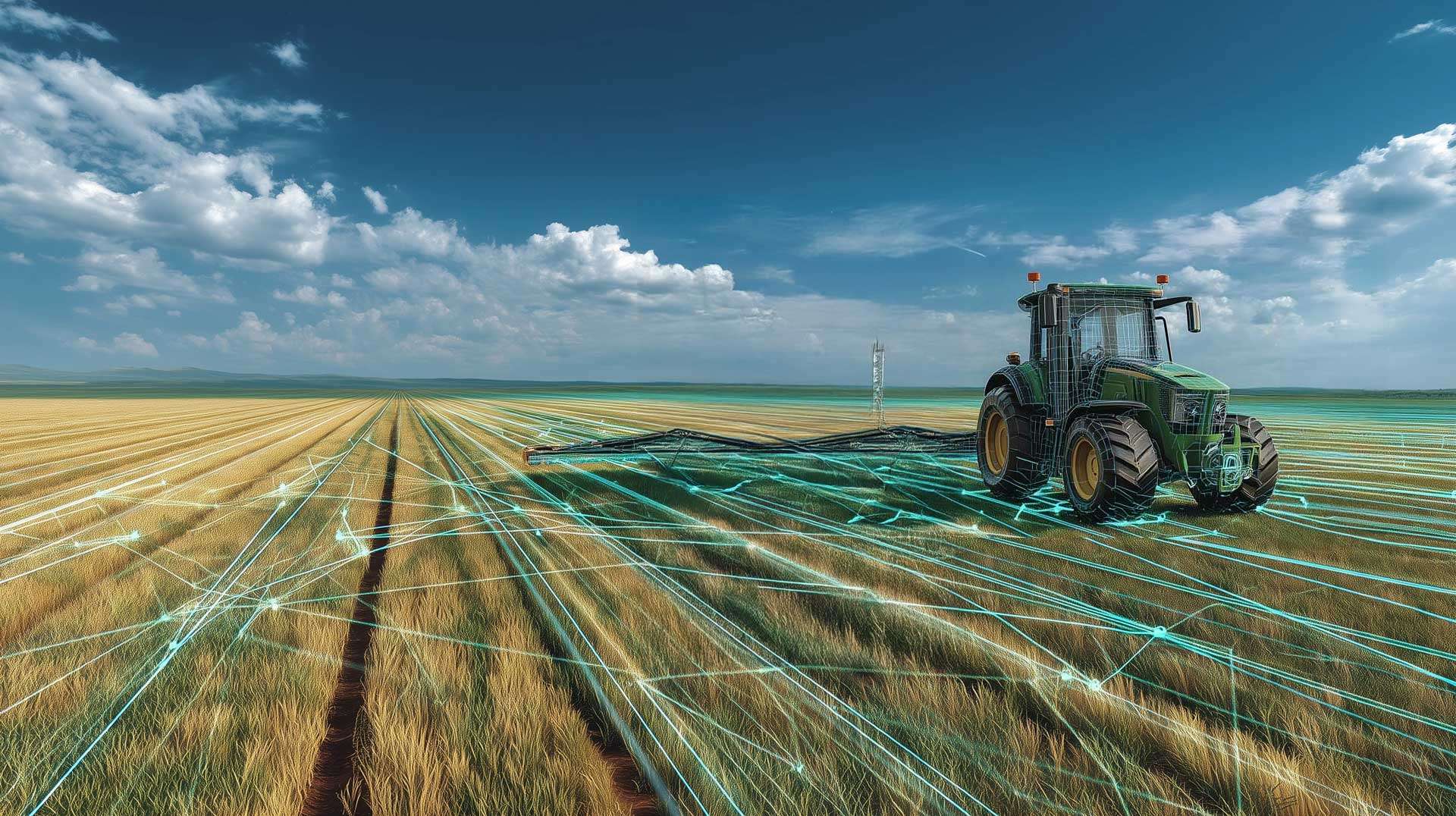
Agricultural Image Annotation
and data Processing
Satellite imagery, drone footage, field photography, LiDAR and sensor data: reliable, training-ready datasets for AI and precision agriculture.
Home > Image Annotation and Agricultural Data Processing

What we do
Data Annotation Expertise Backed by Agronomic Knowledge
From satellite imagery and drone footage to field photographs, 3D data and sensor outputs, we create reliable agricultural datasets to train your AI and Computer Vision models.
For technically demanding projects, our annotation teams can draw on agricultural and agronomy specialists to define annotation guidelines, interpret complex cases and review results.
Rigorous and Controlled Process
Every project starts with a pilot using a representative sample of your agricultural data. This allows us to assess the images, videos or other data involved, review your annotation guidelines and work with you to identify ambiguous or exceptional cases.
We then establish a clear annotation protocol covering classes, ontology, labeling rules, edge cases, quality targets and review procedures. Where specialist knowledge is required, agricultural or agronomy experts can help define the guidelines or validate annotations.
Our annotators are trained using the pilot before production begins. Quality is monitored throughout delivery using multiple review stages and an appropriate sampling rate. Depending on your requirements, Infoscribe offers contractual quality targets of 95%, 97% or 99%.
Nonconformities are recorded and investigated to address root causes and prevent recurrence. If measured quality falls below the agreed contractual threshold, affected annotations are corrected or redone at no additional charge before delivery.
Security and ISO 27001 Compliance
Infoscribe is ISO 27001:2022 certified and embeds data security throughout the project, from receipt to final delivery. Access to data and annotation tools is restricted to authorized personnel, while file transfers can be encrypted and checked for integrity using checksums.
These safeguards apply to satellite and aerial imagery, drone data, field photographs, LiDAR, documents and other agricultural information that may be confidential or commercially sensitive.
When data must remain within the European Union, we can host the working environment on our infrastructure in France. For particularly sensitive projects, our teams can also work directly within the client’s infrastructure so the data never leaves its servers.
System architecture, access permissions and transfer arrangements are agreed with each client based on the project’s confidentiality and security requirements.
Technologies and Tools
We select annotation tools to match each agricultural dataset and project, whether it involves satellite or aerial imagery, field photography, drone video, LiDAR, 3D point clouds or sensor data.
Our teams work with CVAT, Label Studio, SUSTechPOINTS, CloudCompare and X-AnyLabeling, as well as directly within our clients’ own platforms and tools.
Depending on the project, we provide image classification, bounding boxes, polygons, semantic and instance segmentation, keypoints, object tracking and 3D point cloud annotation. Deliverables are provided in agreed formats for integration into your model training pipeline.
The technical environment, input and output formats, and annotation and quality-control workflows are validated during a pilot using your own data.
EXpertise
Expertly Annotated Data for the Next Generation of Agricultural AI.
From satellite imagery and drone footage to field photographs, 3D datasets and agronomic documents, we turn raw agricultural data into structured, labeled datasets for AI model training.
Our quality processes, supported where necessary by agricultural and agronomy specialists, cover crop and weed detection, field monitoring, plant analysis and a broad range of precision agriculture applications.
IMAGE ANNOTATION FOR AI – AGRICULTURE SECTOR
Crop Detection and Segmentation
We annotate satellite, aerial, drone and ground-level imagery to identify, classify and segment crops, individual plants and crop rows. Depending on your model's requirements, annotations can use bounding boxes, polygons or segmentation masks.
Plant Disease and Stress Detection
We label and classify visible signs of disease, nutrient deficiency and water stress in images of leaves, fruit and whole plants. Agronomy, botany or plant pathology specialists can help define classes and review annotations on more complex projects.
Soil Condition Analysis
We segment and classify soil types, areas and visible characteristics in aerial, satellite or multispectral imagery, creating training datasets for soil analysis and precision agriculture models.
Plant Counting and Monitoring
We detect and label plants, fruit and seedlings in ground-level, aerial and drone imagery to create datasets for crop counting, crop monitoring and planting density estimation models.
Datura, Thistle and Weed Detection
We detect, classify and precisely locate datura, thistles and other weeds in aerial, drone and ground-level imagery, building datasets for precision weeding and crop monitoring models.
Vegetation Cover Analysis
We segment and classify vegetation cover in aerial, satellite and multispectral imagery to create datasets for assessing vegetation, crop density and changes over time.
Pest Detection and Visual Anomaly Annotation
We detect, classify and annotate insects, fungal growth, lesions and other visible anomalies affecting leaves, fruit and plants. Agronomy or botany specialists can support cases requiring domain expertise.
Field Monitoring and Crop Rotation
We annotate and classify satellite or aerial images collected at different times to identify crops, track their development and create datasets for field monitoring and crop rotation analysis.
Deforestation and Land-Use Monitoring
We annotate and segment satellite and aerial imagery to identify forests, cropland, bare soil and other land-cover classes, creating datasets for monitoring environmental change and land-use transitions.
Post-Harvest Quality Inspection
We detect, classify and segment defects, disease symptoms, damage and visible quality indicators in images of fruit, vegetables and other harvested produce, building datasets for automated sorting and quality inspection systems.
High-Precision Vineyard Monitoring
We detect, classify and segment vines, grape clusters, leaves, disease symptoms and signs of stress in ground-level, drone and vehicle-mounted imagery to build datasets for precision viticulture.
TEXT ANNOTATION FOR AI – AGRICULTURE SECTOR
Named Entity Recognition (NER)
We label and classify entities in agricultural texts, including crops, varieties, diseases, pests, treatments, active ingredients, weather conditions, soil properties and other agronomic information, creating datasets for NER and information extraction models.
Agronomic Information Extraction
We annotate and extract information from field reports, farm logs, agronomic studies and document repositories to identify fields, crops, operations, yields, observations and other domain-specific data, creating structured datasets for agricultural NLP models.
Standardized Reports and Bulletins
We annotate and structure agricultural reports and bulletins to build datasets for document generation and automated document processing models.
Agricultural Data Coding and Standardization
We structure and standardize agronomic data according to your reference frameworks, taxonomies and standards, creating consistent datasets that your systems and AI models can use directly.
Crop Log and Technical Note Analysis
We annotate and extract information from crop logs, technical reports and field observations to structure data on crops, field operations and agronomic conditions.
Agronomic Relationship Annotation
We label relationships between weather conditions, treatments, yields and plant stress, creating structured datasets for agronomic analysis models.
Multilingual Agricultural Text Analysis
We annotate and normalize agricultural documents in multiple languages, producing multilingual datasets for NLP and document analysis models.
Agricultural Market and Price Intelligence
We annotate and classify market reports, price bulletins and economic analyses to create datasets for agricultural market and price analysis models.
Client Testimonials & References

Other Industry Sectors
FAQ
Frequently Asked Questions
Infoscribe annotates a wide range of data used in agriculture, agritech and precision farming, including satellite and aerial imagery, drone and ground-level photography, video, multispectral imagery, LiDAR, 3D point clouds, and text-based documents.
For visual data, we provide classification, bounding boxes, polygons, semantic and instance segmentation, object tracking and keypoint annotation. Depending on the project ontology, labels may cover crops, individual plants, fruit, weeds, diseases, pests, fields, soil and other relevant features.
We also annotate and structure agronomic reports, crop logs, field observations, technical documents and other text corpora for agricultural NLP applications.
When specialist knowledge is needed, agricultural, agronomy, botany or plant pathology experts can help define classes, interpret complex cases and review annotation quality.
Infoscribe supports projects across agriculture and agritech, including arable farming, vegetable production, orchards, vineyards, precision agriculture, crop protection, plant breeding, field management and environmental monitoring.
Our annotated datasets can be used to train models for crop detection and segmentation, plant and fruit counting, weed and pest identification, plant disease and visual anomaly recognition, vegetation cover analysis, field monitoring and post-harvest quality inspection.
We also support remote sensing and geospatial AI projects using satellite imagery, drone data, multispectral imagery and 3D point clouds, as well as NLP applications involving agricultural data and documents.
Where required, we can involve specialists in agriculture and agronomy, including more focused expertise in botany or plant pathology.
A substantial amount of agricultural knowledge is locked in unstructured content, including agronomic reports, crop logs, field observations, technical sheets, scientific studies, market bulletins and regulatory documents.
Text annotation turns these materials into structured training datasets for Natural Language Processing (NLP) models. It can identify and classify crops, varieties, diseases, pests, treatments, weather conditions, soil properties, yields and agricultural operations.
We can also label relationships between entities, classify documents and normalize information against an ontology or reference framework agreed with the client.
These datasets can then support information extraction, named entity recognition (NER), document classification, semantic search and agronomic data analysis models.
Annotations are delivered in formats agreed with each client, ready to integrate into their data workflows or model training pipelines. We support widely used formats for images, video, geospatial data, 3D point clouds and text.
Depending on the project, deliverables can be structured as JSON, XML, CSV or COCO, or in GIS-compatible formats used with QGIS, such as GeoJSON, Shapefile, GeoPackage (GPKG), GeoTIFF and KML.
For agricultural and geospatial projects, we can deliver georeferenced annotations, polygons, points, field boundaries and other vector or raster data ready for use in a GIS environment.
Input and output formats, coordinate reference systems, classes and conversion rules are confirmed during the pilot so the final dataset works within your technical environment.
Every project starts with a pilot using a representative sample of your own data to validate annotation classes, guidelines, edge cases and production throughput.
Infoscribe offers three contractual quality levels: 95%, 97% or 99%. Production is reviewed through multiple quality-control stages, with sampling rates adapted to the agreed quality target and observed results.
For projects requiring agronomic expertise, specialists can also help define guidelines and review annotations.
Nonconformities are documented and investigated to identify their causes. If measured quality falls below the contractual threshold, affected annotations are corrected or redone at no additional cost until the agreed level is reached.
Yes. When datasets or annotation classes require domain expertise, Infoscribe can involve specialists in agriculture and agronomy, including more specific expertise in botany and plant pathology.
These experts can review the requirements, help define classes and ontologies, train annotators, resolve ambiguous cases and support annotation quality control.
This approach transfers specialist knowledge to production teams while reserving direct expert involvement for the tasks and decisions that genuinely require it.
Infoscribe is ISO 27001:2022 certified and applies security measures throughout the project, including access controls, encrypted transfers, file-integrity checks and operational traceability.
When data must remain within the European Union, the working environment can be hosted on our infrastructure in France.
For especially sensitive projects, our teams can also work directly within the client’s infrastructure, ensuring satellite imagery, drone data, geospatial datasets and other strategic information remain on the client’s servers.
Yes. Infoscribe can build dedicated teams to match project volumes, timelines and complexity, from pilots involving a few hundred items to production programs requiring several thousand annotation hours per month.
This scalability applies to satellite imagery, drone and ground-level photography, video, LiDAR and 3D data, as well as agricultural document collections.
The pilot establishes actual annotation and quality-control throughput, allowing us to plan team size and delivery schedules for the full dataset.
We begin by reviewing your data and annotation requirements, followed by a pilot using a representative sample of your own dataset.
The pilot validates classes and ontology, annotation guidelines, edge cases, the required quality level and actual production throughput. Where necessary, agriculture or agronomy specialists participate in this stage and in annotator training.
Once the pilot is approved, we agree on pricing, delivery timelines and team size before production starts.
Pricing depends on the data type, annotation complexity, specialist expertise required, quality target and overall volume.
For standard annotation services, our rates generally range from €5 to €10 per hour, with pricing adjusted to the project’s volume and specific requirements.
We typically run a pilot on a sample of your own data to measure real annotation and quality-control throughput. Based on those results and the expected volume, we can provide tailored pricing and a production schedule.
Where more suitable, we can also price by unit, such as per image, object, video frame, document or another agreed production unit.
Yes. For projects within the scope of the EU AI Act, Infoscribe can document data-handling activities, including data provenance, annotation guidelines, classes and ontologies, quality checks, corrections and key traceability records.
This information can be compiled into a data governance file to support the client’s own compliance documentation, particularly with reference to Article 10 of the EU AI Act and its requirements for data used in high-risk AI systems.
Documentation can cover satellite and drone imagery, field photography, geospatial and 3D datasets, as well as text corpora and agronomic documents.