

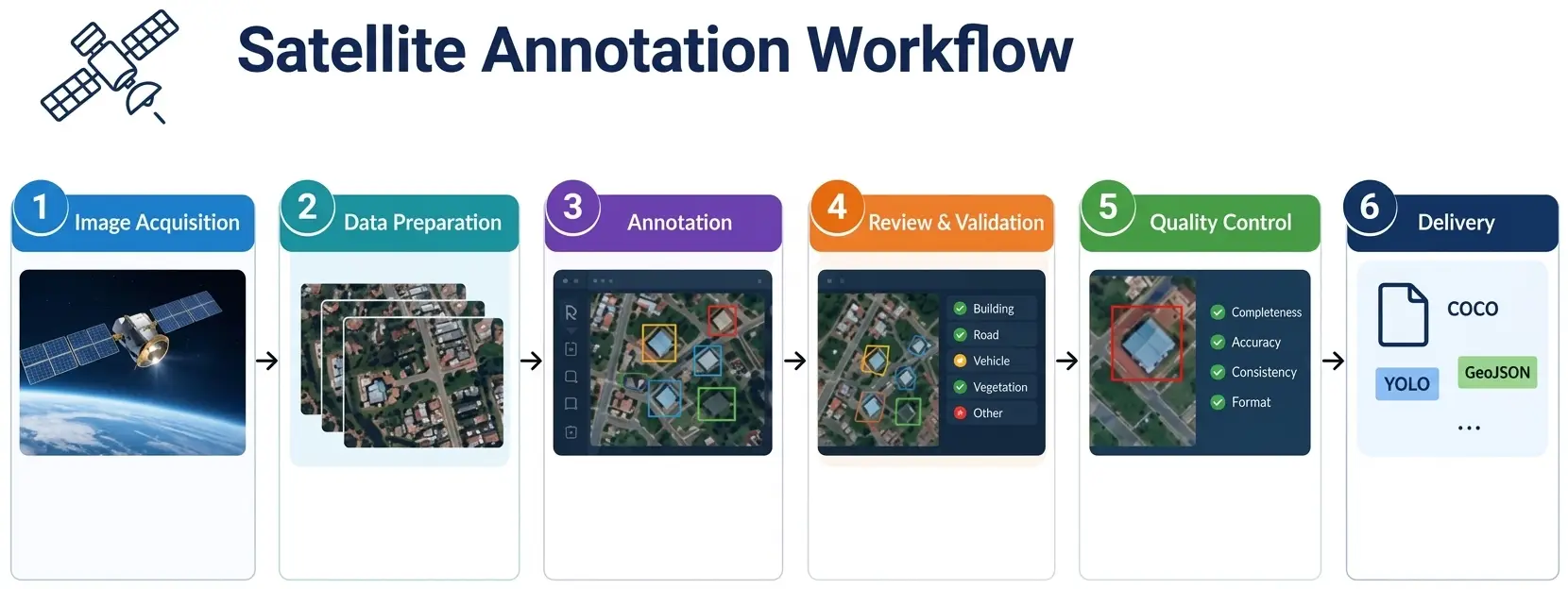
A per-tile rate looks simple and proves almost always misleading. Two tiles of the same size can demand working times that bear no comparison, and the headline price says nothing about what the project will really cost.
This article sets out those economics. It extends the article on annotation in constrained contexts.
What the price really covers
Six distinct lines compose the cost of a satellite imagery project.
Preparing the archive, entirely prior to any annotation.
Training the operators in the reference finally adopted.
The annotation itself, the only line usually costed.
Quality control, including the fraction annotated twice.
Reworking rejected batches as well as disputed cases.
And the documentation handed over along with the deliverable.
One important practical consequence follows. Five of those six lines disappear purely behind a unit rate, which makes two quotations rigorously incomparable until one knows which ones each covers.
What makes the time per tile vary
Five factors weigh more than the satellite imagery surface handled.
The number of objects genuinely present in the scene.
The geometry required, from a simple point to a precise outline.
The fineness of the class reference employed.
The proportion of ambiguous cases actually met.
And the visual difficulty proper to the context.
One important observation follows for a satellite imagery project. The first factor explains considerable gaps between two tiles identical in size, a fragmented peri-urban area demanding several times the time an agricultural plain of the same surface requires.
What the billing unit changes
Five units occur in satellite imagery annotation.
The tile, which is at once simple and deaf to density.
The annotated object, at once fair and unpredictable for the client.
The ground surface, legible but disconnected from the real work.
The working hour, which is exact but hard to budget for.
And the fixed fee, reassuring but heavy with assumptions.
One practical consequence follows. Each shifts the risk onto a different party, the per-tile price placing it on the provider while the per-object price places it on the client, which makes the choice of unit as negotiable as the amount itself.
What preparation adds to the budget
Four tasks precede the first satellite imagery annotation.
Verifying georeferencing as well as superimposition.
Cutting into tiles as well as choosing the overlap.
Harmonising an archive that has stayed heterogeneous.
And drafting the full annotation reference.
One observation follows. Those four tasks are never billed per tile and are very regularly omitted, which produces a quotation apparently lower than that of a competitor who costed them.
What quality costs
Five arrangements weigh on the final price of a satellite imagery project.
Double annotation carried out on a fraction of the corpus.
Rereading, either systematic or else conducted by sample.
The control of junctions carried out after reassembly.
Reworking any batches found non-compliant.
And the full production of the measurement report.
One important practical consequence follows for a satellite imagery project. Those five arrangements represent a genuinely significant share of the total and are easily removed to lower a quotation, which explains why a large price gap between two proposals often reflects a difference in control rather than in productivity.
What volume changes about the unit price
Five effects accompany a satellite imagery project large in volume.
The training cost is then spread across more tiles.
Throughput improves markedly as the team gradually settles in.
Limiting cases are settled once and then serve thereafter.
Preparing the archive is amortised across the whole programme.
And specific tooling eventually becomes worthwhile.
One important practical consequence follows. Those five effects justify an honest tapering rate rather than a commercial discount, a provider genuinely producing more cheaply after some weeks, which makes a first batch’s price a poor guide to a programme’s cost.
What the reference does to the cost
Four scoping choices weigh directly on a satellite imagery price.
The number of classes as well as their mutual proximity.
The geometry finally adopted for each of the classes.
The size threshold below which an object is ignored.
And whether or not a class of indetermination exists.
One important observation follows. The third choice produces the clearest effect, a threshold even slightly raised removing a considerable share of the objects most expensive to handle, which sometimes permits halving a budget without harming the intended use.
What the trial batch permits establishing
Five figures come out of a properly conducted satellite imagery trial batch.
The average number of objects genuinely met per tile.
The real time spent on a tile judged representative.
The proportion of ambiguous cases actually put to adjudication.
The disagreement rate observed between two operators.
And the share of tiles holding absolutely no object.
One important observation follows for a satellite imagery project. Those five figures turn an estimate into a costing, a provider holding a trial batch being able to commit to a firm price where a competitor is obliged to allow a safety margin, which makes the trial advantageous for both parties.
What pre-annotation changes about the price
Four effects accompany an automatic proposal produced in satellite imagery.
Tracing time falls markedly on well contrasted objects.
Search time stays unchanged on the most difficult objects.
A tuning cost comes to be added at the project’s start.
And quality control then gains in importance rather than losing it.
One important practical consequence follows. Those four effects explain why the announced gain is rarely realised in full, the automatable share being precisely the one that costs least in the work, which makes a moderate price reduction more credible than a promise of halving.
What particular sensors add
Four situations take a satellite imagery project outside the ordinary rates.
A point cloud, whose annotation demands a tool as well as training of its own.
A multispectral acquisition, whose visualisation is settled before even starting.
Radar data, whose reading remains a genuinely rare competence.
And a constrained context, whose arrangement is funded well before production.
One important observation follows for a satellite imagery project. Those four situations share an economic characteristic, most of the extra cost being paid before the very first tile rather than per tile, which makes them disproportionate on a one-off project and reasonable on a recurring programme.
What the payment terms change
Four payment arrangements occur on these satellite imagery projects.
A payment made upon delivery of each batch.
A staging aligned on stages agreed in advance.
An advance covering the whole preparatory phase.
And monthly billing bearing on a continuous programme.
One important observation follows for a satellite imagery project. The third arrangement deserves proposing rather than enduring, preparation being carried out before any annotable delivery, which makes the provider carry a cash position the client funds without difficulty once the line has been explained to them.
What the client can lower themselves
Five levers belong to the client rather than to the provider.
Raising the size threshold of the objects that must be handled.
Reducing the number of classes whenever the use permits it.
Accepting a simpler geometry on some of the classes.
Supplying an archive already prepared as well as correctly georeferenced.
And targeting certain areas rather than covering a whole territory.
One important practical consequence follows for a satellite imagery project. Those five levers act far more strongly than any rate negotiation, a mere simplification of the reference reducing a budget by proportions no commercial discount reaches, which makes a discussion about the need more productive than a discussion about the price.
What revising a price presupposes
Five situations justify reopening a satellite imagery rate mid-project.
An object density markedly above that of the initial assumption.
A class reference enriched after the project has started.
An added territory whose characteristics differ appreciably.
An image archive markedly less well prepared than announced.
And a control arrangement strengthened at the client’s own request.
One important practical consequence follows for a satellite imagery project. The first situation is handled badly afterwards and well in advance, a clause providing for revision beyond an agreed density threshold avoiding the painful discussion that follows discovering a gap, which makes that clause protective for both parties rather than defensive for one.
What the delay does to the price
Four effects accompany a compressed satellite imagery schedule.
Parallelisation then requires training more operators.
Consistency between the teams demands increased adjudication effort.
Quality control is then conducted at the same time as production.
And the rework margin disappears entirely on a non-compliant batch.
One important practical consequence follows for a satellite imagery project. The last effect represents the real cost of urgency, a schedule devoid of margin turning a simple defect into a late delivery, which justifies billing for speed rather than granting it in the hope that nothing goes wrong.
What the provider’s geography changes
Four satellite imagery factors weigh beyond hourly cost alone.
The availability of operators trainable and retainable over time.
The stability of teams once the training is amortised.
Linguistic proximity to the reference finally employed.
And the time difference in view of the daily exchanges needed.
One important practical consequence follows for a satellite imagery project. The second factor matters more than the first in this field, a team renewing itself too quickly forcing constant retraining on references that are always long to master, which cancels within months the advantage of a lower hourly cost.
Three errors proper to costing
Three satellite imagery defects are committed before production even begins.
A per-tile rate built with no object density assumption at all.
A quality control removed from the quotation to match a competing price.
And a preparatory phase entirely absent from the initial budget.
Those three defects are paid for during production and never before, they turn a planned margin into an observed loss, and their common point is to make the quotation more attractive by making it less true.
What this chapter shares with the rest of the course
Four economic findings run through the preceding satellite imagery chapters.
What is paid before the first tile is amortised only over time.
A control arrangement is easily removed and noticed late.
A trial batch turns an estimate into a firm commitment.
And a regulatory or technical constraint builds an entry barrier.
One important observation follows for a satellite imagery project. Those four findings explain the market’s structure far better than productivity alone, a field where fixed costs dominate markedly favouring players established on recurring programmes over those responding one contract at a time.
What the client should ask a provider
Four questions reveal a serious costing in satellite imagery.
What object density assumption the rate was built on.
Which precise lines the headline price covers exactly.
What happens if the observed density comes to exceed the assumption.
And how the price evolves between the first batch and the following ones.
One important observation follows for a satellite imagery project. The third question separates them markedly, a provider having planned nothing discovering that gap mid-production and then seeking to pass it to the client, whereas a clause agreed in advance turns that discovery into the application of an accepted rule.
What the first quotation must say
Five statements make a satellite imagery proposal legible.
The density assumption adopted as well as its origin.
The list of lines included as well as of those that are not.
The size threshold below which an object is ignored.
The revision conditions applicable should a gap be observed.
And the distinction between the first batch’s price and the running rate.
One important observation follows for a satellite imagery project. Those five statements fit in half a page and change the nature of the discussion, a client holding these elements ceasing to compare two numbers in order to compare two offers at last, which benefits the provider whose offer is the most complete rather than the cheapest.
What the provider brings here
Four contributions distinguish a serious costing in satellite imagery.
A quotation listing the lines covered rather than a single rate.
An explicit density assumption, revisable after the trial batch.
Quality control costed separately rather than folded into the price.
And a rate structure distinguishing the first batch from the running regime.
One important practical consequence follows. The first contribution hurts in the short term and serves in the long term, a detailed quotation looking more expensive than a single rate covering in reality far less, which requires explaining the scope rather than matching an incomplete proposal.
Approaching the costing of a project
Five questions scope the costing of a satellite imagery project.
Which lines does the rate cover. Five out of six get forgotten.
What object density is expected. It outweighs surface.
Which billing unit. It distributes the risk.
Is control included. It is easily removed.
And what size threshold applies. It weighs heavily on the total.
Those five answers make two quotations comparable. Asking them before negotiating avoids choosing the least complete proposal rather than the cheapest.
The question that frames the budget
One question determines the whole costing in satellite imagery.
Will the corpus be produced once or fed over time.
A one-off production concentrates every fixed cost on a single batch, preparation, training and the reference then weighing as much as the annotation itself.
A lasting feed spreads those same costs across several campaigns, the unit price genuinely falling as the team and the conventions settle.
That question belongs to the client’s programme and not to the work requested, it is asked before the first quotation, and it separates two price structures no negotiation brings together.
Three decisions before costing
Three decisions commit the costing of a satellite imagery project.
Fixing the exact scope the rate covers, five lines out of six getting forgotten.
Choosing the billing unit, which distributes the risk between the parties.
And settling the size threshold, which weighs more than any other parameter.
Those three decisions cost one meeting, they precede sending the quotation, and their absence produces a proposal the client will compare with another without knowing which one is complete.
Three checks on a quotation
Three checks make two satellite imagery proposals comparable.
The list of lines the rate covers, preparation and control included.
The object density assumption the price was built on.
And the size threshold below which an object is not handled.
Those three checks are each asked in one question, they require no technical expertise, and their absence indicates a quotation whose amount says nothing about what will be delivered.
Three checks before signing
Three checks start a satellite imagery project on the right footing.
The density assumption, written into the contract rather than assumed.
The scope of the lines covered, enumerated rather than summarised.
And the revision rule, agreed before the first gap is observed.
Those three checks fit in one contract paragraph, they precede production, and their absence produces a commercial relationship that will sour on the first atypical batch.
What this chapter teaches
One cross-cutting observation deserves closing this examination.
A price compares only at a known scope.
Three findings compose it.
Five lines out of six disappear behind a unit rate.
A fragmented area demands several times the time of a plain of the same surface.
And a large price gap often reflects a difference in control.
That finding casts light on the preceding chapters, every quality or compliance requirement there translating sooner or later into a line on a quotation.
Why losing on price is sometimes the right outcome
One point about competing bids belongs at the close of this chapter.
Not every contract lost on price was worth winning.
Three reasons follow in satellite imagery.
A quotation matched by cutting control produces a batch that fails acceptance.
A rate accepted on a wrong density assumption is loss-making by month two.
And a client who buys purely on rate will leave for the next cheaper offer.
One important practical consequence follows for a satellite imagery provider. Explaining the scope and then losing the contract is a better outcome than winning it incomplete, since the second path costs money to discover and the first costs only the bid, and clients who reject a detailed quotation this year often return after a cheaper provider has delivered them something unusable.
What this chapter closes about the field
Three economic traits define geospatial satellite imagery annotation.
Fixed costs dominate, so scale and repetition decide the unit price.
The hardest work is the least automatable, so tooling helps least where cost sits.
And every quality requirement is removable, so scope must be stated to be compared.
One important observation follows. Those three traits together explain why this field rewards providers who commit to it and punishes those who treat it as an extension of ordinary image work, the economics being structurally different rather than merely harder.
Common mistakes
These failures recur often enough that naming them is usually enough to avoid them.
- Comparing two quotations without knowing which lines each covers.
- Costing per tile with no indication of object density.
- Omitting the preparation of the archive from the budget.
- Removing quality control in order to match a price.
- Ignoring the size threshold’s effect on the total cost.
- Billing a precise geometry at the price of a point.
- Neglecting batch rework in the initial costing.
- Assuming identical productivity across every territory.
- Choosing a billing unit without measuring its risk.
- Handling a recurring project at a one-off assignment’s rate.
What to take away
The price of a satellite annotation compares only at a known scope.
Three readings emerge. Five lines out of six disappear behind a unit rate, which makes two quotations incomparable until one knows which ones each covers and shifts the negotiation towards scope rather than towards amount. A fragmented peri-urban area demands several times the time an agricultural plain of the same surface requires, which makes object density a more determining parameter than the surface handled. And a large price gap between two proposals often reflects a difference in control rather than in productivity, which invites asking what has been removed before concluding to better efficiency.
For recent tools, the article on geospatial foundation models details what they bring. For technical preparation, the article on resolution and tiling sets it out.
To explore delivery arrangements, supported formats and applicable control mechanisms, see our dedicated page on annotation for geospatial. And if you are preparing a geospatial project, let us discuss your need.


