A satellite image is not read like a photograph. It covers kilometres, is measured in metres per pixel, carries bands invisible to the eye, and that particular nature commands everything an annotation project will have to decide before it even begins.
This article opens a series of fifteen chapters devoted to this field.
What makes this support particular
Six characteristics separate satellite imagery from an ordinary photograph.
Each pixel corresponds to a perfectly known ground surface.
Each point carries a directly usable geographic position.
Scenes cover expanses no framing comes to narrow.
Sensors record bands lying beyond the visible.
The view is almost always vertical or only slightly oblique.
And the same area is photographed again at regular intervals.
One important practical consequence follows. The first characteristic changes the whole reasoning, an object no longer being measured in pixels but in metres, which makes the available resolution decisive before any discussion of method.
The uses that structure the field
Six families of application occur today in satellite imagery.
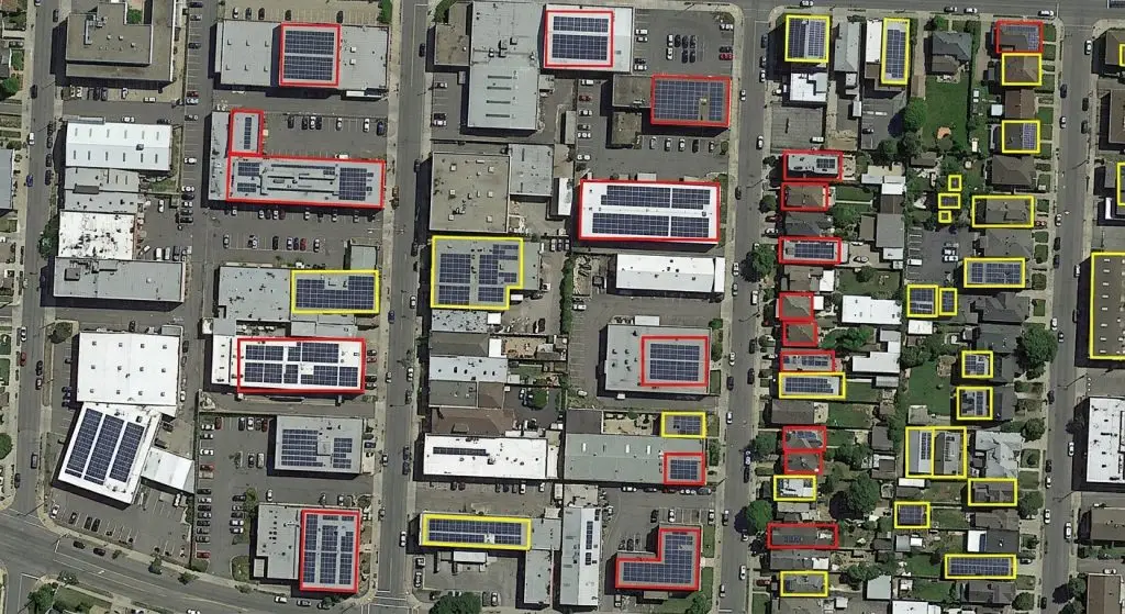
Mapping the built environment along with infrastructure.
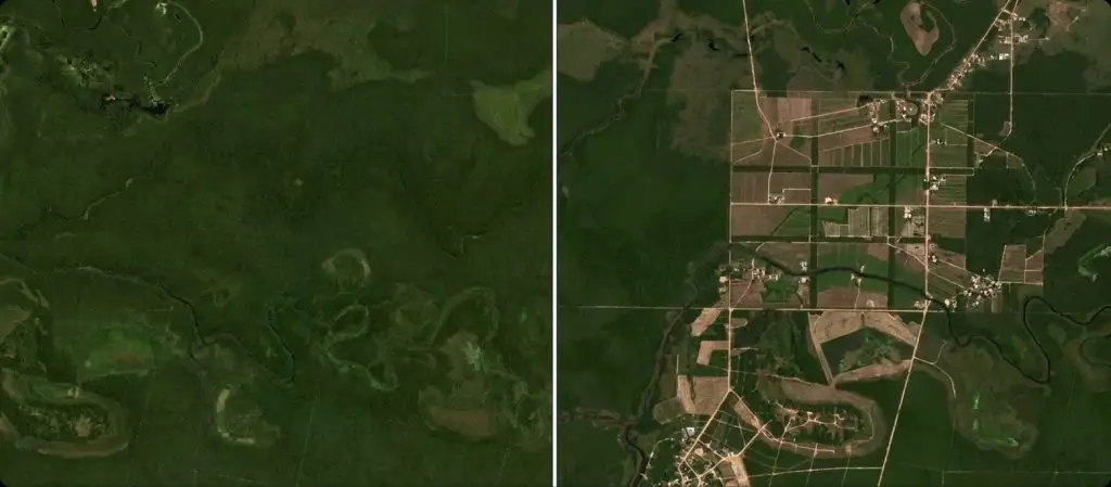
Monitoring land use as well as its changes.
Agricultural observation, from fields through to crop states.
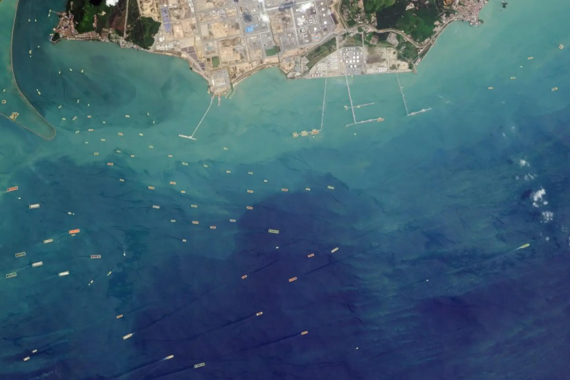
Detecting isolated objects, whether installations or equipment.
Assessing the damage occurring after an event.
And environmental surveillance conducted over long periods.
One important observation follows for a satellite imagery project. The second use stands apart from the others, a change being detected by comparison between two dates rather than on a single image, which requires a corpus built from pairs rather than from isolated views.
What the resolution determines
Five consequences follow from the ground pixel size in satellite imagery.
It fixes the minimum size of a genuinely identifiable object.
It decides which annotation geometry stays usable.
It finally conditions the distinction between two neighbouring objects.
It bears directly on the number of objects per tile.
And it directly determines the cost of acquiring the data.
One practical consequence follows. Those five consequences combine to the point of making resolution the first parameter to fix, an object a few pixels across being delimitable by no useful outline whatever the annotator’s competence.
What georeferencing brings
Five satellite imagery uses follow from a known position for every pixel.
Superimposing several acquisitions of one area exactly.
Cross-referencing the imagery with existing cartographic data.
Carrying an annotation directly into a geographic information system.
Computing surfaces and distances that are genuinely measured.
And splitting the training sets by geographic area.
One important observation follows for a satellite imagery project. The last use prevents a frequent defect, two neighbouring tiles resembling each other strongly, which makes a random split misleading and requires a spatial separation of the sets.
What tiling imposes
Five decisions structure the cutting up of a satellite imagery scene.
The tile size, which arbitrates between visible context and manageability.
The overlap adopted between two adjacent tiles.
The treatment given to objects cut by a tile boundary.
The counting rule applied to those shared objects.
And the reassembly of the annotations at the whole scene’s scale.
One important practical consequence follows. The third decision recurs in every project, a building crossing two tiles being annotated twice, once, or according to an edge rule that has to be written before production starts.
What the geometries cover
Five geometric forms occur in satellite imagery.
The simple point, which locates without ever dimensioning.
The box, suited to objects that are both isolated and compact.
The polygon, which follows a building’s or a field’s footprint faithfully.
The line, used for networks and traffic routes.
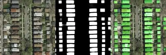
And the class mask, which covers the entirety of the surface.
One observation follows. The fifth form dominates this field far more than elsewhere, a satellite scene often being described entirely rather than by detached objects, which brings the annotation closer to cartography than to detection.
What the scale of the scene changes
Four effects accompany the considerable expanses of satellite imagery.
The number of objects per scene reaches unusual orders of magnitude.
Exhaustive annotation becomes impractical beyond a certain threshold.
Selecting the areas actually handled becomes a step in its own right.
And the representativeness of those areas then conditions the whole result.
One important practical consequence follows for a satellite imagery project. The last effect weighs more than the volume handled, areas chosen for their legibility over-representing the easy situations and producing a corpus simpler than the territory it claims to describe.
What the sensors offer
Five families of sensor feed satellite imagery today.
Optical in natural colours, by far the most legible for an annotator.
Multispectral, which adds bands outside the visible.
Hyperspectral, which considerably multiplies the narrow bands.
Radar, insensitive to cloud as much as to the absence of light.
And airborne LiDAR, which restores a genuine three-dimensional geometry.
One important practical consequence follows. The fourth family raises a difficulty of its own, a radar image not being read like a photograph, which makes annotation impossible without specific training and the corresponding competence rare.
What temporality brings
Five satellite imagery uses follow from repeated acquisitions.
Detecting the appearance or else the disappearance of an object.
Monitoring one surface’s evolution across the seasons.
Separating a lasting change from a merely passing variation.
Dating an event precisely between two acquisitions.
And building a historical reference on a given area.
One important observation follows. The third use requires an explicit convention, a bare field being able to reflect a harvest or an abandonment, a distinction belonging to knowledge of the ground and not to the image.
What the annotator must know here
Five kinds of knowledge condition correct work on satellite imagery.
Reading a vertical view, which is neither immediate nor natural.
The appearance of the target objects given the available resolution.
The most common confusions between land-use classes.
The tracing conventions specifically adopted for the project.
And the rule of treatment applied to objects cut by a tile.
One important observation follows. The first kind surprises, a vertical view removing the cues of shape and shadow human perception is used to, which makes this work less intuitive than it appears and requires training even on familiar objects.
What the ground truth requires here
Five sources establish a ground truth in satellite imagery.
The on-site survey, exact but expensive and very limited in extent.
Existing cartographic bases, very broad but sometimes out of date.
Higher-resolution imagery acquired over the same areas.
Administrative declarations, particularly in an agricultural context.
And interpretation conducted by an experienced photo-interpreter.
One important observation follows for a satellite imagery project. The second source is the most used and the most misleading, a cartographic base describing the territory’s state at its date of production, which turns buildings simply newer than the reference into apparent model errors.
What the class reference must settle
Five decisions structure a land-use nomenclature in satellite imagery.
The number of classes adopted along with their level of detail.
The treatment of mixed zones no class describes on its own.
The boundary between two neighbouring classes along a continuous gradient.
The fate given to surfaces temporarily modified by the season.
And whether or not a class dedicated to the indeterminate exists.
One important practical consequence follows. The third decision recurs constantly in satellite imagery, a woodland edge or a peri-urban fringe grading progressively from one class into another, which requires fixing an observable criterion rather than letting each annotator place the boundary by judgement.
What the acquisition conditions modify
Five factors change the appearance of one area in satellite imagery.
Cloud cover, which masks all or only part of the scene.
The solar angle, which lengthens or shortens the cast shadows.
The season, which modifies vegetation and therefore the surfaces.
The viewing angle, which displaces the tops of buildings.
And the sensor employed, whose colour rendering varies appreciably.
One important observation follows for a satellite imagery project. The fourth factor deserves attention, an oblique capture displacing a building’s roof relative to its ground footprint, which obliges deciding whether the annotated outline follows the visible roof or the building’s base.
What the volume of data imposes
Five constraints follow from file sizes in satellite imagery.
One single scene reaches sizes the most common tools handle badly.
Transfer and storage themselves become lines in their own right.
Tiling then serves manageability as much as method itself.
Multiple bands multiply the weight of one same surface accordingly.
And the delivery format entirely conditions the client’s reuse.
One important practical consequence follows. The fifth constraint is better settled at scoping than at delivery, a client expecting annotations directly usable within their geographic system, which makes the choice of format as decisive as the quality of the tracing.
What the corpus coverage must ensure
Six axes structure a satellite imagery dataset.
The types of territory covered, from dense urban to extended rural.
The geographic regions handled and their own landscapes.
The seasons covered, whose effect on surfaces is considerable.
The atmospheric conditions along with partial cloud cover.
The sensors employed along with the resolutions obtained.
And the different viewing angles encountered.
One important observation follows for a satellite imagery project. The second axis is the most underestimated, a system trained on one country transferring badly to another where built forms, field sizes and materials differ, which makes geographic diversity more decisive than total volume.
What the measurement must reflect
Five indicators describe a satellite imagery system’s performance.
The proportion of objects detected, systematically broken down by apparent size.
The accuracy of the outlines obtained, set against a reference footprint.
Performance measured by class rather than a mere overall average.
The behaviour observed on geographic areas absent from the training.
And the stability of the results obtained between two acquisition dates.
One important practical consequence follows. The fourth indicator is the most revealing and the most rarely produced, a performance measured on tiles neighbouring those of the training saying nothing of the system’s capacity on a new territory, which is precisely the use awaiting it.
What data availability changes
Four situations separate access to images in satellite imagery.
Public programmes, free but limited to moderate resolution.
Commercial operators, finer but billed by surface covered.
Aerial acquisitions, very fine but restricted in extent.
And existing archives, available but with imposed characteristics.
One important observation follows for a satellite imagery project. The second situation introduces a trade-off absent from other fields, the surface covered itself becoming a line of expenditure, which makes the choice of areas to acquire as economic as it is methodological.
What the regulatory context adds
Four constraints occur according to the nature of the data.
Distribution restrictions bearing on certain areas or resolutions.
Traceability requirements bearing on who accessed what.
Localisation obligations bearing on processing and storage.
And rules proper to the client, whether public or contractual.
One important practical consequence follows for a satellite imagery project. Those four constraints arise before the choice of provider rather than after, an annotation arrangement having to comply from the very first image, which sometimes narrows the field of solutions far more than cost considerations do.
What the first project should aim at
Four criteria designate a good starting point in satellite imagery.
Objects markedly larger than the available resolution.
Sharp boundaries rather than a progressive continuous gradient.
A reference holding a few classes only.
And a ground truth accessible without a dedicated survey campaign.
One important observation follows. Those four criteria often designate detecting isolated installations rather than mapping land use, a compact and well-contrasted object being verifiable by eye while a complete nomenclature presupposes settling dozens of boundaries before even producing the first tile.
What the field’s vocabulary covers
Five terms recur constantly in a satellite imagery project.
Spatial resolution, expressed in metres per pixel on the ground.
Extent, which designates the surface covered by one acquisition.
Georeferencing, which ties the image to a coordinate system.
Orthorectification, which corrects the distortions due to relief.
And nomenclature, which designates the class reference adopted.
One important observation follows. The fourth term covers a step often assumed to be settled, an uncorrected image presenting offsets that prevent any reliable superimposition, which makes it a prerequisite and not an option for projects combining several sources.
What the provider brings here
Four contributions distinguish an engagement conducted on satellite imagery.
Annotators trained in vertical reading, a competence nobody improvises.
A reference explicitly settling the boundaries between neighbouring classes.
A tile-edge rule applied with no variation between operators.
And a capacity to handle the volumes the extent of scenes imposes.
One important practical consequence follows. The first contribution weighs more than one imagines, an operator experienced on ground photographs staying a novice before a vertical view, which makes geospatial specialisation more decisive than general seniority in annotation.
Approaching a satellite imagery project
Five questions scope such a satellite imagery project.
What is the minimum size of the target objects. It fixes the resolution.
Does the result bear on one date or on a change. That changes everything.
Is the tile-edge rule written. Otherwise the counts vary.
Is the set separation spatial. Otherwise the measurement misleads.
And are the areas handled representative. Their choice weighs heavily.
Those five answers determine the project’s feasibility. Asking them before acquisition avoids a corpus that is impeccable and unsuited to the intended use.
The question that frames the project
One question determines the nature of the corpus in satellite imagery.
Does the expected result describe a state or a change.
A state, land use at one date or an inventory of installations, is handled on isolated views, which permits a corpus made of independent acquisitions.
A change, a building appearing or a forest receding, requires superimposable pairs of acquisitions, a convention on what constitutes a change and coverage of several dates.
That question is asked before acquisition, it belongs to the use and not to technique, and it separates two corpora whose construction and cost bear no comparison.
Three decisions before starting
Three decisions commit a satellite imagery project.
Verifying that the available resolution permits identifying the target objects.
Writing the rule of treatment for objects cut by a tile boundary.
And fixing a spatial separation of the sets rather than a random split.
Those three decisions cost one meeting, they precede the first annotation, and their absence produces a corpus that is impeccable and unsuited to the intended use.
Three checks on a satellite corpus
Three checks qualify a satellite imagery dataset.
The effective resolution of the images, systematically set against the target objects.
The separation rule between training and evaluation, spatial or random.
And the effective geographic distribution of the annotated areas.
Those three checks are each asked in one question, they require no access to the images, and their absence indicates a corpus whose measured performance will overestimate the system’s real capacity.
What this chapter teaches
One cross-cutting observation deserves closing this examination.
Resolution commands what no method makes up for.
Three findings compose it.
An object a few pixels across is delimitable by no useful outline.
Two neighbouring tiles resemble each other enough to distort any performance measurement.
And the choice of areas handled weighs more than the volume annotated.
That finding opens the following chapters, which each take up one particular use.
What this chapter leaves to the next ones
This panorama has set out the common constraints without handling any use.
Three questions stay open in satellite imagery.
How to describe a whole scene rather than detect objects within it.
What each application adds as a requirement of its own.
And how to prepare data technically before any annotation.
Those three questions belong to the following chapters, starting with semantic segmentation.
Why geospatial work suits a specialised team
One observation about this field belongs at the close of a panorama.
Vertical reading is a trade rather than a variation on image annotation.
Three reasons follow in satellite imagery.
An operator’s experience on ground photographs transfers poorly to it.
The conventions that matter are cartographic, not visual.
And the client usually works in a geographic system the delivery must fit.
One important practical consequence follows for a satellite imagery provider. This makes the field harder to enter and steadier once entered, since a team that reads vertical views fluently and delivers into the client’s own system holds an advantage generalist capacity does not reproduce, and clients with recurring territory to cover rarely change provider once one works.
Common mistakes
These failures recur often enough that naming them is usually enough to avoid them.
- Setting a detection objective without checking the available resolution.
- Splitting the sets randomly rather than by geographic area.
- Leaving implicit the treatment of objects cut by a tile.
- Choosing annotation areas for their legibility.
- Confusing detection on one date with change detection.
- Ignoring bands beyond the visible where they are available.
- Annotating a whole scene when reasoned sampling would suffice.
- Neglecting georeferencing in the delivered data.
- Using a box where the real footprint is expected.
- Comparing two acquisitions without verifying their superimposition.
What to take away
Satellite imagery imposes its constraints before any decision of method.
Three readings emerge. Resolution fixes the minimum size of an identifiable object and the usable geometry, an object a few pixels across being delimitable by no useful outline whatever the annotator’s competence, which makes it the first parameter to settle. Two neighbouring tiles resemble each other strongly, which makes a random split of the sets misleading and requires the spatial separation georeferencing makes possible. And the choice of areas handled weighs more than the volume annotated, areas retained for their legibility producing a corpus simpler than the territory it claims to describe.
For the complete description of a scene, the article on semantic segmentation details the methods. For preparing the data, the article on resolution and tiling sets out the decisions. For a project’s economics, the article on the cost of satellite annotation details the lines.
To explore delivery arrangements, supported formats and applicable control mechanisms, see our dedicated page on annotation for geospatial. And if you are preparing a satellite imagery project, let us discuss your need.